Home
Services
About us
Blog
Contacts
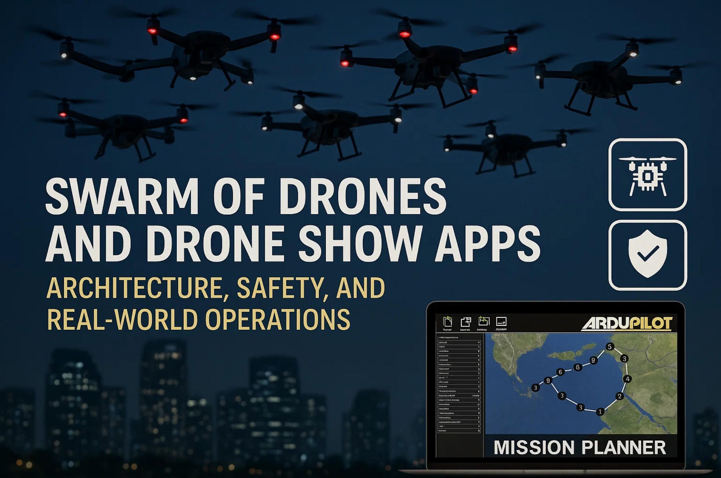
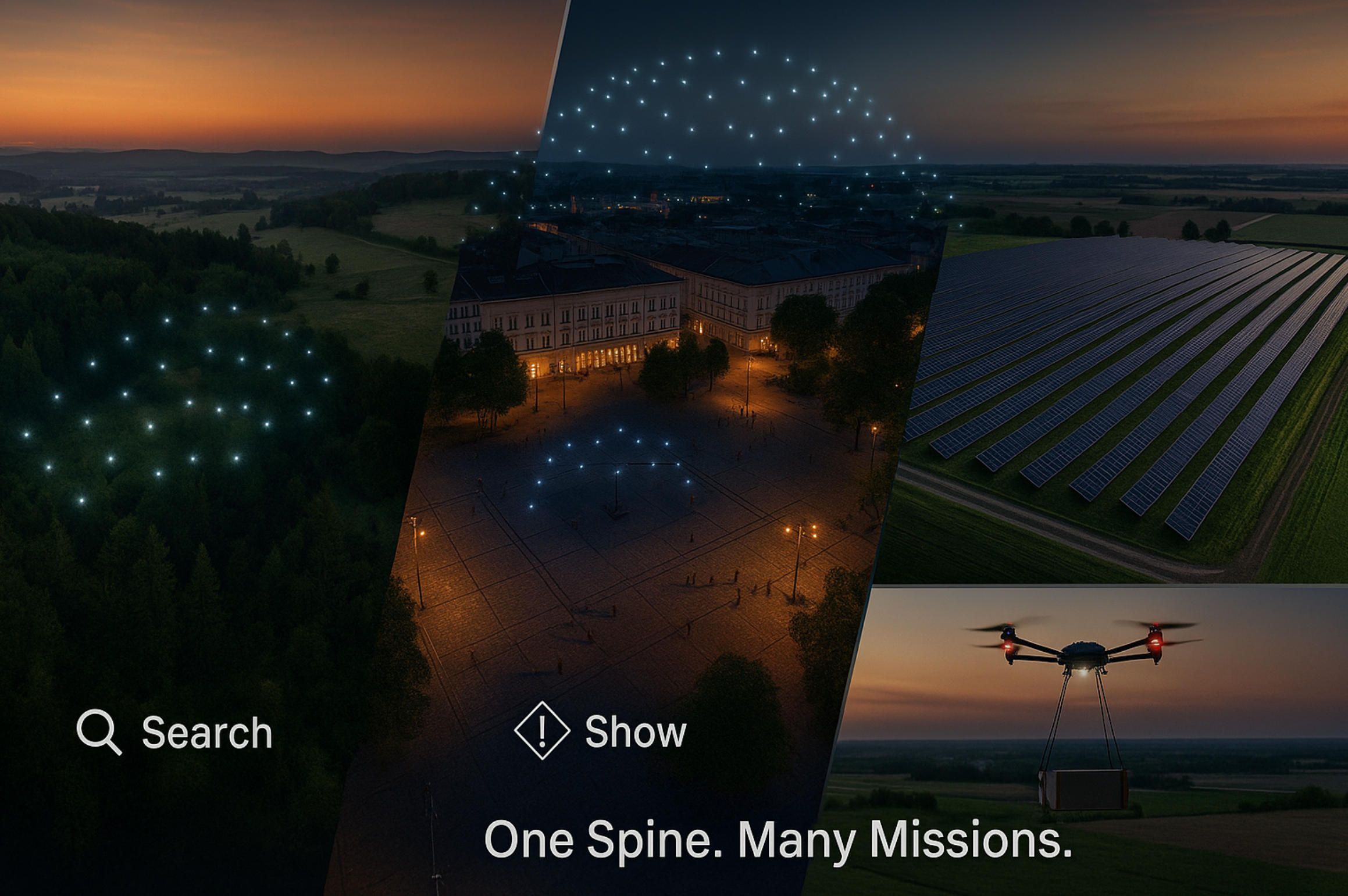
Swarm of Drones and Drone Show Apps: Architecture, Safety, and Real-World Operations (with ArduPilot and Mission Planner)
1) Why Swarm of Drones and Drones Show Are Booming Now
2) Reference Architecture for Drones Show Software Development & Swarm Ops
3) The Development Stack in Practice: ArduPilot + Mission Planner to Production
4) Where Swarms Work (Today & Next): Use-Cases and the Feature Roadmap
5) FAQ: Drone Show Platforms and Swarm-of-Drones Operations
6) Shop Talk: A Conversation with an A-Bots.com Lead Engineer on Swarm & Drone Show Software
A-Bots.com is an IoT app development company that builds production-grade control systems for complex aerial operations—from a single pilot interface to full software development for swarm of drones. Whether you need a backstage console for a drones show, a mission server that schedules hundreds of airframes, or a rugged mobile app that works offline at the edge, our team ships the stack: choreography tools, mission orchestration, fleet health, safety interlocks, and show-time telemetry. We routinely work with ArduPilot Mission Planner toolchains and MAVLink-based fleets to take concepts from simulator to stadium, field, or factory floor.
If you’re seeking a partner to lead app development for swarm of drones or to deliver a custom operator console for a drones show, A-Bots.com combines avionics know-how with product-grade UX. From requirements and air-risk modeling to SITL/HITL simulation and on-site rehearsals, we act as your drones show app development company—owning reliability, safety, and latency budgets so your first public performance (or pilot deployment) feels like your tenth.
1) Why Swarm of Drones and Drones Show Are Booming Now
The “why now?” moment for both the swarm of drones category and the broader drones show market comes from three converging arcs: record-scale demonstrations that prove technical maturity, regulatory clarity that lowers operational friction, and public demand for quieter, cleaner sky spectacles and safer multi-UAS operations. In April 2025, Ho Chi Minh City staged a record-setting formation of 10,518 drones, underscoring that synchronized control, time-discipline, and link resiliency can scale well past the five-figure mark. Even amid controversy around how the show was promoted, the technical feat—and the vendor’s claim of “five nines” reliability—signaled that formation flight isn’t a lab demo anymore; it’s an industrialized capability. TechRadar
Those headline moments aren’t isolated. Late 2024 saw a separate Guinness-recognized display with 7,998 drones, showing the record frontier advancing quarter by quarter as teams optimize choreography compilers, GNSS/RTK timing, and interference-resilient command protocols. The practical takeaway for executives and city organizers: large formations can be engineered with predictable error envelopes, survivable packet loss, and graceful degradation strategies—so you can confidently book prime-time. DRONELIFE
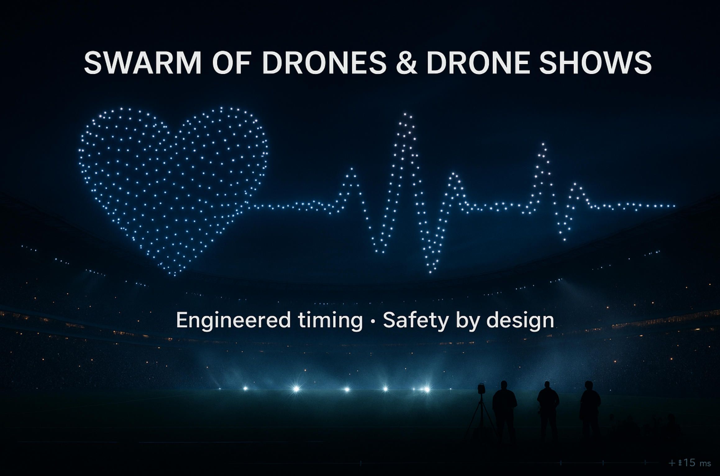
On the demand side, municipalities and venues are rethinking fireworks. Drone light shows avoid explosives, particulate smoke, and embers that elevate wildfire risk—factors that increasingly matter in dry, wind-sensitive seasons. Ahead of July 4th celebrations in 2025, roundups documented dozens of U.S. cities that either blended drones with fireworks or replaced fireworks outright, citing lower noise, pet/wildlife friendliness, and dramatically reduced cleanup. The same trend has been chronicled across Europe and beyond, where local authorities frame drone shows as inclusive—less distressing for veterans with PTSD and more accessible for families with sensory sensitivities. The Drone Girl, planetizen.com
Regulation has also moved from ambiguity to operational scaffolding. In the U.S., Remote ID is now enforced, effectively turning each aircraft into a “digital license plate” that helps coordinators and regulators manage airspace at scale; discretionary enforcement ended March 16, 2024. In the EU, Remote ID obligations and SORA (Specific Operations Risk Assessment) combine with the maturing U-space concept to formalize risk-based approvals for show and swarm operations, including requirements for mitigations, training, and procedures. For operators and solution vendors, that means fewer one-off interpretations and more repeatable compliance playbooks—an essential precondition for enterprise deployments. faa.gov, gao.gov, sphengineering.com, EASA
Under the hood, three technical capabilities have quietly crossed key thresholds:
- Clock discipline & choreography fidelity. GNSS/RTK timing and PTP-style synchronization allow milliseconds-level triggers across hundreds or thousands of nodes, so frames and poses render crisply even under RF stress. The result is better “image resolution” in the sky and tighter minimum separation without visual wobble.
- Link resiliency with bounded risk. Mixed comms (local ISM links plus LTE/5G backhauls for control or telemetry) combined with onboard “autonomy rails” (return-to-slot, shaped hover, or pre-negotiated hold patterns) keep formations coherent when packets drop—vital in urban RF noise.
- Operational safety as code. Preflight attestations, geofence stacks, and kill/abort semantics are instrumented in the ground stack—so a supervisor can soft-freeze a sector, re-slot an unwell airframe, or compress timing without cascading failures.
Taken together, this is why buyers today aren’t just purchasing “pretty patterns.” They’re acquiring a system: choreography software, a mission/trajectory server, an operator app, and a hardened field SOP that converts rehearsals into repeatable public performances. That is precisely the problem space where a drones show software development company adds value—codifying best practices into a reusable platform with safety interlocks, observability, and black-box telemetry for post-event analysis.
The same readiness is spilling over into non-entertainment swarms. Research teams continue to publish advances in cooperative autonomy—faster consensual path planning, collision-free group flight in constrained spaces, and multi-UAV task allocation that respects energy budgets. In September 2025, one university group announced a new coordination method enabling swarms to fly faster and safer even in cluttered environments; other studies detail probabilistic search patterns and distributed intelligence for search and rescue that increase coverage and reduce time-to-find. While many of these methods are early-stage, they’re shaping the feature backlogs for commercial swarm platforms—especially where time-critical missions meet sparse comms and GPS-degraded conditions. EurekAlert!, techxplore.com, ResearchGate
For organizers, agencies, and brands, the business case blends risk, reach, and reputation. Drone spectacles are programmable media: the same fleet can render a city crest one night and a sponsor narrative the next, without the single-use debris and noise footprint of pyrotechnics. For public-safety agencies, the swarm of drones model creates a lever: cover a grid, hand off tracks, and maintain persistent stare with rotating cells—even as individual units peel off to charge. For industrials, swarms shrink time-to-insight in large-area inspections (solar farms, tailings dams, pipelines) by distributing workload and fusing results into a single operator UI. That mixture of impact and optics explains why demand is rising for software development for drones show as well as software development for swarm of drones—buyers want both a spectacle platform and a mission platform, often sharing the same core.
Where do ArduPilot and Mission Planner fit? For many teams, they’re the shortest path from idea to flight-worthy behaviors. ArduPilot’s MAVLink stack and Lua scripting enable custom triggers, swarm roles, and health checks; Mission Planner provides trajectory prototyping, vehicle profiling, and HIL/SITL test harnesses that make choreography or patrol logic testable before a single rotor spins. That’s why an app development for drones show engagement with A-Bots.com frequently begins with ArduPilot-based SITL pipelines and grows into a production orchestration server and custom mobile app—the outward-facing operator experience that masks the complexity behind a single “Go Live” button.
All of this still hinges on trust and governance. Remote ID is necessary but not sufficient; public trust also depends on clear geofencing, published windows, and responsive “quiet buttons” when unexpected aircraft or weather impacts appear. In the EU, SORA formalizes this via operational risk objectives, competency matrices, and mitigations; in the U.S., Remote ID plus waivers, NOTAMs, and local coordination increasingly form an operational routine—not an exception. In other words, the friction of “How do we get approval?” is steadily becoming a standard checklist, which is exactly what scale needs. faa.gov, EASA
For decision-makers, the practical implication is straightforward: the enabling stack is real, the regulatory pathway is predictable, public sentiment is favorable when shows are designed responsibly, and the economics improve as fleets and batteries amortize over repeat engagements. This is the macro context that justifies investing now—not just in a one-off event, but in a reusable app development for swarm of drones platform that you can retheme for city festivals, sports halftime shows, or inspection patrols. If you’re scouting a swarm of drones app development company, prioritize partners who can prove discipline in time sync, RF planning, abort semantics, and flight-test telemetry—not just animation shaders. That’s how you get to “first show, zero drama.”
In short: the boom in drones show and operational swarms isn’t hype; it’s a function of matured control stacks, codified safety, and rising expectations for responsible, programmable skies. Choose a drones show app development company that treats the sky as a shared, regulated medium—not a blank canvas—and you’ll be ready for the next season of larger formations, tighter imagery, and cross-over use cases that turn spectacle into capability.
2) Reference Architecture for Drones Show Software Development & Swarm Ops (with ArduPilot & Mission Planner)
A robust drones show platform and an operational swarm of drones share the same bones: an offline planning toolchain, a choreography compiler or mission planner that turns intent into time-coded trajectories, an orchestration service that sequences the fleet, an operator-facing mobile app, and a hardened safety envelope that can tolerate packet loss, wind shear, individual vehicle faults, and last-minute venue constraints. The goal is not merely to “render” shapes in the sky; it’s to engineer a predictable system with bounded risk and crisp timing. Below is a production-grade reference model we repeatedly see succeed—especially when the stack leans on ArduPilot and Mission Planner during development and pre-flight validation.
Conceptual flow. Designers begin with intent: a sponsor logo, a scripted story, or a patrol grid. That intent becomes geometry and timing (poses, keyframes, beats) and, after constraint solving, becomes per-airframe trajectories with jerk-limited motion and minimum separation. The trajectories feed an orchestration server that owns time discipline and command dispatch; a custom mobile app provides the on-site operator surface for arming, slotting, go/hold, emergency aborts, and health awareness. Telemetry flows back for observability and black-box logging. Throughout, safety acts both as policy (geofences, no-fly polygons, altitude ceilings) and as mechanisms (soft-kill, hard-kill, return-to-slot behaviors). This is the core we harden in software development for swarm of drones and in software development for drones show.
Planning Studio to Choreography Compiler
The planning layer is where creative intent meets physics. A typical pipeline converts vector art or 3D paths into spatial frames and then slices these into synchronized keyframes with per-drone assignments. The compiler’s job is to prevent pretty collisions: it assigns drones to slots, solves for continuous, jerk-bounded paths, keeps lateral/vertical separation, and respects airframe envelopes (max acceleration, turn rate, battery curve). For drones show content, this pipeline also optimizes “image resolution”: how many points are needed to make a shape legible at the venue’s viewing distance, what brightness modulation is required, and how long dwell times can be without visible wobble.
Under the hood, the compiler operates like a constrained optimizer. Inputs: geometry, beats, fleet size, per-UAV performance models, local wind estimates, and venue limits. Outputs: JSON (or protobuf) bundles of per-drone trajectories—time-stamped position/heading setpoints, luminance keyframes, and contingency slots. For app development for swarm of drones, we add mission-centric primitives to the same compiler: search grids, inspection waylines, or cooperative lift nodes with pre-agreed hand-offs. The important point is unification: one compiler feeding both spectacle and mission styles lowers total cost of ownership.
ArduPilot & Mission Planner in the loop. During authoring, we dry-run the trajectories through ArduPilot SITL and Mission Planner to validate flight envelopes and parameterization (e.g., waypoint acceptance radii, WPNAV speed/accel limits, geofence stacks). The same toolchain supports hardware-in-the-loop (HITL) benches where ESC/motor responses, GPS degradations, or baro drift are injected before field rehearsal. This is where a drones show app development company earns its fee—catching issues in simulation instead of during a paid public slot.
Mission/Trajectory Orchestration Server
Think of the orchestration server as a conductor. It maintains global time and distributes cues and setpoints, but it also degrades gracefully when RF reality intrudes. We typically split it into micro-services so each concern is testable and scalable:
- Time discipline & cueing. GNSS-backed clocks (and PTP-style sync within the ground system) guarantee that when the “beat” lands, every airframe knows exactly which frame to execute—even if a packet arrives late. For very large formations, we additionally fan out squad leaders that relay cues to their cohorts, reducing head-of-line blocking.
- Trajectory serving. Every vehicle has a pre-authorized flight bundle. The server streams deltas and cross-checks health; if a drone reports a fault (battery, GPS, motor), it can be re-slotted to a safe holding assignment while neighbors re-interpolate to preserve the figure’s continuity.
- State, health, and observability. Telemetry ingestion (MAVLink on UDP/serial gateways) aggregates into time-series and event logs. We track not only position but also oscillator discipline, packet loss, link margin, and geofence state transitions. When software development for drones show is treated as an SRE problem, “blameless post-mortems” become possible—and improvements compound.
Security is integral, not decorative. We sign choreography bundles, bind them to a venue/time window, and require mTLS on ground links. Operator roles are gated: one person can arm, another can launch, and emergency authority is explicit. For public venues, we also integrate Remote ID monitoring and local UTM hooks so airspace awareness and conflict alerts feed the same operator UI used for show control.
Operator Mobile App (Edge UX)
The ground station is not always a flight case with a laptop. Many teams demand an operator experience that runs on a hardened tablet or smartphone with offline caches, explicit pre-flight checks, and camera-first diagnostics. Here is where A-Bots.com, as an IoT app development company, delivers the tactile layer for both app development for swarm of drones and show control:
- Pre-flight & attestations. The app forces checklists: firmware versions, geofence policy digest, battery/prop checks, compass calibrations, remote ID status. Only when every craft attests does “Arm All” appear.
- Slotting & late edits. Field crews can reassign airframes to slots, exclude a sick unit, or nudge a figure’s centroid to compensate for wind or an unexpected stage extension. Edits are bounded and logged.
- Go/Hold/Abort semantics. “Go” is time-tagged, not immediate; “Hold” freezes at the nearest keyframe; “Abort” sends every airframe to a pre-approved loiter volume or return-to-slot funnel. Semantics are boring by design—and that’s the point.
For drones show brightness control, we add venue-aware presets: urban light pollution vs. rural darkness, wildlife-safe modes near wetlands, and “quiet patterns” (minimal translation) for sensitive windows in a program. For security patrols or inspection swarms, we add task primitives: “expand grid by 10%,” “persistent stare on track 27,” or “handoff section C to Team 2.” Because the app is Flutter/React Native, we can ship the same operators’ muscle memory to iOS and Android without diverging codebases.
Communications & Link Budgeting
A swarm of drones is an RF system as much as it is an aerial one. The architecture plans for mixed links: local ISM bands (2.4/5 GHz or 900 MHz depending on region and vendor) for time-critical cues, with LTE/5G (or temporary private 5G) for telemetry and supervisory control. We design the protocol so that cueing is deterministic (tiny packets, strict retry windows, no chatty state) and telemetry is best-effort (graceful degradation when the crowd’s phones saturate spectrum). At the very large end, we cluster into squads; squad leaders receive the master clock and cue, then fan-out over short-range links that are less congested than the public channels around a stadium.
Critical to software development for swarm of drones is modeling the RF environment before trucks roll. We run site surveys, simulate people as absorbers/reflectors, and test worst-case jitter budgets. We prefer a timing budget where crisp visual poses tolerate ±10–20 ms of jitter without perceptible wobble; beyond that, the compiler exaggerates dwell time or reduces the “stroke” length to keep the effect intact. This attention to the link budget is one reason a seasoned drones show software development company consistently beats hobbyist stacks when audience phones, Wi-Fi APs, and venue radios light up the spectrum.
Safety Envelope (Policy + Mechanisms)
Safety is not a modal dialog; it is a layered system:
- Geospatial policy. Hard geofences (ceiling, lateral bounds), venue-defined no-fly polygons, and temporary keep-out volumes for cranes/stages. Policies carry version IDs; the operator app refuses to arm if the craft’s policy digest doesn’t match the job’s.
- Runtime mechanisms. Soft-kill (freeze at current keyframe), hard-kill (disarm), and return-to-slot vs. return-to-home behaviors depending on crowd geometry. We also specify “drift buckets”: if GPS degrades, vehicles are allowed to drift only within a defined bucket before flipping to a containment pattern.
- Procedural guardrails. Roles, rehearsals, and SORA-like documentation packages: hazard identification, mitigations, and contingency maps. Black-box logs (flight dataflash + ground telemetry) are preserved for post-event analysis and regulator comfort.
ArduPilot helps here: LUA scripts can watch for local health anomalies (vibes, redundancy mismatches) and trigger behaviors milliseconds before the ground system could notice. Mission Planner remains invaluable for configuring geofence stacks, validating RTL behaviors, and staging HITL rehearsals of fault trees (lost link, low battery, GPS multipath). This all feeds the same promise: a drones show or patrol mission that fails gracefully, predictably, and audibly to the operator.
Data Model, Testing, and CI/CD
Great fleets behave like great web services: everything is versioned, testable, and reproducible. We treat choreographies and missions as artifacts (immutable, content-addressed), and we ship them through environments: simulation → rehearsal → show. Continuous integration runs scripted SITL regressions: “render figure 12 at wind W with two failed vehicles; verify minimum separation never dips below R.” Hardware test racks spin props against dynos to track tolerant envelopes across firmware updates. OpenTelemetry spans stitch ground services, operator app events, and MAVLink telemetry so engineers can replay a failure at nanosecond resolution.
This rigor matters for both app development for swarm of drones and for the entertainment stack. It’s how a drones show app development company transforms creative notes (“the heart should beat faster”) into a safe, shipping system (“increase luminance L, reduce stroke S, add dwell D; regression suite green”). It is also how we hold latency and jitter budgets as shows scale: we can A/B test squad sizes, relay hops, and cue window widths across rehearsals and know—quantitatively—what changed.
Extensibility: From Spectacle to Mission
A hallmark of the architecture is that it generalizes. The same compiler and orchestration engine that render a logo can also coordinate search and rescue grids, long-baseline inspection of solar rows, or a cooperative lift where multiple craft share load via synchronized winches. The operator app swaps a brightness slider for a “persistent stare” toggle; the orchestration server swaps a choreography bundle for a patrol mission with dynamic retasking; the safety envelope swaps wildlife-safe brightness for a conservative over-people exclusion. This is why buyers increasingly ask for both app development for drones show and operational swarm features in one program—they want a durable platform, not a one-off stunt.
Where ArduPilot Mission Planner continues to shine is in the prototyping loop: planners sketch routes, check acceptance radii, tune WPNAV parameters, and quickly answer “can we do this safely within the envelope?” Once proven, the orchestration server takes over for stadium-scale precision or patrol persistence. That bridge—from lab to live—is the beating heart of software development for drones show and of software development for swarm of drones.
Production swarm architecture is a discipline of time, risk, and empathy for the venue and mission. Build around a compiler that respects physics, an orchestration server that respects causality, an operator app that respects human factors, and a safety envelope that respects regulators and the public. With that spine—and with ArduPilot & Mission Planner embedded in the development loop—your swarm of drones or drones show becomes a reliable product, not a gamble.
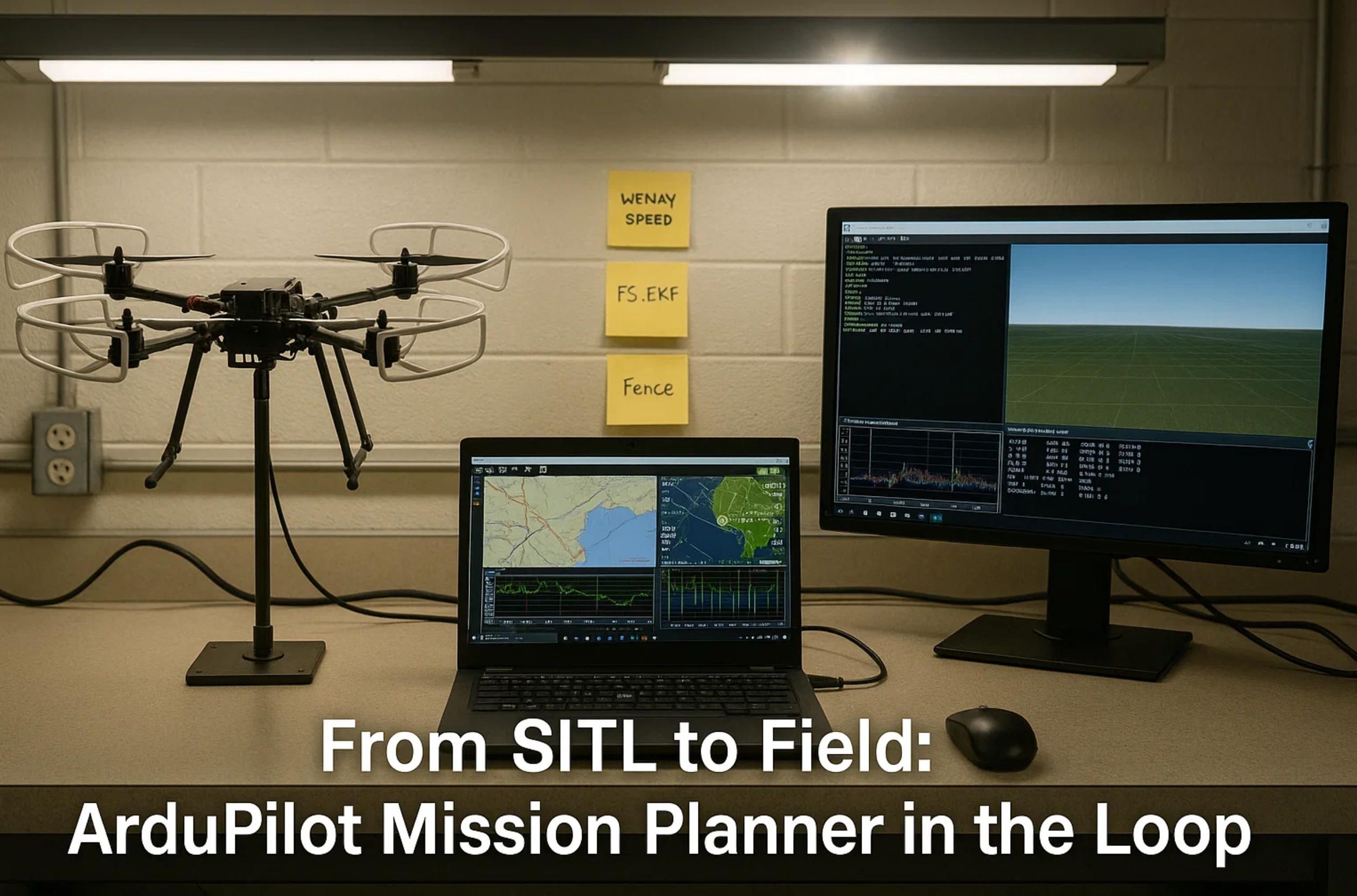
3) The Development Stack in Practice: ArduPilot + Mission Planner to Production
A modern swarm of drones program is won or lost in the handoff from pretty simulations to ugly reality. Wind shear, RF crowding, GPS multipath, a last-minute stage change—none of that reads the storyboard. What actually ships is a disciplined stack that treats choreography or mission logic as code, versions every artifact, and proves safety and timing budgets before the trucks even roll. This is where an IoT app development company like A-Bots.com leans on ArduPilot and Mission Planner during the build, then graduates to a hardened orchestration backend and a field-ready operator app at showtime.
“In God we trust; all others must bring data.” — W. Edwards Deming
From intent to time-coded reality
Every job starts with intent: a drones show sequence of frames and beats, or a patrol/inspection plan for an operations swarm. We convert that intent into a geometry-plus-timing model and feed it to a compiler that respects physics: minimum separation, jerk-bounded curve fitting, and per-airframe envelopes (accel limits, climb rates, roll/pitch ceilings). The compiler emits per-vehicle, time-stamped trajectories and luminance keyframes (for shows) or waypoint bundles with task semantics (for missions). Those bundles are signed, versioned, and sandboxed for site-specific constraints (geofence polygon, altitude ceiling, hazard keep-outs). Only then do we push them into SITL.
Why ArduPilot & Mission Planner first? Because the fastest way to discover that a shape curls too tightly—or that a patrol leg will skim a crane— is in simulation. In Mission Planner, we tune acceptance radii, WPNAV speed/accel limits, RTL behavior, fence parameters; we inject wind, GPS variance, and battery sag; and we graph EKF health long before propellers see sunlight. For show content, we measure the visual “stroke” stability under timing jitter and deliberately exaggerate dwell at critical frames if the RF budget is tight. For mission swarms, we exercise grid hand-offs and “persistent stare” logic with simulated link drops and clock skew. The aim is simple: prove that the plan is boring when everything goes right and graceful when something goes wrong.
The operator app is a safety instrument
At the venue or the worksite, laptops give way to a rugged custom mobile app with a human-factors-first UI. A-Bots.com typically ships this in Flutter so the same codebase covers iOS and Android. The app is opinionated: it refuses to arm until pre-flight attestations pass (firmware compatibility, compass calibration stamp, battery health, Remote ID status, fence digest match). Slotting is visual and constrained, late edits are logged, and go/hold/abort semantics are deterministic rather than “best effort.”
We build the app for edge reality: offline-first caches for trajectories and policies; a camera-first diagnostic mode (QR pairing, visual heartbeat on each airframe); and explicit role separation—one operator can arm, another can launch, a third holds emergency authority. For drones show, brightness profiles adapt to ambient light; “wildlife-safe” presets limit translation near wetlands or nesting seasons. For inspection/security swarms, task primitives appear in the same UI (“expand grid 10%,” “retask squad B to section 4,” “persistent stare on track 27”). The operator never sees MAVLink minutiae; they see the job.
Orchestration as a real-time service
Behind the app sits a mission/trajectory server that behaves like a conductor with a stopwatch. It maintains clock discipline (GNSS-disciplined grandmaster; PTP-style sync in the ground system), distributes cues, streams deltas, and monitors health. We prefer micro-services so every concern is testable: cueing, state/health ingestion, policy enforcement, logging, and squad fan-out for very large formations. Crucially, the server degrades gracefully: if an airframe flags a fault (low voltage, GPS health below threshold, motor imbalance), it is re-slotted to a holding pattern while neighbors re-interpolate to preserve figure continuity or grid coverage.
Security is built in, not bolted on. Bundles are signed and bound to venue/time. All ground links use mTLS; operator actions are role-gated and audited. Remote ID and local UTM feeds appear in the same UI so a supervisor can spot and pause for conflicting traffic without leaving the console.
ArduPilot-centric development: the details that matter
ArduPilot is more than “firmware”—it’s an instrumentation layer for safety and timing. In practice, we rely on:
- SITL and HITL loops to validate envelopes with and without GPS degradations; to verify RTL vs. return-to-slot; and to test fence violations and recovery behaviors.
- Lua scripts watching local health (vibes, EKF variance, motor thrust asymmetry) to trigger micro-behaviors milliseconds before the ground system could react: hold a keyframe, broaden separation, or enter a containment loiter.
- Parameter discipline via versioned profiles: WPNAV_SPEED/ACCEL, PSC_ACCZ for vertical feel, fence params, FS_EKF thresholds, and link failsafe semantics. Profiles are part of the artifact set—no “tribal knowledge” living on a field laptop.
- Mission Planner for fence authoring, route prototyping, dataflash log review, and side-by-side HIL benches where we inject clock skew, packet loss, and battery curves.
This blend is why app development for swarm of drones and software development for drones show both start on the same bench. Only after these behaviors are boring in the lab do we scale them in the field.
RF and timing budgets you can defend
A swarm of drones is equal parts aerodynamics and RF engineering. We assume mixed links: short-range ISM for deterministic cueing and LTE/5G (or temporary private 5G) for telemetry and supervisory control. Cue packets are tiny and time-tagged; retry windows are narrow; telemetry is best-effort. For stadium-scale shows or long-baseline patrols, we cluster into squads: squad leaders carry the master cue and fan out over short hops. During site surveys we model spectators as absorbers/reflectors, measure venue Wi-Fi, and set a jitter budget that the human eye will tolerate (often ±10–20 ms at keyframes). If the environment demands it, we automatically increase dwell at high-detail frames or reduce stroke length to keep imagery crisp.
Testing, fault injection, and post-event truth
We treat the stack like a web service: artifacts are immutable, environments are explicit (sim → rehearsal → live), and regressions are automated. Typical fault-injection drills include:
- Lost-link during a high-detail frame; verify soft-freeze and recovery never violate minimum separation.
- Two adjacent vehicles fail in opposite corners; verify neighbor interpolation preserves the figure outline and coverage envelope.
- GPS multipath near stages; verify drift stays inside “buckets” before containment logic triggers and the supervisor receives an immediate, loud alert.
All of this is measured. Ground services emit OpenTelemetry spans; Mission Planner/dataflash logs capture vehicle truth; the mobile app logs operator decisions. After every job we replay events and generate a human-readable “flight book”: what flew, what changed, what tripped mitigations, and what to tune. That’s how the next show or patrol gets calmer.
Safety: policy plus mechanisms
Safety lives in layers. Geospatial policy is explicit (hard fences, altitude ceilings, no-fly polygons). Runtime mechanisms are explicit (soft-kill freezes at the nearest keyframe; hard-kill disarms; return-to-slot funnels to a safe loiter volume). Procedural guardrails are explicit (roles, two-person launch, rehearsal tiers, weather minima). Because these are code and configuration rather than heroic memory, compliance stops being a pre-show panic and becomes a checklist. For stakeholders and regulators, we provide the bundle: hazard analysis, mitigations, rehearsal logs, and the black-box recordings that demonstrate why the risk is bounded.
Extending the same spine to real-world missions
What makes this stack valuable is that it generalizes beyond drones show into operations. The same compiler and orchestration service that render a sponsor logo can run a search-and-rescue grid with persistent stare and dynamic retasking; can coordinate cooperative lift where multiple craft share a load via synchronized winches; can compress an inspection tour over a solar field by distributing rows among squads and fusing results in a single UI. The operator experience barely changes; only the task primitives do. This is why buyers increasingly request one partner for both software development for swarm of drones and spectacle delivery—they want a durable platform, not a one-off stunt.
Production discipline, not heroics
Production wins are rarely about a clever shader or a genius pilot; they’re about repeatability. We codify success as:
- Versioned everything. Choreographies, missions, parameter sets, geofences, brightness profiles, operator roles—all under source control with signed releases.
- Observability everywhere. If a frame looked soft, we can show the jitter; if a patrol missed a strip, we can show the retask and why it happened.
- Boring rehearsals. When the stack is right, rehearsals are predictable to the point of being dull. That’s the compliment you want.
For customers, the outcome is tangible: a drones show app development company and swarm of drones app development company that deliver the promise of creative ambition with the habits of an SRE team. For teams that need to move from a one-night wow-moment to a dependable multi-city season—or from a successful pilot patrol to a 24/7 operation—that discipline is the difference between adrenaline and scale.
Why A-Bots.com
A-Bots.com’s approach is intentionally conservative where it counts and ambitious where it pays off. We prototype fast in ArduPilot Mission Planner, but we won’t skip the envelope tests, the RF budget work, or the signed-bundle discipline. We obsess over operator ergonomics because humans carry the last responsibility loop. And we design the platform so you can reuse it: app development for swarm of drones and software development for drones show on the same spine, with the same safety invariants, from stadium to substation. If you need a partner that can take a concept from deck to sky and keep it there, that’s exactly the stack we build.
4) Where Swarms Work (Today & Next): Use-Cases and the Feature Roadmap
When people hear swarm of drones, they first picture a synchronized drones show. That’s fair—stadium-scale spectacles have become the public face of multi-UAS coordination. But the same spine—compiler → orchestration → operator app → safety envelope—unlocks far more than artwork in the sky. In practice, the highest ROI swarms are those that compress time, extend human reach, and turn sparse data into decisions with repeatability. This section maps what’s working now, what’s one integration away, and which features will define the next 24 months. Throughout, remember that the technology is already production-grade; the differentiator is disciplined engineering and the ability to move from simulation to site with minimal drama.
Search & rescue (SAR) and disaster assessment. The most obvious operational win is coverage. After a storm, landslide, or flood, time is oxygen: you want to grid a large area, enforce minimum overlap, and maintain a persistent stare over any hot lead—while the rest of the fleet keeps searching. A swarm framework treats this like a living optimization problem. The compiler emits energy-aware grids and contingency slots; the orchestration service watches link quality, battery sag, and weather telemetry; the operator app exposes simple primitives (“expand grid 10%,” “persistent stare on track 27”). Models on the vehicles do the first-pass triage—motion detection, heat signatures, color anomalies—so the uplink carries only the interesting parts. The difference from single-UAS ops isn’t just speed: it’s resilience. If one vehicle fails, neighbors re-interpolate the grid without human micromanagement. That is where app development for swarm of drones pays for itself in the first season.
Drone light shows as programmable media. In entertainment, the buyer isn’t purchasing “flights,” they’re licensing story beats rendered by pixels in the sky. That mindset reshapes the stack. The choreography compiler becomes a content pipeline; the orchestration server becomes a low-latency CDN for time-coded poses; the operator app becomes a stage console with go/hold/abort semantics, brightness presets, and wildlife-safe modes. A reliable drones show app development company treats this like site reliability engineering: signed bundles, versioned parameter sets, blameless post-mortems, and reproducible rehearsals. The result is creative agility without operational roulette. It’s also why brands increasingly ask for software development for drones show that they can reuse across tours and cities, not just a one-off stunt.
Cooperative heavy-lift and precise placement. Multi-UAS lift looks exotic until you write it down as control laws and safety rules. Each airframe becomes a node in a distributed winch, sharing load through tension sensing and phase-locked position control. The orchestration service treats the payload as the primary actor and the drones as actuators that maintain geometry under wind and gusts. Safety envelopes are stricter (over-people exclusions, certified drop procedures, redundant tethers), but the payoffs are real: installing lightweight sensor masts on remote ridgelines, pulling temporary power lines over ravines, or staging materials in places where cranes can’t go. Here the operator app needs a different face—tension graphs, micro-nudges, explicit “freeze payload” and “descend 10 cm” commands. The principle is the same as a drones show: time, geometry, and bounded risk—just applied to force instead of light.
Inspection and monitoring at scale. Solar farms, tailings dams, pipelines, wind arrays, orchards—their common trait is surface area. A swarm compresses inspection cycles from days to hours and yields more consistent coverage. The compiler packs rows or transects into balanced chunks; squads launch in waves to maintain airspace separation and to guarantee continuous backhaul bandwidth; the operator app exposes audit-friendly features like “re-fly missed tiles,” “revisit anomaly cluster,” and “handoff section C to Team 2.” On-board models (defect detection, thermal anomalies, vegetation stress) filter the firehose so supervisors see a dashboard, not a folder of JPGs. This is where an IoT app development company earns trust with data hygiene—content-addressed artifacts, signed logs, and integrations to CMMS or EAM systems. It’s also where app development for drones show experience transfers: the same orchestration rules that keep a heart shape crisp keep a transect plan on tempo.
Security, perimeter patrol, and event safety. The least glamorous but most steady use-case is persistent patrol. Think large campuses, ports, or festivals: repeatable routes, scheduled relief, and the ability to linger in response to a cue from ground sensors. The swarm spine adds value by automating retask and handoff and by fusing detections from multiple angles and spectra. Privacy and policy matter here: geofences, recording rules, and retention budgets must be coded, not discussed. A swarm of drones software development company will wire those invariants into the operator app so that compliance becomes a user experience feature, not a training memo.
Near-Future “Must-Haves” (12–24 months)
The next two years won’t be defined by a single breakthrough so much as a stack of pragmatic upgrades that improve precision, reduce staffing, and widen the weather window. Three categories stand out—perception & localization, orchestration intelligence, and trust by design:
- Perception & localization. Relative localization that doesn’t crumble when GNSS does is moving from research to product. Expect UWB ranging, visual-inertial odometry, and collaborative SLAM to backstop RTK, tightening formation geometry in urban canyons and under mild canopy. On-vehicle models will get smaller and faster (quantized networks on NPUs), enabling real-time “do we have the right slot?” checks, dynamic occlusion handling in shows, and better target reacquisition in SAR. For choreographies, expect the compiler to reserve visibility corridors automatically so silhouettes read cleanly from the primary audience vantage.
- Orchestration intelligence. Today’s orchestration is deterministic by design; tomorrow’s adds bounded adaptability. Think consensus-based timing (so squads hold formation even under variable jitter), energy-aware job scheduling (so no single craft dies mid-figure), and dynamic spectrum management that senses crowd Wi-Fi/5G load and shifts cue channels without visible artifacts. For missions, the same layer will manage “intent drift”—the grid expands because the wind shifted smoke, or patrol priority flips because a perimeter sensor fired.
- Trust, safety, and compliance as code. Zero-trust ground links, SBOMs for vehicle firmware, signed mission/choreo bundles bound to venue and time windows, automatic Remote ID and UTM reporting, and red-team fault-injection rehearsals built into CI/CD. Black-box telemetry will become table stakes, not a “nice to have,” allowing operators to publish after-action reports that stakeholders can actually read. The winner here is the team that treats governance like reliability: measurable, enforceable, boring.
These “must-haves” are not moonshots; they’re roadmap items that a disciplined drones show software development company can stage over a season. They also dovetail with the ArduPilot ecosystem. ArduPilot Mission Planner remains the fastest way to validate envelopes, fences, and return behaviors before you put craft in the air, and its SITL/HITL loops are perfect harnesses for the kind of regression tests—lost link during a high-detail frame, two adjacent failures, GPS multipath buckets—that convert heroics into process.
What Buyers Should Ask for (and Why)
Whether you’re a city booking your first Independence Day spectacle or a utility compressing inspection cycles, your RFP should read like a reliability brief, not a demo reel. Demand signed artifacts (choreographies, fences, parameter sets); insist on operator role separation; require a post-event “flight book” with time-aligned ground spans and dataflash logs; and ask candidates to show their fault-injection scripts. If a vendor cannot simulate and replay their own failures, they cannot scale your season. This is where A-Bots.com is comfortable being evaluated: we engineer for the boring show, the predictable patrol, the lift that feels routine.
Just as important, align your platform choice with your reuse plan. A single drones show might justify a one-off, but a tour across multiple cities clearly doesn’t. A one-time SAR exercise might succeed with ad hoc coordination, but a regional disaster plan needs a repeatable playbook. That is exactly the gap a swarm of drones app development company is meant to fill—turning skills into software, and software into a product you can carry from site to site. If you eventually want to blend spectacle and operations—night shows to fund community SAR training, or halftime shows that double as battery and link stress tests for campus patrol—then the economics overwhelmingly favor a unified stack.
Finally, keep human factors at the center. The operator app is not a dev console; it’s a safety instrument. It should refuse to arm when attestations fail, surface loud and legible alerts, and make pause/abort semantics unambiguous. It should also assume offline reality: cached bundles, QR pairing, camera-first diagnostics, and a UI that makes it impossible to “fat finger” a destructive command. Those details are the difference between a great story and a great season.
If your roadmap includes programmable skies or scalable multi-UAS operations, you don’t need to gamble; you need a partner that treats timing, risk, and governance as first-class features. A-Bots.com is an IoT app development company that builds exactly this: orchestration servers, operator-grade mobile apps, and safety envelopes that have already been exercised in simulation and rehearsal. We are the drones show app development company that can ship your content pipeline and the swarm of drones software development company that can harden your mission stack—one spine, from ArduPilot Mission Planner benches to the field. If you’re considering software development for drones show or planning app development for swarm of drones, let’s design the first release so your tenth show or patrol feels as calm as your best rehearsal.
5) FAQ: Drone Show Platforms and Swarm-of-Drones Operations
Q1. What’s the practical difference between a drones show and a swarm of drones?
A drones show treats the fleet as pixels in the sky: choreography, brightness control, and crisp timing are paramount. A swarm of drones adds mission semantics—search grids, inspection transects, cooperative lift—so vehicles must retask, hand off work, and preserve coverage under failures. The healthiest programs use one spine (compiler → orchestration → operator app → safety envelope) for both, so creative spectacles and field operations share engineering rigor and reliability.
Q2. Can one software stack serve both entertainment and operations?
Yes—if you design for it from day one. The same orchestration engine that time-codes frames for a drones show can schedule patrol waylines or grid cells. Your operator app swaps brightness sliders for task primitives (e.g., “expand grid 10%,” “persistent stare on track 27”). This is exactly why many buyers want a single swarm of drones platform that can also stage shows: lower cost of ownership, shared training, and common safety tooling.
Q3. Where do ArduPilot and Mission Planner fit in a professional stack?
ArduPilot provides MAVLink, flight modes, Lua scripting, and a mature SITL/HITL pipeline. Mission Planner lets you prototype routes, fences, RTL behavior, and parameter sets, then read dataflash logs with the same rigor you apply to server logs. In our builds, ArduPilot + Mission Planner power simulation and envelope validation; production orchestration and the custom mobile app run the live show or mission, with ArduPilot enforcing local safety rails onboard.
Q4. How do you keep timing tight when the venue is RF-noisy?
We separate deterministic cueing from best-effort telemetry. Cue packets are tiny, time-tagged, and retried within strict windows; squads can relay cues to reduce head-of-line blocking. Clocks are GNSS-disciplined, with PTP-style sync on ground systems. The choreography compiler budgets jitter and may lengthen dwell during high-detail frames so the audience perceives stable shapes even when spectrum is crowded.
Q5. What happens if GNSS degrades or drops?
The safety envelope defines “drift buckets” and containment patterns. Vehicles may hold the nearest keyframe, return to slot, or funnel to a safe loiter volume. For next-gen reliability, we add relative localization (UWB, visual-inertial odometry, collaborative SLAM) so formations remain coherent in urban canyons. ArduPilot Lua hooks can trigger micro-behaviors milliseconds before the ground system could react.
Q6. How big a fleet do I need for a first public performance?
It depends on venue size and viewing distance. Many city plazas succeed at 200–400 craft; large stadiums often begin around 500–1,000 for legibility. The gating factor is not “how many” but whether your drones show pipeline (planning → compile → rehearsal → show) is engineered with geofences, signed choreographies, and rehearsed abort semantics.
Q7. What about weather?
Wind and precipitation define go/no-go thresholds per airframe. Before show day we simulate your set list under forecast winds, adjust dwell for high-detail frames, and prepare a “storm program” with minimal translation. For operational swarms, we bias patrol geometry, launch timings, and energy budgets to widen the weather window without compromising safety margins.
Q8. How is safety enforced beyond a pre-show checklist?
Safety is code and configuration, not memory. Hard geofences, altitude ceilings, and venue no-fly polygons are versioned artifacts; craft won’t arm if their fence digest doesn’t match the job. Abort semantics are deterministic (soft-freeze vs. hard-kill vs. return-to-slot). Roles are split: one user arms, another launches, emergency authority is explicit. Black-box logs and time-aligned ground telemetry support blameless post-mortems and regulator confidence.
Q9. Are we compliant with Remote ID, UTM, and risk-based approvals?
A production platform should emit Remote ID, integrate local UTM feeds (where available), and ship SORA-style documentation for risk assessment (EU) or equivalent operational packages (US). We bind mission/choreo bundles to venue/time with signatures, and we retain the telemetry necessary to demonstrate mitigations after the event or mission.
Q10. How do we protect IP and creative assets for a drone show?
Choreographies are content-addressed and cryptographically signed. Access to planning tools and build servers is role-gated with mTLS. If you license content to third-party operators, the platform enforces time-window and venue locks so a set list can’t be reused without permission. The same controls protect inspection routes and patrol policies on the operations side.
Q11. What’s the typical delivery timeline for a first release?
For a greenfield drones show with an established vendor fleet: discovery and RF/site planning (1–2 weeks), compiler integration and parameter profiles (2–4 weeks), operator app skinning with your brand and roles (2–3 weeks), and rehearsals (1–2 weeks). Operational swarms add mission features (grid scheduling, anomaly workflows) and usually run pilot deployments in parallel. Mature clients often compress this with pre-existing fleet profiles and re-used UI modules.
Q12. Can you work with our existing drones or do we need a new fleet?
If your aircraft speak MAVLink and meet performance envelopes, we can usually integrate them. Otherwise we provide an adapter layer or recommend compatible airframes. For entertainment, LED payload, brightness control, and EMI considerations matter; for missions, endurance, sensor payloads, and environmental sealing become the drivers.
Q13. How do you budget batteries and pit-stop logistics at scale?
We schedule squads in waves to maintain coverage and backhaul bandwidth, and we pre-compute swap windows so no squad ages out mid-figure. The operator app surfaces live energy margins and prevents launches that would violate the set’s budget. For patrols and inspections, jobs are energy-aware: grids are partitioned so return-to-swap never strands coverage.
Q14. What staff do we need on site?
Minimum viable crew: a show supervisor, an RF/ground-systems engineer, and two field technicians handling launch/recovery and health checks. For larger fleets or complex venues, add a compliance liaison and a comms runner. Operator roles are enforced in the app so responsibilities remain clear under pressure.
Q15. How are failures handled in the middle of a figure or mission?
The orchestration service re-slots faulty units to safe holds and interpolates neighbors to preserve figure integrity or grid coverage. Alerts are loud and actionable; post-event, the “flight book” shows the timeline: fault, mitigation, and outcome. You should expect to simulate these events in rehearsals and see the same behavior live.
Q16. What security model should we expect?
Zero-trust by default: signed artifacts, mTLS on all ground links, SBOMs for firmware, least-privilege operators, and audit trails for every sensitive action. If your risk profile requires it, we add secure boot and attestation to the vehicle side, plus hardware tokens for on-site operator roles.
Q17. How does data retention and privacy work for missions?
Retention windows and redaction are policy, not preference. The platform enforces video retention limits, masks PII when required, and logs every data access. For inspections, results are hashed and traceable into your CMMS/EAM; for security patrols, we separate operational logs from evidentiary exports with explicit approvals.
Q18. What are the biggest cost drivers?
Three dominate: fleet size and hardware class, venue or mission complexity (RF density, wind exposure, over-people constraints), and the breadth of software you want to own (one-off set vs. reusable platform). Choosing a unified swarm of drones stack that also delivers software development for drones show usually lowers cost across a season or multi-city tour.
Q19. Do you offer SLAs and post-launch support?
Yes. We provide runbooks, on-call coverage for show windows or mission hours, and scheduled regression testing tied to firmware and parameter updates. Many clients also opt for on-site rehearsal support before high-profile events.
Q20. Why A-Bots.com for this?
Because you need a partner that treats sky operations like product engineering. A-Bots.com is an IoT app development company that unifies app development for swarm of drones with software development for drones show. We prototype fast in ArduPilot + Mission Planner, ship a disciplined operator app, and run an orchestration backend with signed bundles, observability, and rehearsed fail-safes—so your first public show or pilot deployment feels like your tenth.
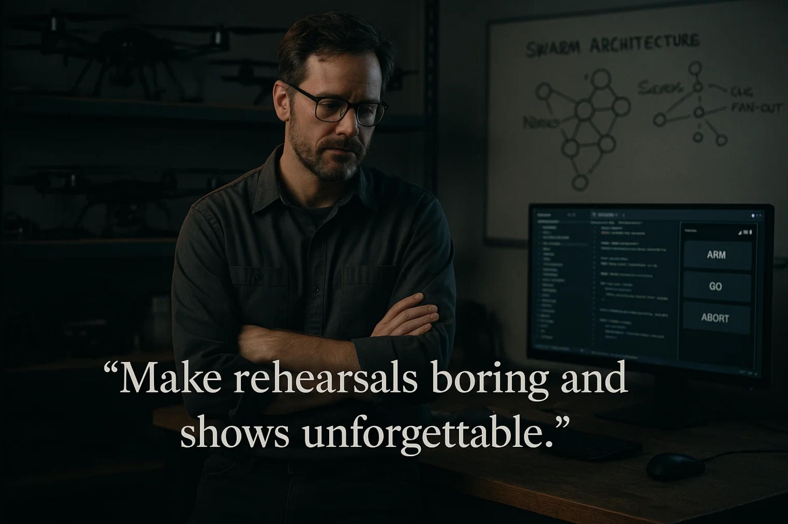
6) Shop Talk: A Conversation with an A-Bots.com Lead Engineer on Swarm & Drone Show Software
Q: If a city or a utility asks you “what stack should we build on for a drones show or a swarm of drones?”, where do you start?
A: With constraints, not languages. We map latency budgets, reliability targets, and what “safe failure” means in their venue or mission. That drives the stack. In practice, our orchestration backends are written in Go or Rust for predictable latency and memory safety. The choreography/mission compiler often begins life in Python for speed of iteration, then we push hot loops to Rust once the math is stable. The operator-facing layer is a custom mobile app—usually Flutter—so we ship one codebase to iOS and Android. We still use Node.js or TypeScript for admin consoles and content tooling because it accelerates UX. The important part isn’t the brand of tool; it’s treating your software development for swarm of drones like SRE: version every artifact, measure everything, and rehearse until it’s boring.
Q: Where do ArduPilot and Mission Planner fit in a professional pipeline?
A: They’re our proving ground. ArduPilot gives us MAVLink depth, great flight modes, Lua scripting for onboard guardrails, and SITL/HITL that let us validate envelopes with no props spinning. Mission Planner is the Swiss Army knife: we prototype fences, RTL behaviors, WPNAV parameters, look at dataflash logs, and run side-by-side benches that inject wind, GPS multipath, or battery sag. For app development for swarm of drones and for software development for drones show, that loop—SITL → HITL → field—saves you from discovering physics during a paid show window.
Q: Everyone touts “synchronization.” What does that actually mean on show night?
A: It means the sky looks crisp when the venue is RF-noisy. We GNSS-discipline the ground clock and use PTP-style sync across ground services; we time-tag cues so drones execute the same frame even if a packet arrives late. For very large formations we fan out via “squad leaders”—that cuts head-of-line blocking. The choreography compiler also “knows” about jitter: if your spectrum looks rough, it lengthens dwell on high-detail frames so the human eye still sees a sharp outline. That combination is why a drones show reads cleanly from the stands.
Q: What about missions—search, inspection, security—where GNSS can degrade?
A: Two answers. Today: define “drift buckets,” containment patterns, and deterministic return-to-slot/loiter behaviors, with Lua hooks onboard to act faster than the ground can. Tomorrow: relative localization. We’re productionizing UWB ranging, visual-inertial odometry, and collaborative SLAM so a swarm of drones stays coherent in canyons or near glass. It’s not a moonshot; it’s incremental reliability.
Q: How do you structure the orchestration backend so it scales beyond a one-off?
A: As a real-time service with boring semantics. Micro-services for cueing, trajectory serving, policy enforcement, health ingest, and logging. Cues are idempotent and monotonic; we can replay a night deterministically. State is event-sourced so post-mortems are truth, not opinion. And everything speaks mTLS with least-privilege roles. When cities ask for a drones show app development company, they’re actually asking for that reliability DNA.
Q: RF is always the boogeyman. How do you plan links for a stadium or a port?
A: We separate deterministic cueing from best-effort telemetry. Cue packets are tiny, retried inside tight windows, and can relay through squads. Telemetry is opportunistic and compressible. Before show day we do site surveys, model people as absorbers/reflectors, and reserve channels accordingly. If we can, we deploy private 5G for the supervisory path. The KPI is perceptual: keep effective jitter under ~10–20 ms on keyframes so a logo doesn’t “swim.”
Q: Safety sounds like policy docs. How do you make it software?
A: We treat safety like code. Geofences, altitude ceilings, no-fly polygons—versioned artifacts signed into the job bundle. Craft won’t arm if their fence digest doesn’t match. Abort semantics are deterministic: soft-freeze at the nearest keyframe, hard-kill, or return-to-slot, depending on crowd geometry. Roles are explicit: one person arms, another launches, emergency authority is separate. That’s the difference between a checklist and an invariant.
Q: What does observability look like when the lights are on and the crowd is loud?
A: Correlated truths. Ground services emit OpenTelemetry spans; MAVLink and dataflash capture vehicle reality; the mobile app logs operator intent. After the event we publish a “flight book”: what flew, what changed, what mitigations triggered. If a show frame looked soft, we can show the jitter; if a patrol missed tiles, we can show retask timing. That’s how software development for drones show becomes a learning loop, not a gamble.
Q: Speaking of the operator—what’s non-negotiable in the mobile app?
A: Three things. First, attestations before “Arm All”: firmware compatibility, compass stamps, battery health, Remote ID status, fence digest. Second, go/hold/abort that’s deterministic and loud; no tiny gray buttons. Third, offline-first reality: cached bundles, QR pairing, camera-first diagnostics. If the app feels like a dev console, we’ve already failed. It’s a safety instrument.
Q: Edge AI: how much belongs on the drone versus on the ground?
A: As little as you can get away with—until latency forces your hand. Onboard models do triage: movement, thermal anomaly, simple re-ID. We quantize networks for NPUs and keep them refreshable over signed OTA. Heavy lifting—fusion across angles, long-range tracking—belongs on the ground where compute and storage are sane. For a drones show, “AI” mostly means adaptive brightness and occlusion handling so silhouettes read cleanly from the main audience vantage.
Q: Can you share the kinds of tests you run before you ever roll trucks?
A: We run fault-injection like an airline runs sims. Lost link during a high-detail frame; adjacent vehicle failures; GPS multipath near a stage; low-battery mid-figure; spectrum crowding at halftime. We expect soft-freeze to respect minimum separation, and we expect neighbor interpolation to preserve figure continuity or grid coverage. If we can’t make the system fail gracefully in SITL/HITL, we don’t take it live.
Q: Security model?
A: Zero-trust. Signed choreographies/missions bound to venue and time, mTLS everywhere, SBOMs for firmware, secure boot where hardware allows, hardware tokens for on-site roles, and audit trails for sensitive actions. If you want to license your content to third-party operators, we enforce venue/time locks so your set list can’t “walk.”
Q: What are the most common mistakes first-timers make?
A: Three patterns repeat:
-
Treating the sky like a blank canvas, not a regulated, shared medium. That shows up as weak geofences and fuzzy abort semantics.
-
Over-indexing on animation tooling and under-investing in RF planning and time sync. Pretty in a studio doesn’t equal crisp above a stadium.
-
Skipping artifact discipline. If your fences, parameter sets, and bundles aren’t versioned and signed, you’re one field laptop away from chaos.
Q: We’re a city doing our first drones show. How many drones “feel big”?
A: Venue-dependent. A plaza reads well at 200–400. Stadiums usually start at 500–1,000 for legibility. But the better question is: can your pipeline keep jitter low, maintain separation, and give the operator a crisp “Hold/Abort” the crowd can’t hear? That’s what separates a spectacle from a story you actually want to repeat.
Q: And if we’re a utility or a security team considering a swarm of drones for operations?
A: Start with one mission you run every week—solar transects, tailings checks, night perimeter. Make it repeatable with squads and energy-aware scheduling. Prove your “retask and handoff” works under failure and wind. Once the spine is solid, you can add polish: anomaly workflows into your CMMS/EAM, role-based data retention, and multi-sensor fusion. The stack is the same; the primitives change.
Q: Final advice for choosing a partner?
A: Ask any vendor—us included—to replay a failure, not a highlight reel. “Show me the lost-link drill and the logs.” If they can’t do that, they’re selling a demo, not a platform. A-Bots.com stakes its reputation on being both a drones show app development company and a swarm of drones software development company that will bring you a spine you can reuse—app development for swarm of drones today, software development for drones show on tour tomorrow—bench-proven in ArduPilot Mission Planner and battle-tested in the field.
✅ Hashtags
#SwarmOfDrones
#DroneShow
#DroneShowSoftware
#ArduPilot
#MissionPlanner
#MAVLink
#IoTApps
#AerialRobotics
#EdgeAI
#RealTimeSystems
#RemoteID
#UTM
#FlutterDev
#ABots
Other articles
App for DJI Drone: Custom Flight Control and Mapping Solutions DJI dominates the skies, yet real value materialises only when flight data flows into business-ready insights. Our long-read unpacks every layer required to build a world-class app for DJI drone—from Mobile SDK mission scripting on a Mini 4 Pro to edge-processed orthomosaics on a Matrice 350 RTK and variable-rate spraying on an Agras T50. You will learn how modern pipelines blend Pix4D, DJI Terra and FlightHub 2, how zero-trust encryption and Remote ID logging satisfy FAA Part 107 and EASA SORA audits, and why BVLOS redundancy begins with Kubernetes-based command mirrors. Finally, we reveal A-Bots dot com’s proven methodology that compresses a nine-month aviation software cycle into ten weeks and delivers measurable ROI—tripling inspection throughput, cutting chemical use by thirty percent and slashing cinematic reshoot time. Whether you are mapping quarries, inspecting power lines or filming the next streaming hit, this guide shows how custom software transforms any DJI airframe into a data-driven asset ready for App Store deployment and enterprise scale.
Drone Mapping Software (UAV Mapping Software): 2025 Guide This in-depth article walks through the full enterprise deployment playbook for drone mapping software or UAV mapping software in 2025. Learn how to leverage cloud-native mission-planning tools, RTK/PPK data capture, AI-driven QA modules and robust compliance reporting to deliver survey-grade orthomosaics, 3D models and LiDAR-fusion outputs. Perfect for operations managers, survey professionals and GIS teams aiming to standardize workflows, minimize field time and meet regulatory requirements.
Drone Survey Software: Pix4D vs DroneDeploy The battle for survey-grade skies is heating up. In 2025, Pix4D refines its lab-level photogrammetry while DroneDeploy streamlines capture-to-dashboard workflows, yet neither fully covers every edge case. Our in-depth article dissects their engines, accuracy pipelines, mission-planning UX, analytics and licensing models—then reveals the “SurveyOps DNA” stack from A-Bots.com. Imagine a modular toolkit that unites terrain-aware flight plans, on-device photogrammetry, AI-driven volume metrics and airtight ISO-27001 governance, all deployable on Jetson or Apple silicon. Add our “60-Minute Field-to-Finish” Challenge and white-label SLAs, and you have a path to survey deliverables that are faster, more secure and more precise than any off-the-shelf combo. Whether you fly RTK-equipped multirotors on construction sites or BVLOS corridors in remote mining, this guide shows why custom software is now the decisive competitive edge.
Drone Detection Apps 2025 Rogue drones no longer just buzz stadiums—they disrupt airports, power grids and corporate campuses worldwide. Our in-depth article unpacks the 2025 threat landscape and shows why multi-sensor fusion is the only reliable defence. You’ll discover the full data pipeline—from SDRs and acoustic arrays to cloud-scale AI—and see how a mobile-first UX slashes response times for on-site teams. Finally, we outline a 90-day implementation roadmap that bakes compliance, DevSecOps and cost control into every sprint. Whether you manage critical infrastructure or large-scale events, A-Bots.com delivers the expertise to transform raw drone alerts into actionable, courtroom-ready intelligence.
ArduCopter Apps by A-Bots.com - Custom Drone Control 2025 Need industrial-grade drone control? Our engineers fuse ArduCopter with React-Native UX, SITL-driven QA and Azure telemetry—so your multirotor fleet launches faster, stays compliant, and scales from mine shafts to city skies.
Mastering the Best Drone Mapping App From hardware pairing to overnight GPU pipelines, this long read demystifies every link in the drone-to-deliverable chain. Learn to design wind-proof flight grids, catch RTK glitches before they cost re-flights, automate orthomosaics through REST hooks, and bolt on object-detection AI—all with the best drone mapping app at the core. The finale shows how A-Bots.com merges SDKs, cloud functions and domain-specific analytics into a bespoke platform that scales with your fleet
PX4 vs ArduPilot This long-read dissects the PX4 vs ArduPilot rivalry—from micro-kernel vs monolith architecture to real-world hover drift, battery endurance, FAA waivers and security hardening. Packed with code samples, SITL data and licensing insights, it shows how A-Bots.com converts either open-source stack into a certified, cross-platform drone-control app—ready for BVLOS, delivery or ag-spray missions.
Top stories
Copyright © Alpha Systems LTD All rights reserved.
Made with ❤️ by A-BOTS