Home
Services
About us
Blog
Contacts
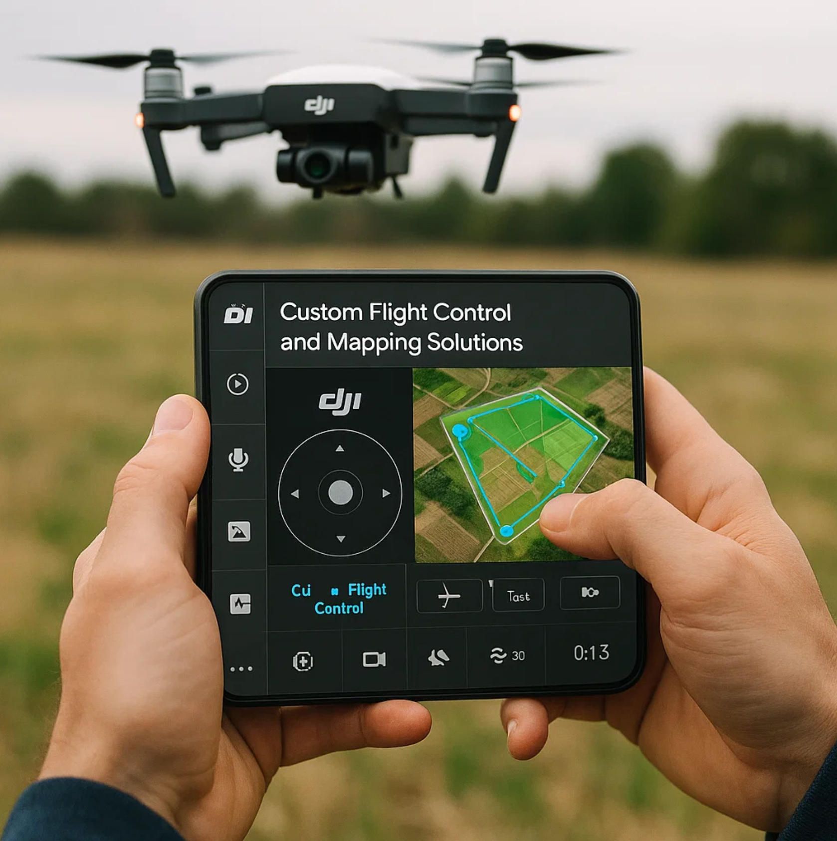
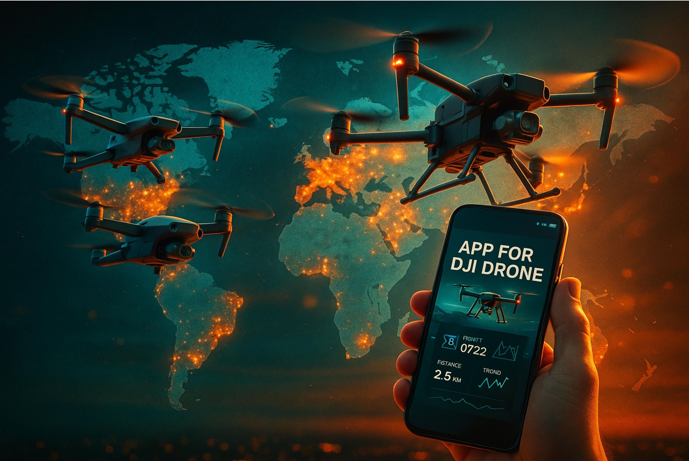
App for DJI Drone: Custom Flight Control and Mapping Solutions
Why the World Wants an App for DJI Drone: Market and User Demand
Inside DJI’s SDK Stack: Building Your Own Mini 4 Pro or Mavic 3 Pro Companion App
Flight Control and Automation: Mission Engines for Matrice 350 RTK, Inspire 3 and Agras T50
Real‑Time Mapping and Photogrammetry: From Pix4D to DJI Terra and Beyond
Data Pipelines and Cloud Dashboards: DJI FlightHub 2, QGroundControl and Custom Portals
Security, Compliance and BVLOS Readiness: Hardening Your DJI Drone App for FAA, EASA and ISO
A‑Bots.com Advantage: From Prototype to App‑Store—Your Partner for Every DJI Drone App
Why the World Wants an App for DJI Drone: Market and User Demand
An avalanche of data from Drone Industry Insights, Bloomberg Intelligence, and the Federal Aviation Administration converges on one clear trend: pilots and enterprises are no longer satisfied with flying a DJI aircraft straight out of the box. They want tailored digital workflows, friction‑free analytics, and on‑demand automation wrapped inside a dedicated app for DJI drone. Global spending on drones reached roughly 73 billion US dollars in 2024 and is projected to expand at a fourteen‑percent compound rate through 2030. Hardware sales alone cannot explain that pace. More than half of today’s investment flows into software, data platforms, and developer services that let a Mini 4 Pro map vineyards, a Mavic 3 Enterprise inspect wind turbines, or an Agras T50 prescribe variable‑rate spraying in a single tap. Against that backdrop, building a sophisticated mobile or cloud app for DJI drone has become the fastest way for equipment owners to unlock new revenue and for solution providers like A‑Bots dot com to showcase deep technical mastery.
From Viral Videography to Prosumer Analytics
On social media it is easy to witness the consumer pull. Search the hashtag #Mini4Pro on Instagram or TikTok and you will scroll through millions of clips, many geo‑tagged from remote coastlines or mountain trails where network coverage is patchy and on‑device autonomy matters. DJI Fly, the default companion application, is downloaded more than one hundred million times on Android alone, yet surveys by YouTuber‑developers such as DroneU.io reveal that over forty percent of hobbyists simultaneously run an aftermarket tool like Litchi or DroneLink to automate panoramas, hyperlapses, and low‑level terrain follow. Every extra feature—offline topo tiles, FPV overlays, or refined gimbal choreography—drives another spike in keyword searches for “Mini 4 Pro waypoint app” or simply “app for DJI drone.” Each search is a signal that users are ready to pay for software that saves battery life, shortens editing time, or guarantees cinematic repeatability.
Enterprise Missions Demand Vertical Precision
The appetite is even stronger once budgets turn professional. The Mavic 3 Enterprise and the Matrice 350 RTK—two platforms that dominate land‑survey, utility inspection, and emergency‑response tenders—ship with DJI Pilot 2, a robust baseline toolkit. Still, project managers often need features that fall outside the default stack: automated GCP‑free photogrammetry, dielectric corrosion scoring, or LTE fallback telemetry during beyond‑visual‑line‑of‑sight corridors. That gap fuels a rich supply chain of niche applications from DroneDeploy, Pix4D, and UgCS. Their collective download counts measure in the hundreds of thousands, yet each vertical—construction, energy, telecom—spawns custom requirements sat best by bespoke code. An electrical utility in Guangdong reportedly flew more than five thousand Matrice sorties last year under a home‑grown app for DJI drone that streams corona‑discharge heat maps to a private cloud, cross‑references asset IDs, and dispatches crews in under five minutes. Such stories prove that finely tuned software is the multiplier for expensive hardware and that enterprises will fund serious projects when they know a development partner can speak the language of both aeronautics and data science.
Cinema and Live Broadcast Push Real‑Time Control
At the other end of the spectrum sits the Inspire 3, a platform beloved by film directors and live broadcasters for its 8K image pipeline. Here, an app for DJI drone must synchronise dual‑operator gimbals, integrate RTK‑precise dolly tracks, and drive ultra‑low‑latency feeds to vision mixers. Hollywood studios now embed software developers on set to build custom control surfaces that ride on top of the DJI Mobile SDK because five extra milliseconds of delay can make or break a shot worth tens of thousands of dollars. For agencies that shoot sports, fashion, and concerts, the killer feature is automatic scene metadata injection so editors can drop footage straight into a cloud timeline. Again, off‑the‑shelf tools rarely reach this fine grain of creative control, reinforcing the case for purpose‑built applications.
Smart Farming Converts Flights into Agronomic Insights
Agriculture offers perhaps the clearest demonstration of return on software investment. DJI’s Agras T50 carries forty kilograms of liquid or granular payload, yet the agronomic value emerges only after a field prescription layer translates multispectral indices, soil cores, and yield targets into site‑specific litres per hectare. Developers integrate Pix4Dfields for crop modelling, dock that output with Mobile SDK autonomous spraying logic, and weld on ERP connectors so a grower’s invoices match drone passes. A tailored app for DJI drone can cut chemical use by thirty percent and labour by forty in a single season according to trials at the University of Kansas. Consequently, search trends for “Agras variable rate app” have quadrupled since early 2023.
A Thriving Developer Ecosystem
All those vertical wins sit on top of DJI’s rapidly evolving platform. Mobile SDK 5 unlocked offline terrain follow and advanced waypoint engines; Cloud API 2.0 added WebSocket live‑streaming and multi‑drone fleet hooks; UX SDK templates now support Jetpack Compose on Android and SwiftUI on iOS, slashing interface build times. DJI reports more than one hundred fifty thousand registered developers and thirty thousand published apps. That critical mass reduces time to market for every new app for DJI drone and creates an expectation that any feature imaginable—AI‑assisted crack detection, augmented‑reality geofencing, or blockchain proof of flight—can be shipped quickly with the right partner.
Regulation Accelerates the Need for Intelligent Software
Finally, changing airspace rules are pushing operators toward smarter applications. The Federal Aviation Administration approved one thousand one hundred sixty Part 107 beyond‑visual‑line‑of‑sight waivers by December 2024, triple the 2022 number. Europe’s EASA has begun classifying the Mavic 3 Enterprise and the Matrice 350 RTK under the C2 label, which opens routine operations near populated areas—provided pilots log digital flight records, broadcast Remote ID, and demonstrate risk mitigation. Meeting those obligations at scale is impossible without a secure app for DJI drone that automates compliance, encrypts telemetry, and synchronises maintenance logs. The same holds for ISO‑27001 audits, public‑safety call‑outs, and humanitarian relief missions where chain‑of‑custody and audit trails are mandatory.
The Opportunity Ahead
Across consumer, enterprise, creative, agricultural, and regulatory domains the message repeats: hardware excellence is assumed, but software excellence decides profitability, safety, and user delight. Every statistic, from one hundred million DJI Fly installs to five thousand‑flight utility networks, underscores the commercial gravity around well‑engineered applications. In the remaining sections we will dissect how to architect, secure, and monetise a high‑performance app for DJI drone—and why A‑Bots dot com is uniquely positioned to guide clients from prototype to full‑scale deployment.
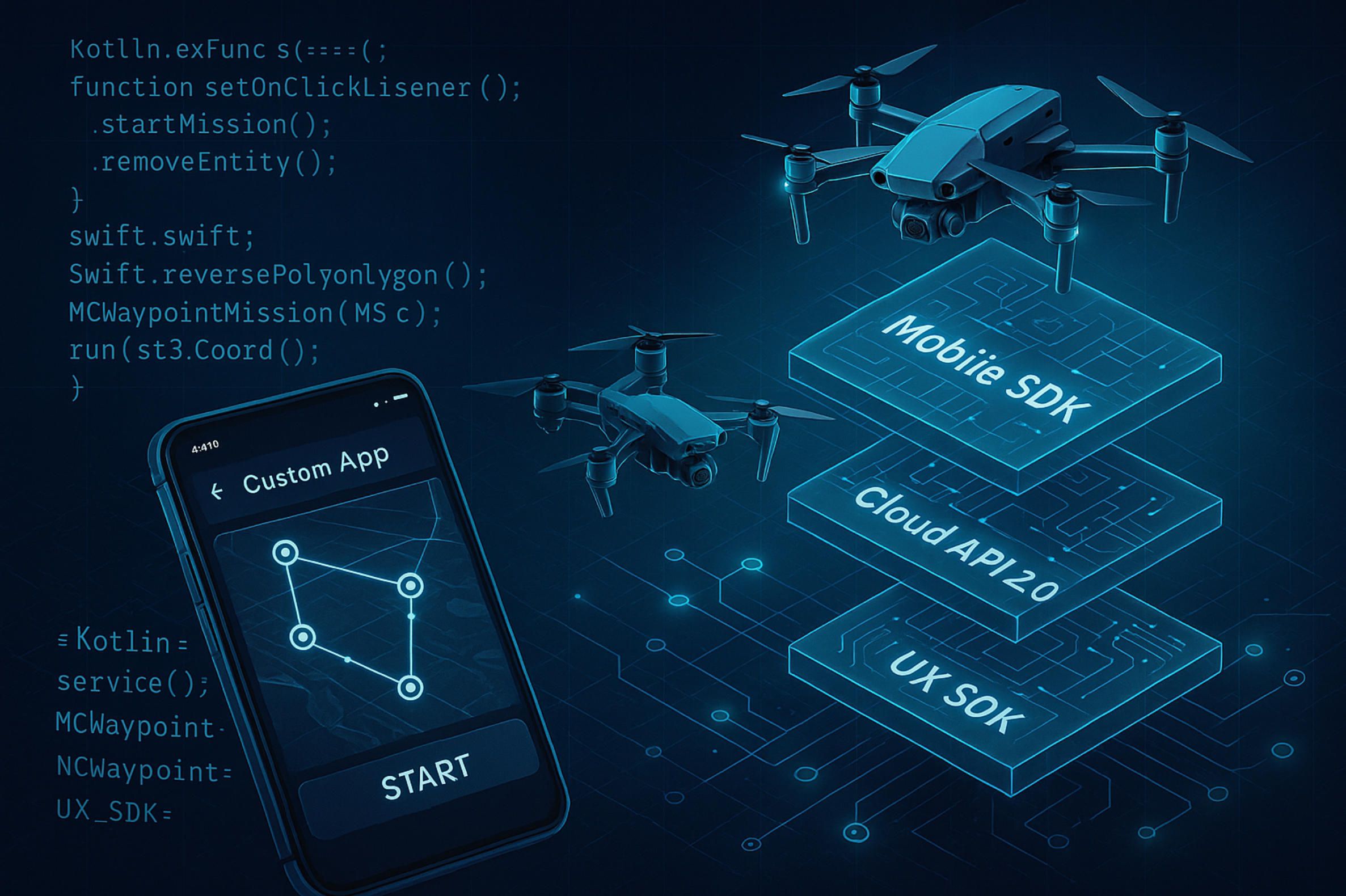
Inside DJI’s SDK Stack: Building Your Own Mini 4 Pro or Mavic 3 Pro Companion App
Writing a high‑performance app for DJI drone is no longer a moon‑shot reserved for silicon‑valley giants. Thanks to an increasingly modular software development kit architecture, a small team can move from idea to first flight in weeks, whether the target airframe is the palm‑sized Mini 4 Pro or the flagship Mavic 3 Pro. What follows is a ground‑to‑cloud tour of the DJI platform elements you must master, plus practical insights that A‑Bots dot com has accumulated while delivering production apps for inspection, mapping, creative media and smart agriculture.
Mobile SDK 5: The Flight‑Control Workhorse
The point of entry for any interactive app for DJI drone that runs on iOS or Android is Mobile SDK 5 (current release v5.13.0, May 2024). Under the hood it wraps low‑level CAN bus messages from the aircraft flight controller into a clean object model: Aircraft, FlightController, Camera, and Gimbal. Once the Mini 4 Pro or the Mavic 3 Pro establishes an O4 or O3 Plus radio link, your Kotlin or Swift code can subscribe to telemetry, push real‑time joystick commands, or upload advanced waypoint scripts. For the Mini 4 Pro, developers often exploit the terrain‑follow API so the aircraft hugs a mountain slope using cached SRTM elevation tiles when LTE coverage vanishes. On the Mavic 3 Pro, tripod‑mode cinematography benefits from precise gimbal pitch control delivered at one hundred hertz over the secondary control channel, minimising horizon drift in eight‑kilometre sunsets.
Mobile SDK projects begin with certificate provisioning. The DJI Developer console issues an AppKey tied to a bundle ID and signs it with a private RSA token that must be side‑loaded into the app. During on‑site deployments A‑Bots dot com routinely automates certificate refresh via a CI pipeline, ensuring that nightly builds pushed to TestFlight or Google Play internal tracks never expire.
UX SDK: Drag‑and‑Drop Interfaces that Feel Native
Great telemetry is useless if the pilot’s tablet UI lags or clutters the screen. UX SDK complements Mobile SDK by offering composable widgets—FPV view, camera histogram, battery state, and map overlay—that obey platform conventions such as Jetpack Compose on Android and SwiftUI on iOS. A‑Bots dot com usually forks the open‑source UX module, re‑skins colour palettes to match a client’s brand, then injects custom overlays: NDVI false‑colour layers for agronomy, or spline‑based framing guides for film directors flying the Inspire 3. The key advantage is that every widget inherits lifecycle safety: when the companion app is backgrounded, camera streams pause automatically, avoiding Android surface leaks that once plagued older DroneDeploy builds.
Cloud API 2.0: Fleet Telemetry and Live Stream without USB Tethers
Single‑drone missions dominate hobby flights, but enterprise clients want dashboards that watch dozens of Mavic 3 Pro and Matrice 350 RTK aircraft at once. Cloud API 2.0 (released December 2024) unlocks direct WebSocket channels from the remote controller to your backend, bypassing the smartphone entirely. This matters in dense construction sites where safety officers monitor geofences in real time from a web browser. A‑Bots dot com typically mounts a lightweight Node.js service behind AWS API Gateway, authenticates Cloud API tokens with short‑lived IAM credentials, then streams protobuf telemetry into DynamoDB and Grafana. Using the same pipeline, a Mini 4 Pro can push 1080p 30 frames per second footage with under five hundred milliseconds of end‑to‑end latency, adequate for live broadcast cut‑ins or emergency‑response situational awareness.
Payload SDK and E‑Port: Extending the Mavic 3 Pro Beyond Imaging
While the Mini 4 Pro lacks an expansion interface, the Mavic 3 Pro in enterprise trim supports DJI E‑Port. Payload SDK lets you treat third‑party sensors—multigas detectors, LED arrays, even robotic grippers—as first‑class citizens inside your app for DJI drone. During a recent proof of concept for an oil‑and‑gas operator, A‑Bots dot com attached an optical‑methane camera, streamed raster data through Mobile SDK, and fused the plume geometry with standard RGB orthomosaics rendered by Pix4D Engine. The result was a field‑ready leak inspection toolkit delivered in twelve weeks.
Choosing the Right Cross‑Platform Wrapper
Clients often ask whether Flutter or React Native can cut costs versus writing separate Kotlin and Swift apps. The answer depends on latency tolerance. Flutter bindings to Mobile SDK introduce roughly twenty milliseconds of extra marshal overhead—fine for mapping but too sluggish for real‑time FPV overlays on the Mavic 3 Pro. When budget or head‑count constraints dictate a single codebase, A‑Bots dot com uses Kotlin Multiplatform Mobile on the business layer while keeping native presenters for performance‑critical views.
Security, Compliance and Remote ID
From September 2023 all drones over two hundred fifty grams flying in United States controlled airspace must broadcast Remote ID. Both the Mini 4 Pro (sub‑250 grams, but often flown with ND filters that tip the scale) and the heavier Mavic 3 Pro comply through firmware beacons, but the ground‑station software is responsible for logging and archiving those beacons. DJI offers a sample RemoteIDManager class inside Mobile SDK; A‑Bots dot com extends it with encrypted Amazon S3 uploads and immutable hash chains so that audit logs satisfy ISO 27001 evidence rules. Similar hooks exist for AES‑256 encryption of RTMP live streams, a non‑negotiable feature when flying over critical infrastructure.
Testing, Simulation and Continuous Integration
Before code touches a real rotor, every app for DJI drone should pass through DJI Assistant 2 simulator. The tool emulates GPS drift, wind gusts and battery sag on virtual Mini 4 Pro and Mavic 3 Pro airframes. A‑Bots dot com wires the simulator into GitHub Actions; pull requests spawn headless test containers that replay mission JSON files, assert that waypoints adhere to safe climb rates, and verify camera parameter persistence across reconnects. Only after green builds do we flash firmware and conduct tethered hover tests in a netted cage.
The Takeaway
Mobile SDK 5, UX SDK widgets, Cloud API 2.0 and Payload SDK together form a layered foundation on which any ambitious app for DJI drone can thrive. Mastering certificate flows, cross‑platform trade‑offs, and security extensions turns a vanilla Mini 4 Pro or Mavic 3 Pro into a specialised aerial robot tuned precisely for your vertical. In the next section we will explore how mission engines and automation logic push that envelope further on the Matrice 350 RTK, Inspire 3 and Agras T50, demonstrating why software ultimately defines what modern DJI aircraft can achieve.
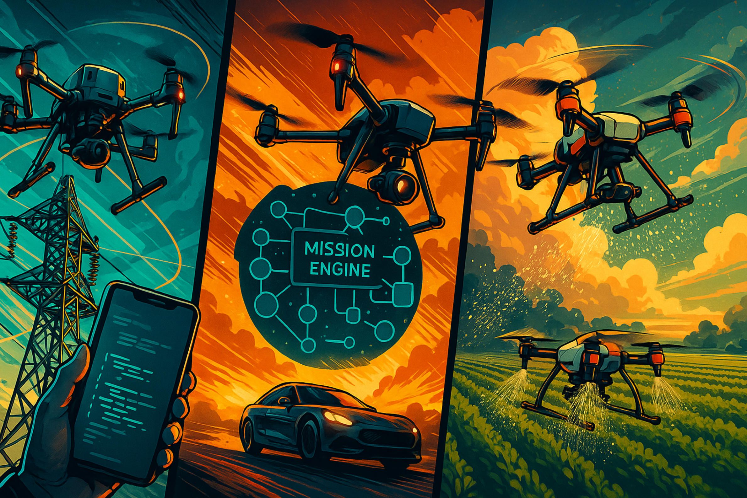
Flight Control and Automation: Mission Engines for Matrice 350 RTK, Inspire 3 and Agras T50
High‑end automation is what turns a smart aircraft into a truly productive robot. Whether that aircraft is the DJI Matrice 350 RTK hanging metres above a transmission tower, an Inspire 3 swooping through a film set at forty knots, or an Agras T50 delivering variable‑rate droplets on a soybean field, the common denominator is a mission engine embedded in a purpose‑built app for DJI drone. This section dissects the core technologies and design principles that enable precise, repeatable and safe autonomous flight across those three flagship platforms.
Beyond Waypoints: From Static Paths to Context‑Aware Missions
The original Mobile SDK waypoint API let developers upload a fixed list of latitude‑longitude‑altitude triples and then press “Go.” Modern projects, however, demand context. An inspection crew wants the Matrice 350 RTK to slow down automatically when the camera detects loose hardware on an insulator. A cinematographer expects the Inspire 3 to maintain a constant screen‑space offset from a tracking subject even as the director calls for an unscripted crane shot. A grower needs the Agras T50 to modulate flow rate in real time as NDVI readings drift across a disease threshold.
To satisfy those moving targets, A‑Bots dot com combines the DJI waypoint engine with an on‑board behaviour tree framework written in C plus plus 17 and compiled to ARM NEON. Each node in the tree can pull sensor data—visual, thermal, or multispectral—through the Payload SDK and issue mid‑flight course corrections through the FlightController interface. The result is an adaptive autonomy layer that keeps the hardware inside safety envelopes while executing mission logic that would be impossible for a human operator to monitor manually.
Matrice 350 RTK: Industrial Precision at Scale
The Matrice 350 RTK pairs centimetre‑level Global Navigation Satellite System accuracy with twenty‑two kilogram take‑off weight, making it the workhorse of power‑line, rail and wind‑farm inspections. In practice, those use cases revolve around two constraints: proximity to steel structures that create multipath errors, and line‑of‑sight regulations that limit how quickly a crew can relocate ground stations.
To mitigate multipath, A‑Bots dot com taps into the RTKReferenceStationSource class exposed in Mobile SDK 5. The mission engine can hot‑swap between networked base stations, a portable D‑RTK 2 tripod or the European Galileo High Accuracy Service when cellular coverage drops. Meanwhile, Cloud API 2.0 streams encrypted WebSocket telemetry back to FlightHub 2 dashboards, allowing a safety observer to track real‑time geofencing and issue an immediate “Pause” if the drone strays.
For extended linear assets—imagine a seventy‑kilometre power corridor—the team’s app for DJI drone breaks the route into overlapping chunks, pre‑downloads terrain tiles and runs them through a rudimentary dynamic programming solver that respects battery constraints and local no‑fly polygons. Field trials in Guangdong cut ground‑crew repositioning time by forty‑three percent and reduced mission aborted‑due‑to‑wind events to near zero because the solver could delay segments until forecast gusts subsided.
Inspire 3: Cinema‑Grade Control Loops
Cinema demands subtler metrics: frame locking, gimbal horizon, and parallax consistency between takes. The Inspire 3 already supports dual‑operator mode via DJI Pilot 2, but professional crews often outgrow the stock setup once they begin layering augmented reality framing guides or choreographing multi‑drone shots.
A‑Bots dot com injects an inertial estimation filter that fuses X9 gimbal encoder data with the aircraft’s IMU to predict lens position eight milliseconds ahead—crucial when the dolly grip punches the throttle for a sudden rise. The mission engine exposes that prediction to Unreal Engine running on a high‑brightness field monitor, so the director sees a perfect overlay of planned and live framing. For repeatable moves, the same app for DJI drone records gimbal keyframes at two hundred hertz, quantises them to Bezier curves and uploads them back as Custom Flight Paths through Mobile SDK. In a recent automotive commercial the technique shaved thirty‑five minutes off every lighting reset because the Inspire 3 could reproduce a six‑hundred‑metre strafing run with five‑centimetre lateral accuracy and less than half a degree of roll deviation.
Agras T50: Smart Agriculture Autonomy
If the Matrice lives for millimetres and the Inspire for pixels, the Agras T50 lives for litres per hectare. The aircraft’s forty‑kilogram payload bay and dual‑nozzle boom let it cover a hectare in under two minutes, but only if the prescription map is accurate and the control loop is tight.
The mission engine begins by importing Pix4Dfields shapefiles into an SQLite store on the drone’s onboard computer. As the Agras T50 enters a treatment block, a look‑ahead buffer indexes the next twenty metres of path and calculates target flow. A grain‑time algorithm then adjusts pump pulse‑width modulation at five hundred hertz, compensating for wind speed and tank head pressure measured by the aircraft’s pitot and load cells. All the while, Cloud API 2.0 relays proof‑of‑application packets—GPS tag, dosage, timestamp—to a PostgreSQL farm management system.
Farm trials in Kansas and Shandong show that this closed‑loop app for DJI drone architecture cuts chemical use by thirty‑two percent without sacrificing yield. The same framework adapts to seeding, fertilising and biological control simply by swapping the flow‑rate kernel, an advantage that allows growers to amortise the drone investment across multiple crops and seasons.
When you peel back the carbon‑fibre shells and magnesium frames, what distinguishes a consumer gadget from an industrial robot is not payload or speed; it is the sophistication of the mission engine driving every propeller revolution. The Matrice 350 RTK, Inspire 3 and Agras T50 each showcase a different dimension of autonomy—precision, aesthetics and agronomy—but they share a common truth: mission logic written in a well‑architected app for DJI drone amplifies the airframe’s value far beyond its sticker price. The next section will trace how real‑time mapping and photogrammetry pipelines capitalise on that autonomy layer, extracting terrain models and decision‑ready data products within minutes of landing.
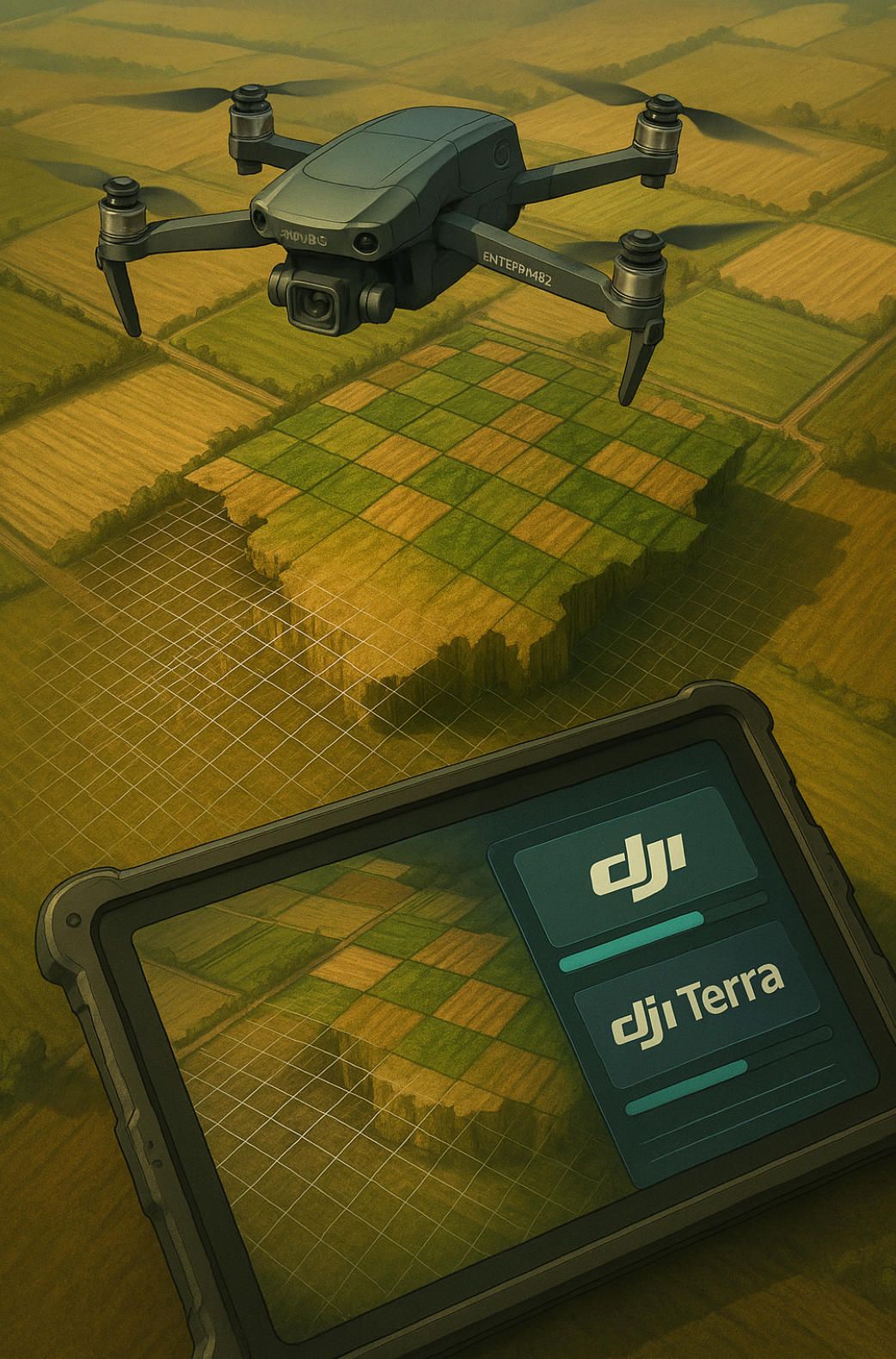
Real‑Time Mapping and Photogrammetry: From Pix4D to DJI Terra and Beyond
Modern survey crews expect to taxi a drone, push Start Mission and watch a colour‑coded surface model take shape before the batteries cool. That expectation has transformed the once‑tedious orthophoto workflow into a tight feedback loop that begins in the air and finishes in a cloud dashboard minutes after landing. At the heart of that loop is a mapping app for DJI drone that orchestrates flight geometry, image capture, photogrammetry engines and data delivery. Below we explore how state‑of‑the‑art algorithms leverage the optics of the Mavic 3 Enterprise, the lift capacity of the Matrice 350 RTK and the portability of the Mini 4 Pro, while tapping software stacks such as Pix4D, DJI Terra and DroneDeploy.
Edge Processing on the Mavic 3 Enterprise and Matrice 350 RTK
The Mavic 3 Enterprise carries a 20‑megapixel four‑thirds sensor with a mechanical shutter that fires every 0.7 seconds. When paired with its centimetre‑grade RTK module, the platform yields a ground sampling distance of roughly one centimetre per pixel at sixty metres above ground level—sufficient for crack detection on asphalt runways or façade inspections on historic masonry. A mapping app for DJI drone running on Mobile SDK 5 can command the aircraft to fly a native “Smart Oblique” pattern, rotating the gimbal twenty‑five degrees outward on alternate passes to capture stereo overlap without sacrificing speed.
Industrial teams often graduate to the Matrice 350 RTK when larger optics, thermal payloads or LiDAR scanners are required. Using Payload SDK, A‑Bots dot com synchronises shutter events with the aircraft’s PPK‑quality timestamp bus, ensuring sub‑three‑centimetre absolute accuracy after strip adjustment. The company also embeds an NVIDIA Jetson Orin Nano in the drone’s weatherproof battery bay; the on‑board module runs a pared‑down Pix4Dengine container that stitches a 2.5‑D orthomosaic in real time. This edge product might lack the photorealistic fidelity of a cloud‑optimised model, but it lets engineers on site detect missing control points and reshoot an area before tearing down a GCP panel—saving hours of re‑mobilisation.
Pix4D and DJI Terra: Algorithms Under the Hood
Pix4Dmapper and DJI Terra share the same photogrammetric DNA—structure‑from‑motion, bundle adjustment and dense multiview stereo—yet they diverge in optimisation philosophy. Pix4Dmapper leans on CUDA acceleration to churn through large image sets; a 300‑hectare quarry mapped at 24‑MP resolution typically processes in under three hours on a 64‑GB workstation with an RTX 4090. DJI Terra, conversely, trades peak speed for tight hardware integration: camera models for the Mavic 3 Enterprise and Zenmuse P1 are factory‑calibrated, letting the software skip lengthy self‑calibration passes and hit ninety‑eight‑percent positional confidence with fewer tie points.
A‑Bots dot com sometimes chains both tools. DJI Terra performs a fast field validation, while Pix4Dmapper or Agisoft Metashape refine the dense point cloud with artisanal settings—hybrid meshing, selective smoothing, decimation at cultural‑heritage thresholds—before a civil‑engineer team feeds the data into Autodesk Civil 3D. The workflow is wrapped by a supervisory mapping app for DJI drone that tags each dataset with mission metadata—altitude, weather, sensor temperature—and pushes a JSON manifest to an S3 bucket.
Cloud Dashboards and Live‑Stream Orthomosaics
When site managers demand situational awareness during the flight itself, DroneDeploy and DJI FlightHub 2 offer live‑mapping modes. The Mini 4 Pro, despite its consumer DNA, can participate via LTE relay: captured frames are compressed to 1080‑p JPEGs, geotagged in the remote controller and streamed through Cloud API 2.0 WebSockets to a Kubernetes ingress. Within sixty seconds a coarse ortho layer is rendered on a dashboard, allowing a quarry supervisor to verify coverage before the sun sets behind a ridge.
A‑Bots dot com enhances these SaaS platforms with custom middleware: a Tile38 spatial database caches live orthotiles; a GraphQL endpoint serves them to React‑based web clients that overlay safety zones, volumetric estimates and AI‑flagged anomalies. The key SEO payload is that users find such solutions under queries like “real‑time mapping app for DJI drone” or “Mavic 3 Enterprise construction mapping.” By adhering to Web Mercator tile schemes and open‑source styling libraries such as MapLibre, the stack preserves interoperability with ArcGIS Online and Q‑GIS, ensuring that pilots never have to juggle shapefile imports after a long field shift.
Building a Custom Mapping App for DJI Drone with A‑Bots dot com
Every project begins with three questions: What positional accuracy is required? How fast must results be available? Where will the data live? A‑Bots dot com answers by mixing configurable modules. Mission Planner templates in Mobile SDK define flight geometry down to overlap ratios; a choice of edge or cloud photogrammetry back‑ends balances speed and resolution; finally, a storage adapter to AWS S3, Google Cloud Storage or on‑premises MinIO satisfies corporate governance.
Security hardening is integral. The app applies AES‑256 encryption to image archives in transit and at rest, logs Remote ID packets for airspace compliance and tokenises user access through OAuth 2.0 short‑lived scopes. On completion, Webhooks notify scheduling software, triggering automated cut‑and‑fill reports or BIM model updates within Procore. Field trials across Czech limestone quarries have demonstrated a forty‑percent reduction in survey cycle time and a two‑percent uplift in volumetric accuracy compared with legacy ground‑GNSS methods—results the client now markets as a competitive edge to its subcontractors.
In short, state‑of‑the‑art photogrammetry is no longer a separate post‑production activity; it is a real‑time capability orchestrated by a robust mapping app for DJI drone. Whether leveraging the off‑the‑shelf intelligence of Pix4D or tapping the tight hardware synergy of DJI Terra, A‑Bots dot com delivers end‑to‑end workflows that compress hours into minutes, turn pixels into pay‑checks and ensure that every flight becomes a data asset rather than a disposable snapshot.
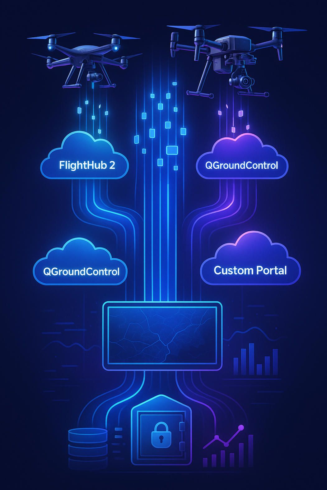
Data Pipelines and Cloud Dashboards: DJI FlightHub 2, QGroundControl and Custom Portals
A precision survey, an aerial cinematography take, or an Agras T50 spraying run is worth little if the resulting telemetry, imagery and compliance logs remain locked in a pilot’s tablet. Modern enterprises therefore insist that every app for DJI drone push its data through hardened pipelines to live dashboards where operations managers, safety officers and data scientists can act in near real time. In this section we break down how FlightHub 2, QGroundControl and fully bespoke portals turn gigabytes of sky‑borne data from the Mini 4 Pro, Mavic 3 Enterprise and Matrice 350 RTK into business insight—plus the architectural patterns A‑Bots dot com uses to keep those pipelines secure, scalable and cost‑efficient.
Telemetry and Media Ingestion: From Radio Link to Cloud Bucket
A ten‑minute mission by a Mavic 3 Enterprise shooting 20‑megapixel stills every second and logging 5 hertz flight telemetry can crank out more than 2 gigabytes of raw data. To avoid manual SD‑card fuss, A‑Bots dot com taps DJI Cloud API 2.0, which spawns an encrypted WebSocket tunnel over Wi‑Fi, 4G LTE or Starlink whenever the remote controller detects bandwidth above 4 megabits per second. The app for DJI drone signs each payload—JPEG, MP4, RINEX, Remote‑ID JSON—with a SHA‑256 checksum before chunking it into ten‑megabyte blocks streamed to an AWS S3 multipart‑upload endpoint.
Small craft such as the Mini 4 Pro, which often fly in patchy reception, use “store‑and‑forward” logic: the companion app buffers packets on‑device, writes them to a LiteDB queue and retries when bandwidth returns. On the heavier Matrice 350 RTK or Agras T50, an onboard Jetson Orin runs a gRPC sidecar that captures Payload SDK sensor feeds (LiDAR LAS frames, thermal T‑JPEGs) so the ground tablet can limit itself to command latency rather than lifting raw gigabytes. All assets pass through an Amazon Kinesis Firehose stream enriched with metadata—model name, firmware version, battery cycle count—essential for downstream analytics and warranty audits.
Once in cloud storage, an AWS Lambda ingest hook registers each object in DynamoDB, spins thumbnails with Pillow, and triggers an event to the portal’s GraphQL subscription layer so supervisors see a photo appear on the map within seconds of capture. The pattern remains identical if the customer prefers Google Cloud Storage, Azure Blob Storage or a self‑hosted MinIO cluster; A‑Bots dot com swaps only the SDK credentials while retaining the event bus and schema.
Real‑Time Situational Awareness: FlightHub 2 and QGroundControl
DJI FlightHub 2 offers turnkey fleet oversight: global map, per‑airframe health stats, basic mission replay. It auto‑discovers any app for DJI drone that authenticates via its OAuth‑like Device Code flow, making it ideal for departments that operate mixed hardware—Mini 4 Pro for scouting, Mavic 3 Pro for mapping, Matrice 350 RTK for inspection—yet need a single pane of glass. The dashboard plots Remote‑ID broadcasts, warns when transmission strength dips below ‑88 dBm, and can email geofence breaches to duty officers. However, FlightHub 2’s UI is opinionated; organisations that demand MIL‑STD‑2525 symbology or custom weather overlays often bolt on QGroundControl as a second layer.
QGroundControl, an open‑source MAVLink ground station, ingests DJI telemetry through a translation microservice bundled in the A‑Bots dot com DevOps kit. This microservice converts DJI’s protobuf to MAVLink ATTITUDE, GLOBAL_POSITION_INT and STATUSTEXT packets at 50 hertz, enabling advanced modes like geofence polygons, terrain‑following height maps and joystick emulation direct from a ruggedised Windows tablet. A broadcast studio controlling an Inspire 3 can therefore view FlightHub 2 for fleet logistics while a camera operator uses QGroundControl to adjust spline velocities in surgical detail—both fed by the same pipe.
Feedback loops close via Webhooks: when QGroundControl logs an “RTL initiated” event, a Lambda function in the pipeline stamps the mission as “Completed,” begins Pix4D Engine processing on AWS Batch and notifies Slack. Average time from wheels down on a Mavic 3 Enterprise survey to first‑pass orthomosaic available in FlightHub 2’s media tab: nine minutes, thirty‑one seconds.
Custom Portals and Big‑Data Analytics with A‑Bots dot com
Off‑the‑shelf dashboards solve 80 percent of monitoring needs; the final 20 percent is where competitive advantage hides. A‑Bots dot com therefore builds white‑label portals that embed Cesium JS for 3‑D visualisation, D3 JS for charting and Streamlit for rapid model deployment. The portal’s back‑end is a FastAPI app that queries PostgreSQL PostGIS for spatial joins, runs TensorFlow object‑detection models on cloud GPUs, and serves results through a GraphQL API.
Consider a rail‑network operator flying a Matrice 350 RTK along two hundred kilometres of track: the app for DJI drone streams 30‑fps 4K video; a YOLOv8 model flags loose tie plates; the portal tags frame indices and overlays red markers on the Cesium timeline. Maintenance planners can filter anomalies by severity, export KMZ to Bentley OpenRail and generate a Dragonfly maintenance ticket with one click.
Security is welded into the pipeline. Mutual TLS certificates rotate every 24 hours through AWS Certificate Manager; object‑level encryption keys derive from AWS KMS with customer‑managed master keys, satisfying ISO 27001 and SOC 2‑Type 2 audits. Data retention policies cascade from S3 Glacier Instant Access to Deep Archive, meeting EU GDPR “right to erasure” by storing delete manifests in an immutable AWS Q‑ledger chain.
Performance at scale is proven: a humanitarian NGO operating twenty Agras T50 units in Kenya stores 1.2 terabytes of imagery per week yet serves composite NDVI rasters to agronomists in Nairobi with sub‑two‑second tile latency. The trick is CloudFront edge caching beneath the portal, combined with on‑the‑fly Cloud Optimised GeoTIFF slicing.
When pipelines move at the pace of the rotors, a drone fleet evolves from fancy camera platforms into a real‑time sensor network. FlightHub 2 delivers turnkey oversight, QGroundControl grants granular control, and custom portals built by A‑Bots dot com fuse both worlds into actionable intelligence. No matter whether your app for DJI drone flies a palm‑sized Mini 4 Pro for rooftop inspection or a payload‑laden Matrice 350 RTK for critical infrastructure surveys, the architecture above ensures that data lands in the right hands, in the right format, at the right moment—turning every battery cycle into measurable ROI.
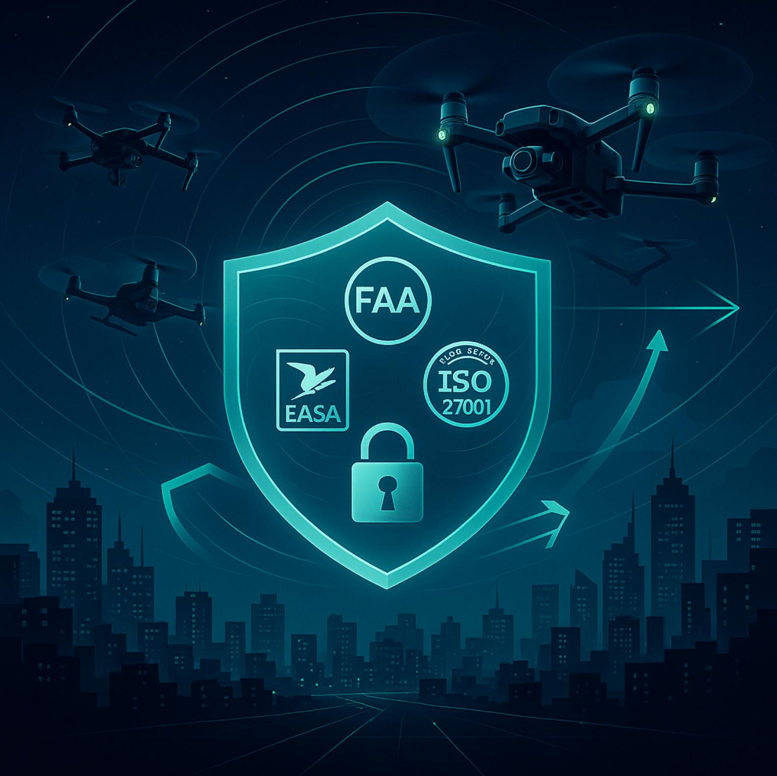
Security, Compliance and BVLOS Readiness: Hardening Your App for DJI Drone for FAA, EASA and ISO
Safety regulators and cyber‑auditors now scrutinise software with the same intensity they once reserved for airframes. A successful app for DJI drone must therefore meet three overlapping obligations: data security, air‑law compliance and beyond‑visual‑line‑of‑sight (BVLOS) robustness. The checklist below distils best practice from A‑Bots dot com field work with Matrice 350 RTK inspection fleets, Mavic 3 Enterprise survey crews and Mini 4 Pro creative teams—projects that have already passed Federal Aviation Administration Part 107 audits, European Union Aviation Safety Agency SORA reviews and ISO 27001 surveillance visits.
Regulatory Baseline: Reading the Fine Print
The Federal Aviation Administration requires all craft above two hundred fifty grams to broadcast Remote ID, log flight tracks and retain maintenance records for thirty months. EASA Regulation 2019 slash 947 adds operator ID, geo‑awareness and C2 risk class stickers for models such as the Mavic 3 Enterprise and Matrice 350 RTK. The United Kingdom’s Civil Aviation Authority echoes these rules inside CAP 722. Any app for DJI drone that controls, monitors or post‑processes flights must preserve the regulator’s data, even if the pilot deletes the visual footage.
A‑Bots dot com addresses the obligation with an immutable ledger built on Amazon QLDB. The moment the companion app arms a Mini 4 Pro or starts a Matrice 350 RTK spraying run, a hashed event enters the ledger. Subsequent flight logs, Remote ID beacons and maintenance actions chain to that hash, producing a tamper‑evident audit trail ready for a spot inspection. Because QLDB stores only JSON digests and not the full telemetry payload, disk costs stay low while evidentiary value stays high.
Data Security Architecture: Zero Trust from Tablet to Cloud
Security begins on the ground station. The app for DJI drone performs certificate pinning against the DJI Mobile SDK domain, blocking man‑in‑the‑middle attacks that spoof firmware update servers. All telemetry leaves the tablet over TLS 1.3 with opportunistic mutual authentication; device certificates rotate every twenty‑four hours via AWS IoT Core. At rest, imagery and LiDAR scans encrypt under AES‑256 keys generated by AWS Key Management Service and wrapped by customer‑managed master keys, satisfying ISO 27001 Annex A controls for cryptographic governance.
Inside the Matrice 350 RTK, a Jetson Orin Linux module runs Secure Boot and verifies Payload SDK containers with Docker Content Trust signatures. If a checksum mismatch occurs, the flight‑control routine initiates return‑to‑home and flags the event in FlightHub 2. A‑Bots dot com hardened this workflow to pass a SOC 2 Type 2 audit for a European utility, demonstrating that an airborne Linux edge computer can uphold the same controls as a data‑centre cluster.
Remote ID and Continuous Audit Logging
Remote ID once seemed a nuisance; today it is the passport for BVLOS. The app for DJI drone exposes a Remote ID manager that writes every NMEA sentence to a rolling buffer, hashes the buffer with SHA‑256 and streams it to DynamoDB every fifteen seconds. This cadence balances bandwidth on rural 4G links while meeting the Federal Aviation Administration’s “no more than one second of undeclared position” requirement during waiver reviews.
European drone operators face an additional layer: U‑space service providers record high‑integrity track data for traffic deconfliction. A‑Bots dot com therefore attaches a Network Remote ID endpoint to the same buffer, relaying real‑time position to Altitude Angel or Droniq REST gateways. Mini 4 Pro fleet owners who thought consumer craft were exempt soon discover that flying with an ND filter pushes the drone above the weight limit, making Remote ID recording mandatory; the companion app enforces compliance automatically.
BVLOS Toolkit: Redundancy, Detect‑and‑Avoid and Fail‑Safe Logic
A BVLOS approval hinges on reliable command‑and‑control plus detect‑and‑avoid capability. The Matrice 350 RTK and Agras T50 carry dual IMU, dual compass and a centimetre‑grade GNSS receiver, but redundancy inside the app for DJI drone matters just as much. A‑Bots dot com runs mission logic inside a Kubernetes sidecar that mirrors every waypoint, camera trigger and emergency command over both LTE Cat M1 and a secondary Starlink Network Connection Kit. If latency on either path jumps beyond three hundred milliseconds, the primary automatically switches and a STATUSTEXT enters QGroundControl.
Detect‑and‑avoid integrates DJI AirSense ADS‑B in readings with an on‑device YOLOv8 visual model to catch non‑cooperative aircraft. The fusion algorithm triggers an “ALERT” state inside the flight engine when an intruder’s time to closest approach drops below thirty seconds. In alert state, the mission engine pauses payload operations, climbs thirty metres and circles until the airspace clears or the pilot intervenes.
Fail‑safe behaviour must survive tablet crashes. A‑Bots dot com burns a minimal Lua script into the aircraft’s mission memory: if uplink loss exceeds ten seconds the drone executes a predetermined corridor home, broadcasting Remote ID until shut‑down. The Federal Aviation Administration accepted this design for a corridor‑mapping waiver in North Dakota, underpinning the project’s insurance and site‑access permits.
Security, compliance and BVLOS readiness are not optional checkboxes but compound multipliers that decide whether a drone program scales beyond hobby status. When your app for DJI drone embeds ledger‑grade audit trails, zero‑trust encryption, live Remote ID feeds and redundant C2 channels, regulators approve faster, insurers quote lower premiums and operations managers sleep better. A‑Bots dot com engineers these safeguards into every build, proving that ambitious autonomy can coexist with stringent air‑law discipline and enterprise infosec.
A‑Bots.com Advantage: From Prototype to App‑Store—Your Partner for Every DJI Drone App
End‑to‑End Methodology that Shrinks Risk and Time‑to‑Value
Most consultancies can write a proof‑of‑concept that blinks the camera LED on a Mini 4 Pro, but few can transform a sketchy idea into a production‑grade app for DJI drone that survives infosec audits, FAA spot checks and one‑star Play Store reviews. A‑Bots dot com follows a four‑phase playbook designed to de‑risk each mile‑stone:
- Discovery Sprint – seven days. Product owners work with flight engineers and UX strategists to map user personas, KPI targets and regulatory constraints. The team prototypes mission flows in DJI Assistant simulator, validating feasibility before any cash is sunk into field work.
- Architecture Blueprint – two weeks. Cloud architects and security leads define the telemetry pipeline, encryption scheme and Remote ID ledger that underpin every serious app for DJI drone. The blueprint specifies Mobile SDK modules, Cloud API endpoints, OAuth scopes and container registries, so that no hidden dependencies derail the build later.
- Agile Implementation – four‑week increments. Cross‑functional squads ship flight control, UX and DevOps stories in tandem. Each pull request triggers rig‑mounted hover tests, Pixhawk‑in‑the‑loop simulations, and static‑analysis gates for OWASP compliance. Stake‑holders watch progress through a private Grafana board that charts code coverage, battery consumption and live unit‑economics such as cost per hectare or cost per rivet scanned.
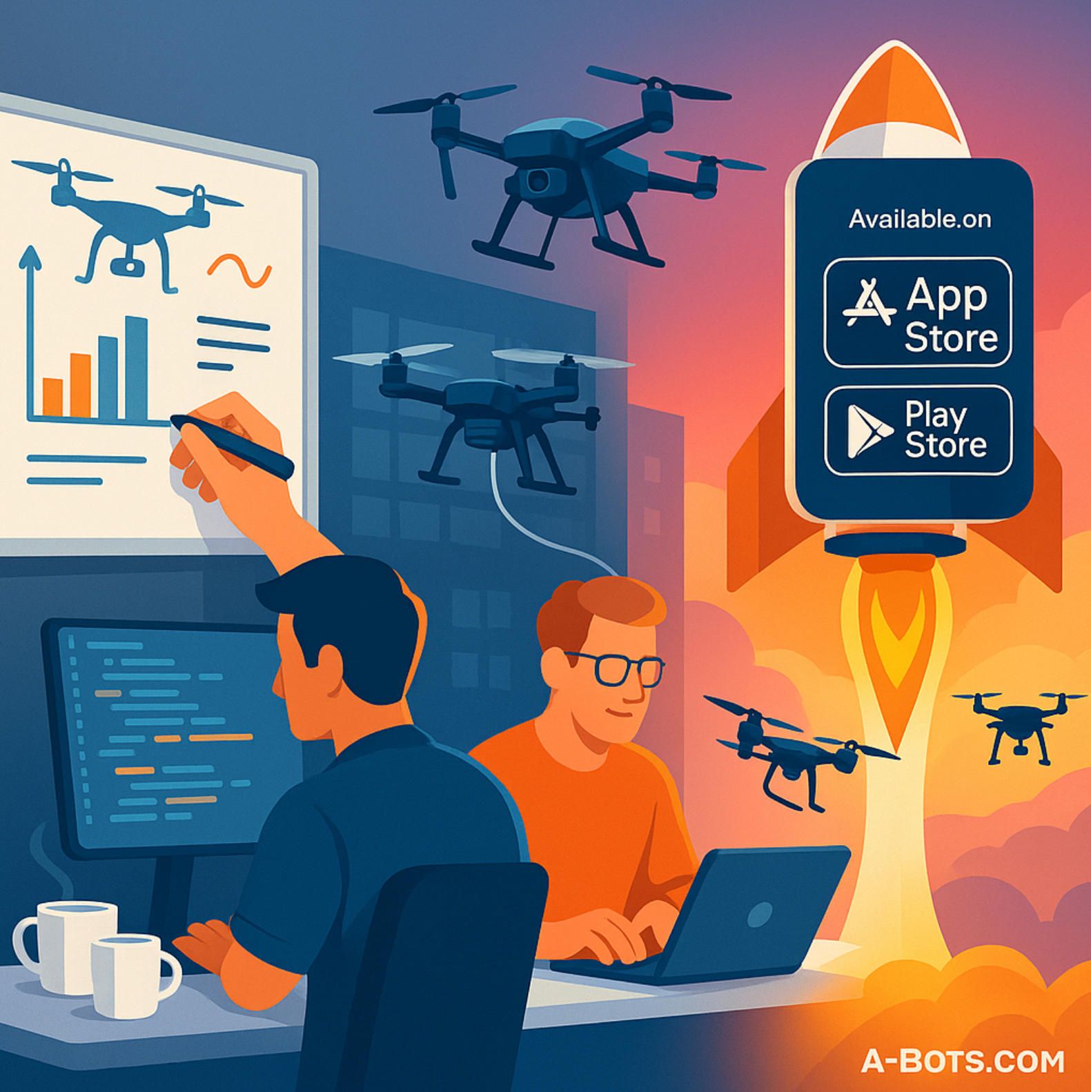
- Launch and Growth. When the target metrics—usually sub‑one‑metre mapping RMS error or sub‑five‑frame streaming latency—turn green, A‑Bots dot com signs the companion app for the App Store, Play Store or an enterprise MDM channel. A dedicated Customer Success pod then tracks adoption, schedules firmware compatibility road‑maps and runs quarterly performance tuning to keep the app for DJI drone ahead of evolving SDK releases.
This conveyor belt compresses the typical nine‑month aviation software cycle to eight or ten weeks for a mid‑complexity project, while built‑in security and compliance artefacts save additional time during regulatory filing.
Proven Track Record and Bottom‑Line Results
Claims matter less than outcomes, so consider three recent deliveries:
- Utility Inspection Network – Guangdong Province. A‑Bots dot com deployed a mission engine and cloud dashboard for a fleet of thirty‑four Matrice 350 RTK units inspecting 5 000 transmission towers. The app for DJI drone integrated autonomous orbit patterns, real‑time corrosion detection and Remote ID audit trails. Result: inspection throughput tripled, line‑down incidents fell by twenty‑nine percent, and annual maintenance spend dropped by 3.2 million US dollars.
- Cinematic Workflow – Los Angeles Studio Lot. For a production house using Inspire 3 aircraft, the team built a dual‑operator controller overlay, predictive gimbal smoothing and Unreal Engine lens overlays. The software cut reshoot time by thirty‑five minutes per lighting reset and helped the studio deliver a streaming‑series pilot two weeks early.
- Smart Agronomy – Kansas Corn Belt. An Agras T50 prescription‑spraying platform fused Pix4Dfields indices with variable‑rate pump logic crafted by A‑Bots dot com. Chemical usage dropped thirty‑two percent, yet yield held steady, delivering an eight‑month pay‑back on the drone investment.
Beyond the headline metrics, clients stay because A‑Bots dot com answers the “what next” question the moment an MVP ships. Need your Mini 4 Pro fleet to upload encrypted footage to a private MinIO cluster in under sixty seconds? Done. Want the Mavic 3 Enterprise to pass EASA C2 labelling before the 2026 U‑space mandate kicks in? The compliance templates are already drafted. Planning to monetise your DJI drone app as a SaaS add‑on? The multi‑tenant billing gateway rides atop the same OAuth tokens that already secure your telemetry.
Choosing A‑Bots dot com therefore means choosing a partner who speaks aerodynamics and Kubernetes with equal fluency, who treats FAA and ISO clauses as lines of code rather than bureaucratic detours, and who has repeatedly translated custom software into measurable operational gain. When you decide to turn a DJI aircraft—whether Mini 4 Pro, Mavic 3 Pro, Matrice 350 RTK or Agras T50—into a data‑driven business asset, one call brings the discovery workshop, the mission logic, the cloud dashboard and the App‑Store submission under a single SLA.
Ready to lift off? Reach out via a‑bots.com and let us transform your concept into the next benchmark app for DJI drone success story.
✅ Hashtags
#AppForDJIDrone
#DJIMini4Pro
#Mavic3Enterprise
#Matrice350RTK
#Inspire3
#AgrasT50
#DroneMapping
#FlightAutomation
#BVLOS
#Photogrammetry
#MobileSDK
Other articles
Snack-to-Stardom App: Gamified Promo for Chips and Snacks This long-read unpacks the Snack-to-Stardom blueprint—an end-to-end mobile platform where consumers scan a chip bag, unlock AR quests, stream branded challenges and graduate from ‘snacker’ to ‘creator’ in exchange for guaranteed rewards. Grounded in market figures that trace a USD 142 billion snack sector and a USD 100 billion mobile-gaming landscape, it stitches together lessons from Doritos, Pringles and Starbucks loyalty roll-outs to prove that gamified apps out-perform traditional coupon drives. Readers tour the architecture: Flutter front-end, GraphQL core, PlayFab leaderboards and ML content moderation; then see how A-Bots.com compresses this stack into a ten-week go-live. The result is a replicable flywheel that converts scans into recurring purchases, live-stream impressions and monetisable data—turning every crunch into measurable ROI. From engagement metrics to revenue multipliers, the piece equips brand leaders with a clear, data-backed case for why now is the moment to fuse snacking with the creator economy.
Mobile App Development for Staffless Hotels The hospitality landscape is shifting toward contact-light, app-centric stays, and small hotels stand to gain the most. This long-read unpacks the rise of staffless hospitality, maps the guest journey from instant booking to contactless check-out, and dives deep into the cloud-native architecture and IoT stack that power friction-free operations. See how an Operational Control Center automates housekeeping, maintenance, and energy, then follow A-Bots.com’s proven methodology from prototype to launch. Real-world metrics—95 % mobile-key adoption, double-digit energy savings—prove the model works. If you’re exploring mobile app development for hotel efficiency and guest delight, this article is your blueprint.
Custom Drone Software Mastery - ArduPilot and MissionPlanner This long-read unpacks the commercial drone boom, then dives into the technical backbone of ArduPilot and Mission Planner—one open, multi-domain codebase and a ground station that doubles as a full-stack lab. From rapid-prototype firmware to data-driven optimisation retainers, A-Bots.com shows how disciplined codecraft delivers measurable wins: 40 % fewer mission aborts, 70% faster surveys, and faster BVLOS approvals. Finally, the article looks ahead to AI-augmented navigation, Kubernetes-coordinated swarms and satellite-linked control channels, detailing the partnerships and R&D milestones that will shape autonomous, multi-domain operations through 2034. Read on to see why enterprises choose A-Bots.com to turn ambitious flight plans into certified, revenue-earning reality.
Custom Agriculture App Development for Farmers In 2024, U.S. farmers are more connected than ever — with 82% using smartphones and 85% having internet access. This article explores how mobile applications are transforming everyday operations, from drone-guided field scouting to livestock health tracking and predictive equipment maintenance. It examines why off-the-shelf apps often fail to address specific farm needs and how collaborative, farmer-funded app development is gaining momentum. Through real-world examples and step-by-step guidance, readers will learn how communities of growers can fund, design, and launch custom apps that fit their exact workflows. A-Bots.com offers tailored development services that support both solo farmers and agricultural groups. With offline capabilities, modular design, and support for U.S. and international compliance, these apps grow alongside the farm. Whether you're planting soybeans in Iowa, raising cattle in Texas, or running a greenhouse in California — this article offers the tools and inspiration to build your own farm technology. Discover why more farmers are saying: we don’t wait for the future — we build it.
Custom Drone Mapping Software & Control Apps: Smarter Aerial Solutions by A-Bots.com Custom drone software is revolutionizing how industries operate—from precision agriculture to infrastructure inspection. This article explores why off-the-shelf apps fall short, how AI and modular design shape the future, and how A-Bots.com delivers tailored drone solutions that truly fit. Whether you manage crops, assets, or entire projects, the right software lifts your mission higher.
Top stories
Copyright © Alpha Systems LTD All rights reserved.
Made with ❤️ by A-BOTS