Home
Services
About us
Blog
Contacts
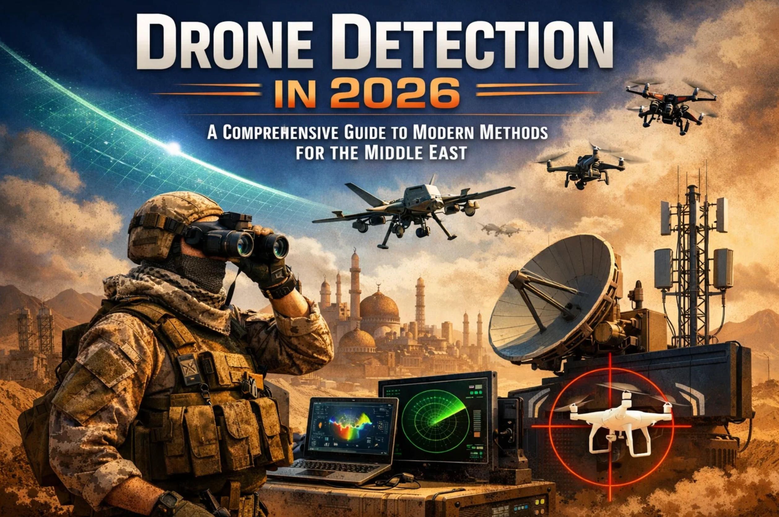
Drone Detection in 2026: A Comprehensive Guide to Modern Methods for the Middle East
The Gulf region is experiencing one of the most intense periods of aerial threat activity in modern history. As of March 2026, the United Arab Emirates alone has engaged over 1,350 drones and 230 ballistic missiles, while Bahrain has destroyed 176 drones and 105 missiles. Kuwait and Qatar report hundreds more interceptions. These numbers are not projections from a defense white paper — they are real, documented events that have reshaped how every country in the Middle East thinks about drone detection and air defense.
At A-Bots.com, a full-cycle custom software development company with over 70 completed projects spanning IoT, mobile applications, and AI-driven platforms, we have deep experience building the kind of software infrastructure that powers modern defense and detection systems. Our team specializes in developing custom mobile applications, real-time data processing platforms, sensor integration dashboards, and IoT solutions — exactly the type of technology stack that underpins effective drone detection networks. Whether a government agency needs a custom command-and-control mobile application, a real-time sensor fusion dashboard, or a scalable IoT platform that connects thousands of distributed acoustic sensors, A-Bots.com has the engineering expertise to deliver.
We also provide comprehensive QA and testing services for existing detection and defense software, ensuring that mission-critical systems perform reliably under the extreme conditions typical of the Persian Gulf region — from temperature extremes and sandstorms to high-humidity coastal environments. With long-term client relationships spanning 1.5 to over 5 years, A-Bots.com understands that defense software requires ongoing maintenance, iterative improvement, and rigorous quality assurance.
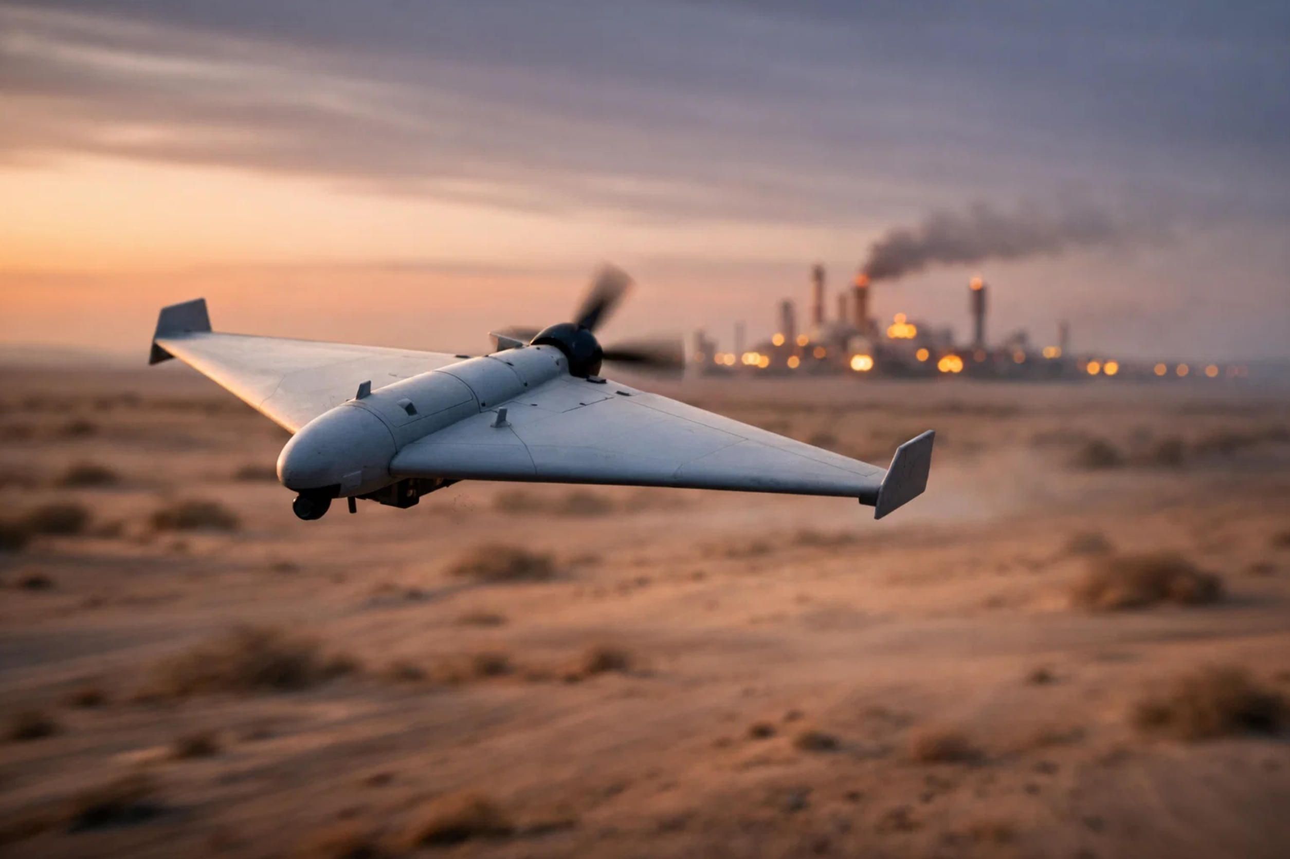
This article offers an expert-level overview of every major drone detection method available in 2026, written in language accessible to decision-makers who may not have a deep technical background. We focus specifically on detecting fixed-wing drones — the delta-wing and aircraft-type unmanned aerial vehicles (UAVs) powered by small jet engines or internal combustion engines (ICE), such as the Iranian Shahed family and its derivatives. These are the drones currently threatening critical infrastructure across Saudi Arabia, the UAE, Bahrain, Kuwait, Qatar, Oman, and the broader Middle East.
Why Fixed-Wing Drones Are the Primary Detection Challenge
Before diving into specific drone detection methods, it helps to understand why fixed-wing attack drones present a fundamentally different challenge than the commercial quadcopters most people imagine when they hear the word "drone."
The Shahed-136, for instance, has a range of approximately 1,600 kilometers, can reach speeds of up to 185 km/h, and carries a warhead weighing between 30 and 55 kilograms. According to the Center for Strategic and International Studies (CSIS), Iran has launched thousands of these drones against Gulf targets in just the first weeks of the March 2026 conflict. The cost per unit is estimated at roughly $35,000 — a fraction of the $4 million price tag of a single Patriot missile interceptor.
These drones fly low, typically between 60 and 900 meters altitude, which keeps them below the effective coverage of many traditional air defense radars. Their radar cross-section (RCS) is extremely small — comparable to a large bird — making them difficult to distinguish from background clutter. Their internal combustion or small turbine engines produce a distinctive but relatively quiet acoustic signature, and they emit minimal radio frequency (RF) signals since they often navigate using pre-programmed GPS waypoints rather than continuous operator control.
Every characteristic that makes these drones cheap and effective as weapons also makes drone detection significantly harder. This is the core problem that every technology discussed below is trying to solve.
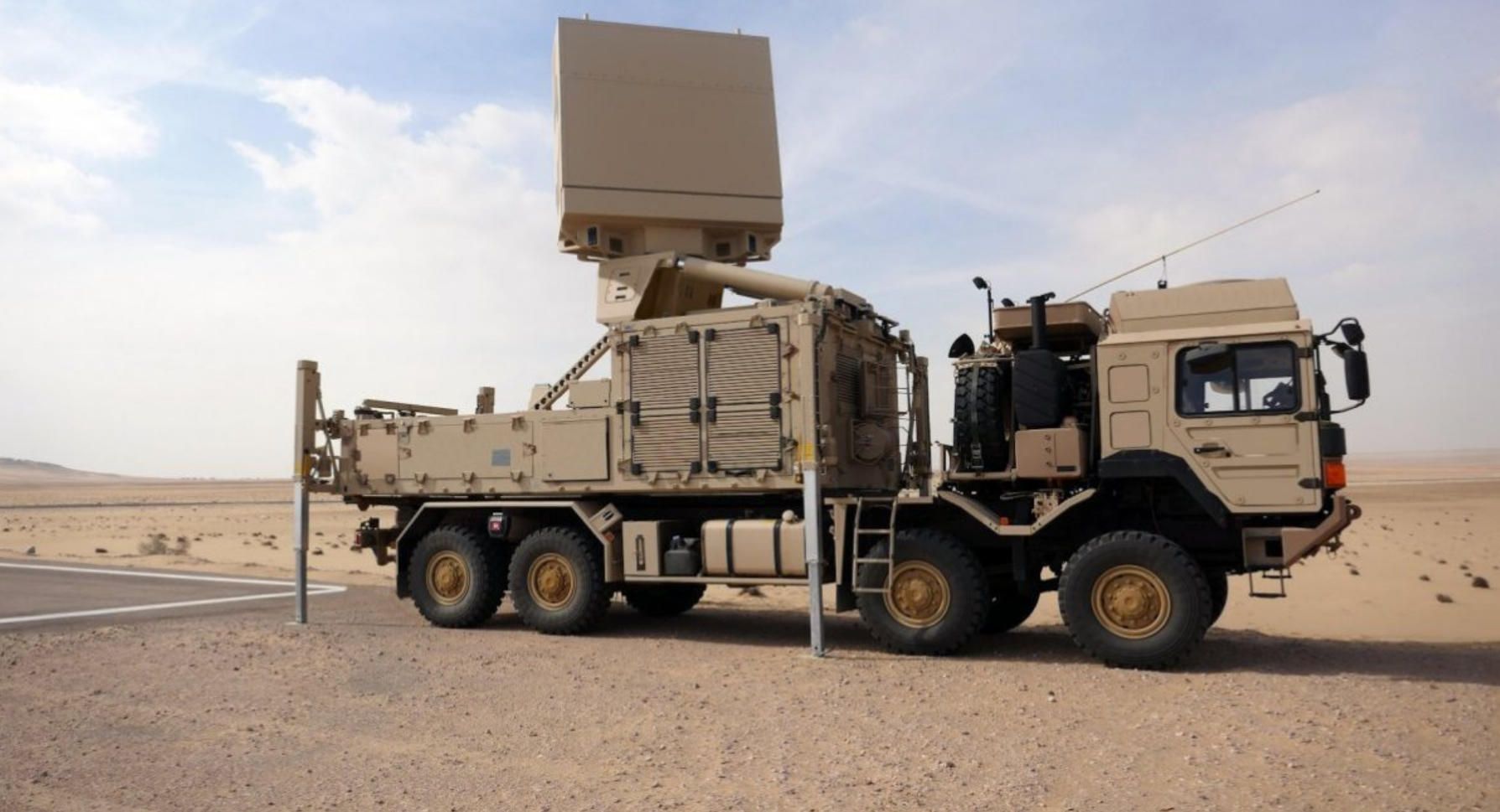
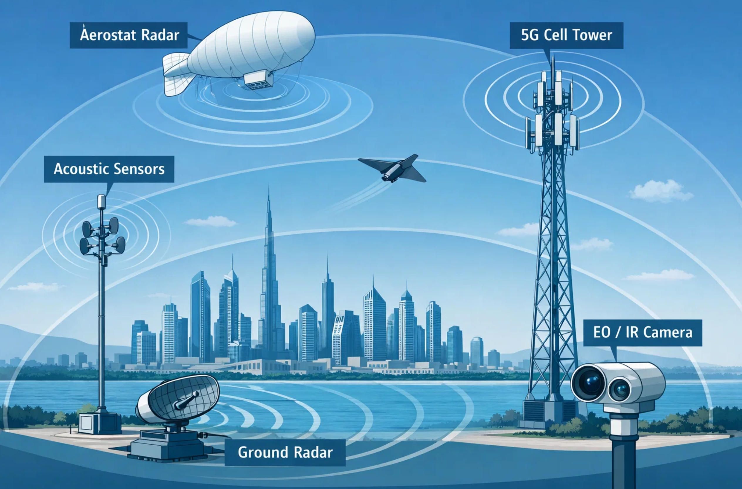
Radar-Based Drone Detection
Radar remains the backbone of any serious drone detection system. It works by transmitting radio frequency pulses and analyzing the signals that bounce back from objects in the sky. The challenge with drones, particularly small fixed-wing models, is that traditional air defense radars were designed to track large aircraft with radar cross-sections measured in square meters. A Shahed-type drone has an RCS closer to 0.01 to 0.1 square meters.
How Modern Drone Detection Radar Works
Modern counter-UAS radars solve this problem through several technical innovations. First, they use higher operating frequencies — typically X-band (8–12 GHz) or Ku-band (12–18 GHz) — which provide shorter wavelengths better suited for resolving small targets. Second, they employ micro-Doppler analysis, which examines the tiny frequency shifts caused by rotating propeller blades or vibrating engine components. This allows the radar to distinguish a drone from a bird, a balloon, or other airborne clutter.
The most advanced systems use Active Electronically Scanned Array (AESA) technology, where hundreds or thousands of individual transmit-receive modules steer the radar beam electronically rather than mechanically. This provides faster scan rates, the ability to track multiple targets simultaneously, and improved resistance to electronic jamming. The Leonardo DRS AESA radar integrated into the U.S. EAGLS counter-drone system, for example, provides drone detection at ranges up to 10 kilometers.
For longer-range surveillance, dedicated counter-UAS radars like the Robin Radar IRIS system or the Blighter A800 series can detect small fixed-wing UAVs at ranges from 5 to 20 kilometers, depending on the drone's size and the radar's configuration. The Israeli EL/M-2083 aerostat-mounted radar extends this range significantly by operating from altitude, which we will discuss in detail later.
Coverage Radius and Limitations
A single ground-based drone detection radar typically covers a radius of 5 to 20 kilometers for small UAV targets. For countries like Saudi Arabia, with over 2.1 million square kilometers of territory and thousands of kilometers of coastline, this means that effective radar coverage requires a dense, networked array of radar installations — a significant infrastructure investment.
The primary limitations of radar for drone detection in the Middle East include ground clutter in desert terrain, atmospheric effects from sand and dust storms, and the fundamental physics of radar line-of-sight. Radar cannot see beyond the horizon or behind terrain features, which is particularly problematic for low-flying drones exploiting the flat desert topography.
"In the defense industry, we have a saying: radar is like your neighbor's dog — it barks at everything except the actual burglar. Fortunately, modern AI-powered classification algorithms are teaching the dog to bark only at drones." — Defense technology humor, popular at IDEX 2025
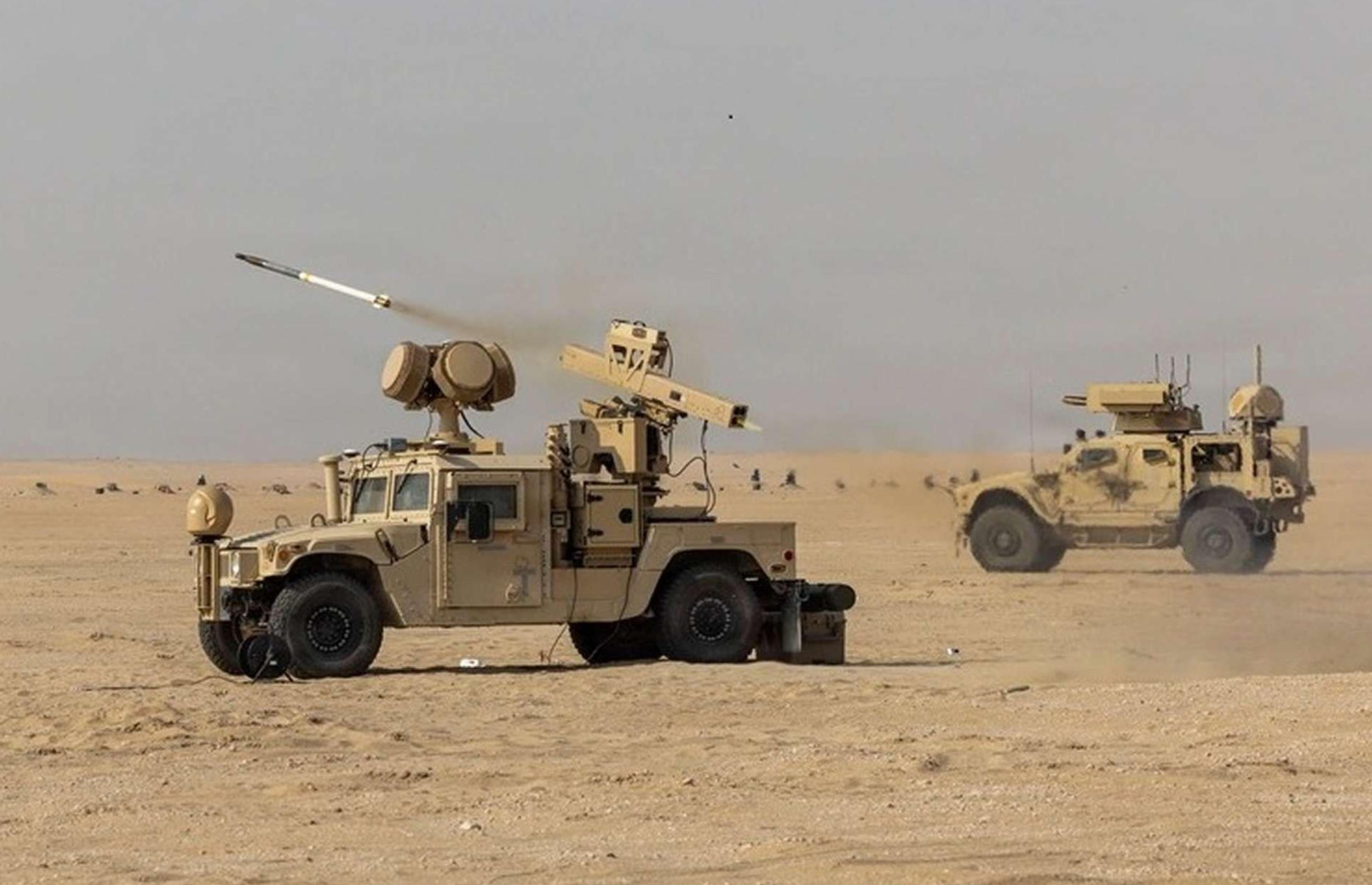
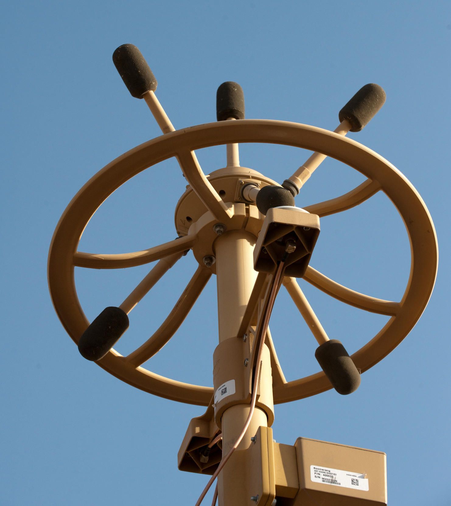
Radio Frequency (RF) Detection
RF-based drone detection systems work on an entirely different principle from radar. Instead of actively transmitting signals, they passively listen for the radio communications between a drone and its ground control station. These systems use one or more directional antennas and spectrum analyzers to scan the electromagnetic spectrum for known drone communication protocols.
How RF Drone Detection Works
When a remotely piloted drone transmits telemetry data, video feeds, or receives flight commands, it creates a distinctive RF signature. Advanced RF analyzers can identify the specific make and model of the drone by matching its signal characteristics against a database of known protocols. Some high-end systems can even extract the MAC addresses of the drone and its controller, providing forensic evidence for prosecution.
Systems like those from Dedrone, Rohde & Schwarz, and D-Fend Solutions can triangulate both the drone's position and the operator's location when multiple RF sensors are deployed across an area. D-Fend Solutions' EnforceAir system takes this further by using RF-Cyber technology to not only detect but also take over the drone's control link and safely redirect it.
Why RF Detection Fails Against Fixed-Wing Attack Drones
Here is the critical limitation: RF drone detection is largely ineffective against the type of drones currently threatening the Middle East. Shahed-type drones navigate using pre-programmed GPS waypoints and onboard inertial navigation systems. They do not maintain a continuous RF link with an operator during flight. Some variants, like the Russian Geran-2 (a modified Shahed), incorporate jam-resistant Kometa-M navigation systems that further reduce their RF visibility.
This means RF drone detection is most useful for detecting commercial quadcopters being used for surveillance or smuggling — a real concern for facilities across Saudi Arabia, Qatar, and the UAE — but it cannot be relied upon as the primary drone detection method for military fixed-wing attack drones.
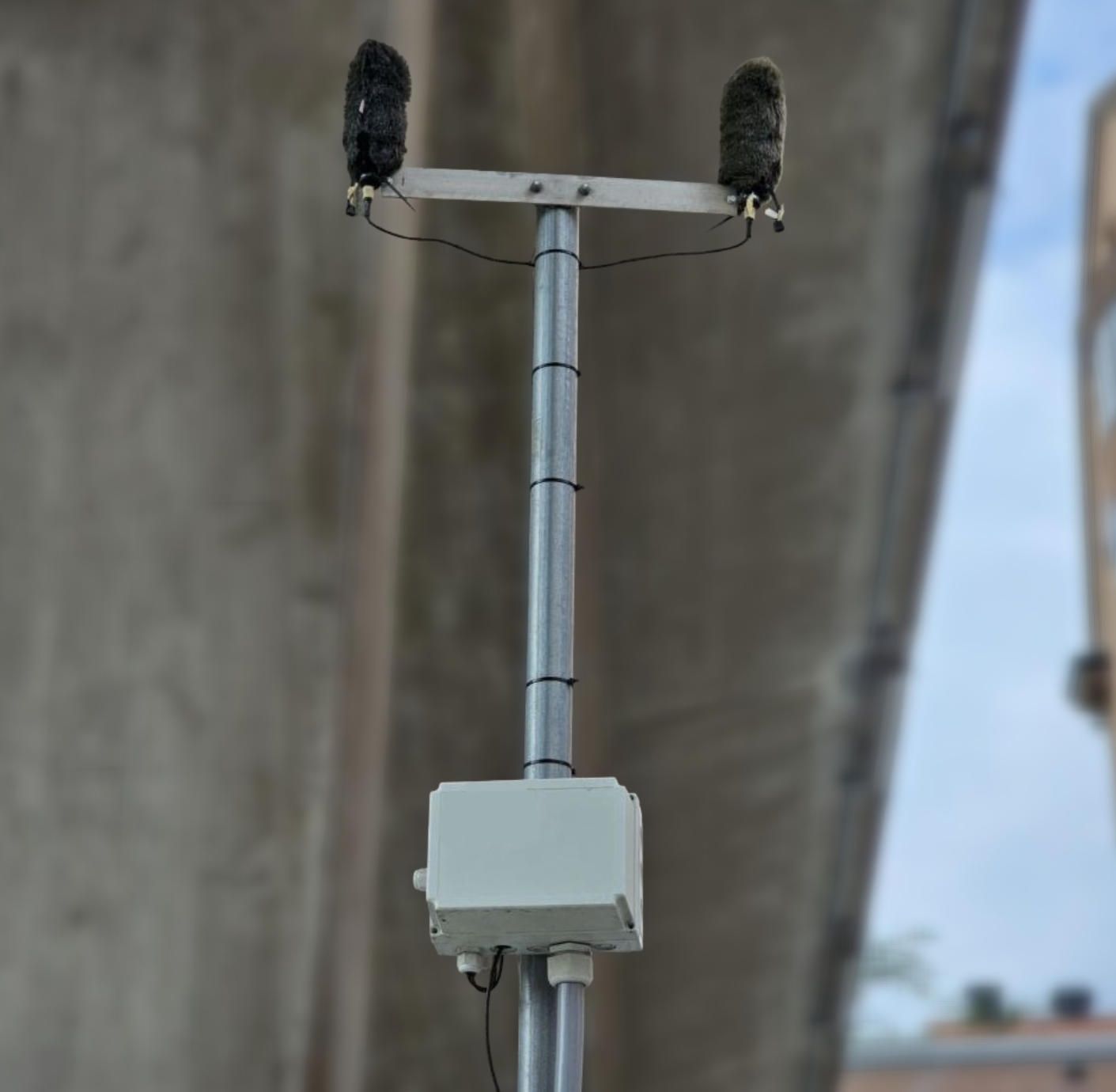
Acoustic Drone Detection: The Sky Fortress Revolution
Perhaps the most remarkable drone detection innovation to emerge from recent conflicts is acoustic detection — using networks of microphones to listen for the distinctive sound signatures of incoming drones.
The Sky Fortress Model
Ukraine's Sky Fortress acoustic detection network has become the gold standard for this approach. Developed in 2022 by two Ukrainian engineers who initially mounted a microphone and a mobile phone on a pole near a garage, the system has grown into a network of over 14,000 acoustic sensors deployed across the country. Each sensor costs between $400 and $1,000 — meaning the entire nationwide network costs less than a pair of Patriot missiles.
As of early 2026, Sky Fortress has achieved a success rate exceeding 95% in detecting incoming Russian Shahed-variant drones. During one large-scale attack involving 84 drones, the system helped Ukrainian forces intercept all but four. According to General James Hecker, Commander of U.S. Air Forces in Europe and Africa, mobile fire teams equipped with tablets receive real-time flight path data from the acoustic network and can engage targets with anti-aircraft guns after as little as six hours of training.
The system works because Shahed-type drones powered by internal combustion engines produce a distinctive low-frequency sound — often described as resembling a lawnmower — that is detectable by sensitive microphones at distances of several hundred meters to a few kilometers, depending on ambient noise conditions.
Acoustic Drone Detection for the Middle East
The Financial Times reported in March 2026 that Ukraine is actively negotiating with the United States and several Persian Gulf countries to deploy the Sky Fortress acoustic detection network in the region. The system's low cost, passive operation (it does not emit any signals that could be targeted), and proven effectiveness against exactly the type of drones threatening the Gulf make it an obvious candidate for rapid deployment.
However, acoustic drone detection has important limitations in the Middle Eastern context. Desert environments can be acoustically quiet, which actually improves detection range, but coastal areas near major cities like Dubai, Abu Dhabi, Doha, and Riyadh generate significant ambient noise from traffic, construction, and industrial activity. Wind noise in open desert terrain can also degrade performance. Additionally, acoustic sensors have a limited detection range — typically a few hundred meters to 2–3 kilometers — which means comprehensive coverage requires deploying thousands of sensors in a dense network.
The detection range for individual acoustic sensors against fixed-wing drones with ICE engines is generally better than for electric quadcopters, because the engine noise is louder and more distinctive. Estimates suggest that in favorable conditions, a single acoustic sensor can detect a Shahed-type drone at distances up to 5–8 kilometers in quiet desert environments.
Electro-Optical and Infrared (EO/IR) Detection
Electro-optical and infrared sensors use cameras — ranging from standard visible-light cameras to thermal imaging systems — to visually detect and identify drones.
How EO/IR Drone Detection Works
Visible-light cameras can detect drones during daylight hours by identifying their visual signature against the sky. AI-powered image processing algorithms, trained on millions of drone images, can automatically distinguish drones from birds, aircraft, and other airborne objects. Dedrone, for example, reports using over 18 million images to train its AI classification system, virtually eliminating false positives.
Thermal infrared cameras detect the heat signature produced by a drone's engine, battery, and electronics. Fixed-wing drones with ICE engines produce significant heat signatures, particularly around the exhaust and engine cowling, making them detectable against the relatively cool sky background. This is especially effective at night, when visual cameras are less useful.
Coverage and Limitations
EO/IR sensors typically provide drone detection at ranges of 2–10 kilometers for fixed-wing UAVs, depending on the camera resolution, atmospheric conditions, and the drone's thermal contrast. They require a clear line of sight and are significantly degraded by fog, sandstorms, and heavy rain — conditions that, while less frequent in the Gulf, do occur.
In practice, EO/IR sensors are most often used as a verification layer rather than a primary detection method. A radar or acoustic system first detects an unknown target, then an EO/IR sensor is cued to that location to visually confirm whether the target is indeed a drone. This multi-step approach significantly reduces false alarms and improves the overall reliability of the drone detection system.
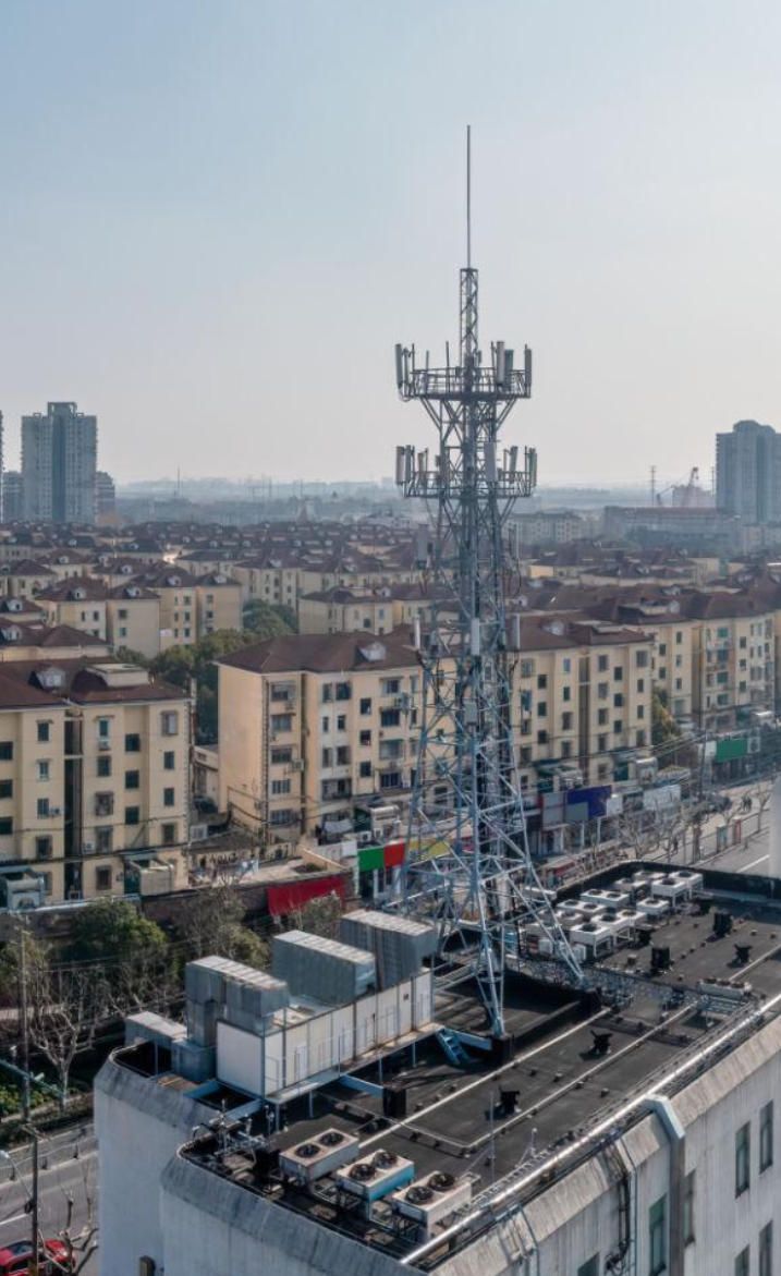
5G Cellular Network Detection: Turning Cell Towers into Sensors
One of the most promising emerging drone detection technologies leverages existing 5G cellular infrastructure — a concept with enormous potential for the Gulf states, which have invested heavily in 5G networks.
Lockheed Martin's NetSense System
In March 2026, Lockheed Martin demonstrated its NetSense system, which transforms commercial 5G cell towers into a passive drone detection network. The concept exploits a fundamental physical principle: 5G networks create a dense field of radio frequency signals between towers and connected devices. When any object — including a drone that is not connected to the network — enters this RF field, it disrupts the signal patterns in detectable ways.
NetSense uses artificial intelligence to interpret these disruptions and determine whether an aerial intrusion is occurring. In the demonstration, a small drone entered an area covered by 5G towers, and the system successfully detected it and raised an alert — without any specialized sensors or hardware modifications to the existing cellular infrastructure.
Why This Matters for the Middle East
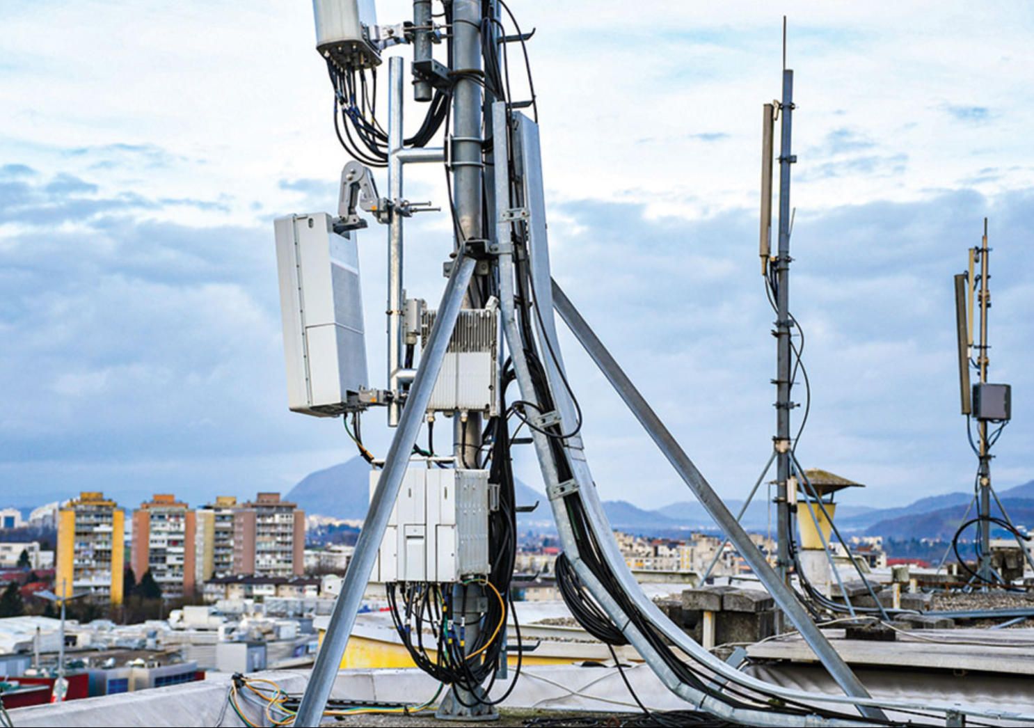
Saudi Arabia, the UAE, Qatar, Bahrain, and Kuwait have some of the most advanced 5G networks in the world. Saudi Arabia's 5G deployment, led by STC and Mobily, covers major urban centers and critical infrastructure corridors. The UAE's 5G coverage through Etisalat and du is among the most extensive globally.
This means that a significant drone detection infrastructure potentially already exists — it just needs the software layer to activate it. Rather than deploying thousands of new radar installations or sensor nodes, Gulf countries could potentially upgrade their existing 5G networks with AI-powered drone detection capabilities at a fraction of the cost.
Research published in the journal Sensors (MDPI, 2024) confirms that 5G base station antennas, operating as millimeter-wave radars, have the potential to detect small drones. The massive MIMO (Multiple-Input Multiple-Output) antenna arrays in 5G towers provide electronic beam-steering capability and high-frequency resolution that rival dedicated drone detection radar systems.
The coverage radius would be determined by the existing 5G network density. In urban areas of the Gulf, where cell towers are spaced every few hundred meters, this could provide near-continuous drone detection coverage. In rural or desert areas, coverage would be limited to corridors along highways and around critical installations where 5G infrastructure exists.

Aerostat-Based Drone Detection: Persistent Eyes in the Sky
Tethered aerostats — large helium-filled balloons moored to the ground by a cable — represent one of the oldest and most reliable approaches to airborne surveillance. In the context of drone detection, they offer a unique combination of persistent altitude, long-range coverage, and multi-sensor capability.
How Aerostat Drone Detection Systems Work
A typical surveillance aerostat operates at altitudes between 300 and 4,600 meters (1,000 to 15,000 feet), tethered to a ground station by a cable that also carries power and data. At these altitudes, the radar horizon extends dramatically — a radar mounted on an aerostat at 4,600 meters can detect low-flying targets at ranges exceeding 200 kilometers, compared to perhaps 20–30 kilometers for the same radar on the ground.
TCOM, the leading manufacturer of military aerostats, offers platforms ranging from the compact 17M tactical system to the massive 117M strategic aerostat. Their 71M system, for example, is used by U.S. forces as an integral component of missile and air defense systems. These aerostats can carry payloads of up to 3,000 kilograms, including radar, electro-optical/infrared cameras, SIGINT (signals intelligence) equipment, and communications relay systems.
The U.S. Customs and Border Protection operates eight Tethered Aerostat Radar System (TARS) sites along the southern border, and despite representing less than 2% of all integrated radars in the surveillance system, these aerostats account for nearly half of all suspect targets detected. From 2014 through 2020, TARS was responsible for detecting 68% of all suspected air smuggling flights approaching the southwest border from Mexico.
The Aerostat Wall Concept for Gulf Defense
One of the most discussed defense concepts for the Middle East is an "aerostat wall" — a chain of tethered aerostats positioned along a country's borders or coastlines, each equipped with drone detection radar and other sensors, creating an overlapping detection perimeter.
For a country like Saudi Arabia, which shares a coastline of approximately 2,640 kilometers along the Persian Gulf and Red Sea, a chain of aerostats positioned every 100–150 kilometers could create a continuous drone detection barrier capable of identifying fixed-wing UAVs at ranges of 100–200+ kilometers. This would provide 15–30 minutes of warning time against a Shahed-type drone traveling at 185 km/h — enough time to alert ground-based interceptor systems.
The advantages of this approach for Gulf countries are significant. Aerostats can remain airborne for days or weeks at a time, providing persistent surveillance without the fuel costs and maintenance cycles of aircraft. They operate above the dust and sand that degrade ground-based sensors. And their elevated position eliminates the radar horizon limitations that constrain ground-based drone detection systems.
The Israeli EL/M-2083 aerostat-mounted radar system is a proven example of this concept. The system provides 360-degree coverage and can track hundreds of targets simultaneously, including small drones and cruise missiles. Similar systems could be deployed across the Gulf to create a comprehensive drone detection network that provides persistent, all-weather drone detection capability.
"An aerostat is basically a balloon with a PhD in surveillance. It floats there, watching everything, judging nothing — like your grandmother at a family dinner, except it's tracking Shahed drones instead of your life choices." — Attributed to a defense contractor at the Dubai Airshow
Multi-Sensor Fusion: The Only Reliable Approach
No single drone detection technology is sufficient on its own. Each method has blind spots: radar struggles with very low-altitude targets in cluttered environments; RF detection cannot find autonomous drones; acoustic sensors have limited range; EO/IR systems fail in poor weather; 5G detection is limited to areas with cellular coverage.
This is why every credible drone detection strategy relies on sensor fusion — combining data from multiple sensor types into a unified picture of the airspace. A modern drone detection command-and-control system might fuse data from ground-based radar, aerostat-mounted radar, acoustic sensor networks, EO/IR cameras, RF analyzers, and 5G cellular detection simultaneously.
AI and machine learning play a critical role in this fusion process. Algorithms must correlate detections across different sensor types, resolve conflicting data, classify targets, predict flight paths, and present actionable intelligence to operators — all in real time. According to CSIS analysis published in March 2026, countering mass drone attacks requires rapid, automated data processing that can handle dozens or hundreds of simultaneous targets.
The software platforms that integrate these diverse data sources are among the most complex engineering challenges in the drone detection space. They must handle massive data throughput, maintain near-zero latency, and provide intuitive operator interfaces — all while operating in harsh field conditions.
The Software Layer: Where Detection Meets Decision
Behind every sensor, every radar sweep, and every acoustic alert is software. The drone detection systems of 2026 are fundamentally software-defined — the hardware sensors provide raw data, but the intelligence comes from the algorithms that process, classify, and present that data.
Key software components in a modern drone detection system include signal processing algorithms that extract drone signatures from noise; machine learning models trained on thousands of drone flight profiles; real-time tracking algorithms that maintain target tracks across multiple sensor handoffs; geographic information system (GIS) integration for mapping detection coverage and threat corridors; automated alert and escalation systems; and mobile applications that provide field operators with real-time situational awareness.
This is precisely the kind of software engineering that A-Bots.com excels at. Our experience with IoT sensor integration, real-time data processing, mobile application development using React Native and native iOS/Android platforms, and backend systems built on Node.js and Python/Django positions us to deliver the custom software components that make drone detection systems operational.
Whether a defense organization needs a custom mobile command-and-control application for field operators, a sensor data fusion platform, an AI-powered classification engine, or comprehensive QA testing of an existing drone detection system, A-Bots.com brings the technical depth and project management discipline that mission-critical defense software demands.
What the March 2026 Conflict Teaches About Drone Detection
The ongoing conflict in the Persian Gulf has exposed a critical gap in the region's air defenses. As Dara Massicot of the Carnegie Endowment for International Peace wrote in her March 2026 analysis, despite years of awareness about the drone threat, low-cost layered drone detection and defense systems were not replicated across Gulf nations or by the U.S. military in the region.
The lesson is straightforward: drone detection must be approached as a distributed, multi-layered problem rather than a centralized, high-end solution. A network of thousands of $500 acoustic sensors can detect threats that a $1 billion radar installation misses. A software upgrade to existing 5G infrastructure can create a drone detection layer that would take years and billions of dollars to replicate with dedicated hardware.
The counter-UAV market reflects this urgency. According to ResearchAndMarkets, the global counter-UAV market was valued at $4.93 billion in 2025 and is projected to reach $36.42 billion by 2035, growing at a CAGR of 22.14%. The defense sector alone is projected to grow from $2.50 billion to $25.65 billion in the same period. For countries in the Middle East, investment in drone detection is no longer optional — it is an existential security requirement.
Country-Specific Drone Detection Priorities in the Middle East
Saudi Arabia faces the largest geographic challenge, with vast desert borders and critical oil infrastructure spread across enormous distances. The kingdom's drone detection strategy will likely require a combination of aerostat-based long-range radar along coastal and border corridors, dense acoustic sensor networks around critical oil facilities managed by Saudi Aramco, and 5G-integrated detection in urban centers like Riyadh, Jeddah, and Dammam.
The United Arab Emirates, having sustained the heaviest drone attacks in the current conflict with over 1,600 UAVs engaged, needs immediate enhancement of its drone detection capabilities around Dubai, Abu Dhabi, and critical infrastructure including desalination plants, data centers, and ports. The UAE's advanced 5G infrastructure makes it an ideal candidate for cellular network-based drone detection.
Qatar, home to major U.S. military facilities including Al Udeid Air Base, requires layered drone detection systems that protect both military installations and civilian infrastructure in Doha and surrounding areas.
Bahrain, Kuwait, and Oman each face unique drone detection challenges based on their geography, proximity to potential launch sites, and the specific infrastructure they need to protect.
Israel, while not a Gulf state, has been at the forefront of drone detection technology development and has faced over 500 drones and 290 missiles since the start of hostilities. Israeli defense companies like Rafael, IAI, and Elbit Systems offer some of the most advanced drone detection solutions available.

The Future of Drone Detection: What Comes Next
Several emerging technologies will shape drone detection in the near future. Passive radar systems that detect drones by analyzing how they disturb existing broadcast or cellular signals are advancing the drone detection frontier. Space-based drone detection using satellite constellations could provide global coverage, though resolution and latency remain challenges. Quantum sensing technologies promise extremely sensitive detection capabilities, though they remain largely experimental.
For the Middle East specifically, the integration of drone detection networks across GCC (Gulf Cooperation Council) member states into a unified regional air picture — similar to what U.S. Central Command is currently coordinating — will be critical. The software infrastructure required for this kind of multi-national, multi-sensor fusion represents one of the most significant defense software challenges of the decade.
Conclusion: Building the Drone Detection Shield the Gulf Needs
The drone detection landscape of 2026 is defined by urgency. The threat is not theoretical — it is active, ongoing, and documented in the daily intercept reports of every Gulf nation's ministry of defense. Effective drone detection against fixed-wing attack drones powered by ICE and small jet engines have proven to be cheap, effective, and difficult to detect with traditional air defense systems.
The solution requires a multi-layered approach: long-range aerostat-mounted radars for early warning; ground-based AESA radars for tracking; acoustic sensor networks for detecting low-flying threats in radar shadows; EO/IR systems for visual confirmation; 5G cellular detection for urban areas; and RF analysis for identifying remotely piloted commercial drones. All of these must be tied together by sophisticated software that fuses data, classifies targets, and delivers actionable intelligence to operators in real time.
At A-Bots.com, we understand that the software powering drone detection systems is just as critical as the hardware. Our expertise in IoT platform development, real-time data processing, mobile application engineering, and comprehensive QA testing makes us a capable partner for organizations building or maintaining drone detection software infrastructure. With offices in the USA, Ukraine, and Romania, and a technology stack that includes React Native, Node.js, Python/Django, and native mobile development, we are equipped to deliver the custom software solutions that modern drone detection demands. Contact our team at info@a-bots.com to discuss how A-Bots.com can support your drone detection software requirements.
✅ Hashtags
#DroneDetection
#CounterUAS
#MiddleEastDefense
#AirDefense
#CounterDrone
#UAVDetection
#GulfSecurity
#DroneDefense
#AcousticDetection
#AerostatSurveillance
#5GDroneDetection
#SensorFusion
Other articles
Smart Thermostat Honeywell: Full Lineup Review Honeywell Home controls a significant share of the smart thermostat market — but understanding what their devices actually do requires looking past the feature list. This article reviews the full current lineup, from the Matter-certified $79.99 X2S to the professionally integrated T10 Pro, with a detailed breakdown of how Smart Response, geofencing, room sensor logic, and utility demand response work mechanically. It also covers the real limitations users encounter — app fragmentation, C-wire dependency, no self-learning schedule — and explains what is technically required to build a custom HVAC mobile application for use cases that mass-market thermostats cannot serve.
App Controlled Space Heater - 7 Smart Models Reviewed Smart space heaters are no longer judged only by watts and oscillation - the mobile app is the real control surface. This review compares 7 app-controlled models by what actually matters in daily use: onboarding speed, scheduling logic, stability on 2.4 GHz Wi-Fi, safety notifications, and what the app cannot do (including the Dyson HP07 heating-control limitation in the US). You will also see how ecosystem choices (Smart Life - Tuya vs proprietary apps) change long-term reliability, plus a hard safety lesson from the Govee H7130 recall tied to wireless-control features. If your product needs this level of app rigor, A-Bots.com builds custom IoT mobile experiences.
OpenClaw Complete Guide 2026: Installation, Databases, Use Cases, and Troubleshooting OpenClaw became the fastest-growing open-source project in GitHub history with over 200,000 stars in early 2026. This expert-level guide walks you through every stage of deploying your own OpenClaw instance — from system requirements and installation on virtual machines, dedicated servers, and personal computers to connecting databases like SQLite, MySQL, and PostgreSQL with pgvector. The article covers the most common OpenClaw errors with tested solutions, explains the memory architecture and search backends, details practical use cases including DevOps automation, browser control, IoT integration, and custom mobile app development, and provides Docker deployment and security hardening best practices for production environments.
MemU Complete Guide 2026: Proactive AI Memory Framework for Always-On Agents MemU is an open-source memory framework by NevaMind-AI that gives AI agents persistent, evolving memory for 24/7 proactive operation. With over 12,000 GitHub stars and 92.09% accuracy on the Locomo benchmark, memU organizes knowledge into a three-layer hierarchical system and uses dual-mode retrieval to cut LLM token costs by approximately 10x. This expert guide covers installation with PostgreSQL and pgvector, the complete memory architecture including the upcoming Intention Layer, real-world use cases from financial monitoring and DevOps to AI companions and counter-drone defense systems, six practical lifehacks for optimizing performance, and comparisons with Mem0 and LangChain Memory. Includes integration patterns for OpenClaw, LangGraph, n8n, and custom mobile applications.
OpenClaw without installation in 2026: Best Hosted Platforms, Hotel and Restaurant CRM Use Cases OpenClaw has become the fastest-growing open-source AI agent framework of 2026, surpassing 163,000 GitHub stars and powering autonomous workflows across industries. This expert guide reviews the top hosted platforms — OpenClawCloud, Amazon Lightsail, ArkClaw by ByteDance, and DigitalOcean — that let businesses test OpenClaw without complex installation. The article explores practical applications of OpenClaw for hotel and restaurant CRM data analysis, from guest behavior prediction and revenue optimization to menu intelligence and churn prevention. It also explains why production-grade deployments demand custom development, and how A-Bots.com delivers tailored AI agent solutions with proven expertise across 70+ projects.
Top stories
Copyright © Alpha Systems LTD All rights reserved.
Made with ❤️ by A-BOTS