Home
Services
About us
Blog
Contacts
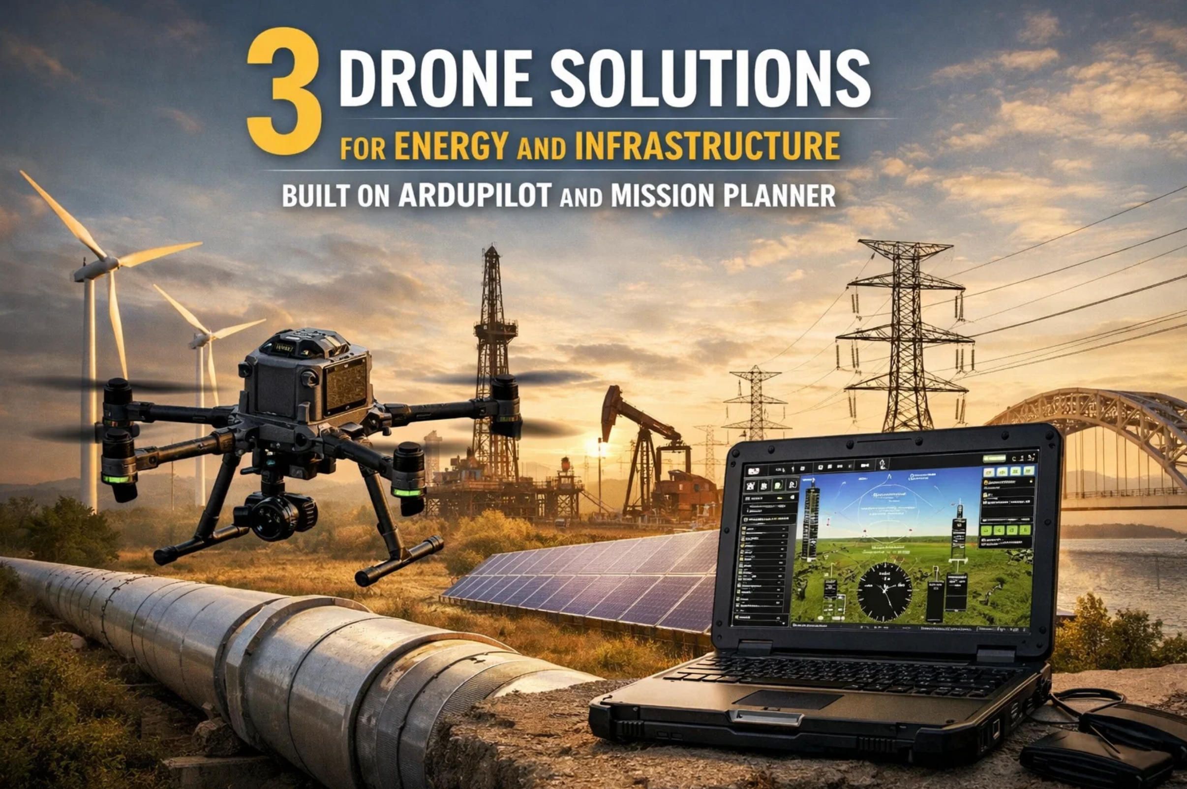
3 Drone Solutions for Energy and Infrastructure Built on ArduPilot and Mission Planner
A 50-megawatt solar farm in Texas loses USD 245,000 in annual revenue because 4.9 percent of its modules carry hotspot defects that no ground crew has time to find. A utility in Georgia spends millions on helicopter patrols and climbing crews to inspect 14,000 miles of transmission lines, yet still misses the corroded insulator that triggers a three-county blackout. An interstate pipeline operator in North Dakota learns about a methane leak from an EPA enforcement letter rather than from its own monitoring program, because the leak sits in a brushy ravine where foot patrols rarely venture.
These are not edge cases. They are the operational baseline across energy infrastructure worldwide. Manual inspection of solar arrays covers only 10 to 25 percent of a PV system and misses faults like micro-cracks that reduce output by up to 5 percent annually. Traditional power line patrols by helicopter cost USD 1,200 to 2,500 per mile. And in the United States alone, more than 630,000 pipeline leaks occur annually in distribution networks, with methane emissions estimated at 1.25 to 2.66 million tons per year.
A-Bots.com, a full-cycle custom software development company with offices in the USA, Ukraine, and Romania, develops drone software solutions that replace these legacy workflows with automated, repeatable, data-rich aerial operations. With a technology stack spanning Python/Django, React Native, Node.js, Java, Kotlin, and Swift — and a track record of more than 70 completed projects, including the Shark Clean IoT vacuum controller and the Scandpay mobile payment platform — A-Bots.com brings the same engineering discipline to energy-sector drone software that it applies to consumer-grade mobile applications. The company builds custom ArduPilot firmware modules, Mission Planner plug-ins, companion computer pipelines, and cloud analytics dashboards that turn thermal mosaics, LiDAR point clouds, and OGI video streams into maintenance work orders.
This is the second article in a three-part series. Part one covered agriculture — vineyard monitoring, broadacre variable-rate mapping, and livestock tracking. Here we tackle energy and infrastructure, where the commercial drone market is driven by a simple arithmetic: drone inspection reduces costs by 60 to 85 percent compared to manned methods while uncovering four times more critical defects. According to Grand View Research, the global commercial drone market was valued at USD 30.02 billion in 2024 and is projected to reach USD 54.64 billion by 2030, with energy and infrastructure inspection among the fastest-growing segments.
Case 4: Thermal Inspection of Utility-Scale Solar Farms
The Problem
A utility-scale solar farm with 50 MW of installed capacity contains roughly 150,000 to 200,000 individual PV modules. Each module consists of 60 to 72 photovoltaic cells, any one of which can develop a hotspot from a cracked cell, a failed bypass diode, potential-induced degradation (PID), delamination, or solder joint fatigue. A single hotspot cell can reduce module output by 20 to 40 percent and, if left unchecked, cascade into a fire risk.
Manual inspection with a handheld thermal camera proceeds at approximately 25 hours per megawatt. At the US national average wage of USD 32 per hour, a 50 MW farm costs roughly USD 40,000 in labor alone — and still covers only a fraction of the array. The industry standard IEC TS 62446-3 requires inspections under specific conditions: at least 600 W/m² solar irradiance, wind below 28 km/h, and no more than 25 percent cloud cover. These constraints shrink the inspection window to a few hours per day in many climates, making manual methods even less practical at scale.
Drone thermography changes the economics entirely. A thermal drone inspects at a pace of roughly 10 minutes per megawatt — versus 25 hours per megawatt on foot. Field tests across multiple PV sites report a 97 percent efficiency boost and approximately USD 1,250 in savings per megawatt compared to legacy methods. One solar asset owner estimated annual savings of over USD 475,000 by discovering defective modules that manual inspection would have missed entirely.
Hardware Architecture
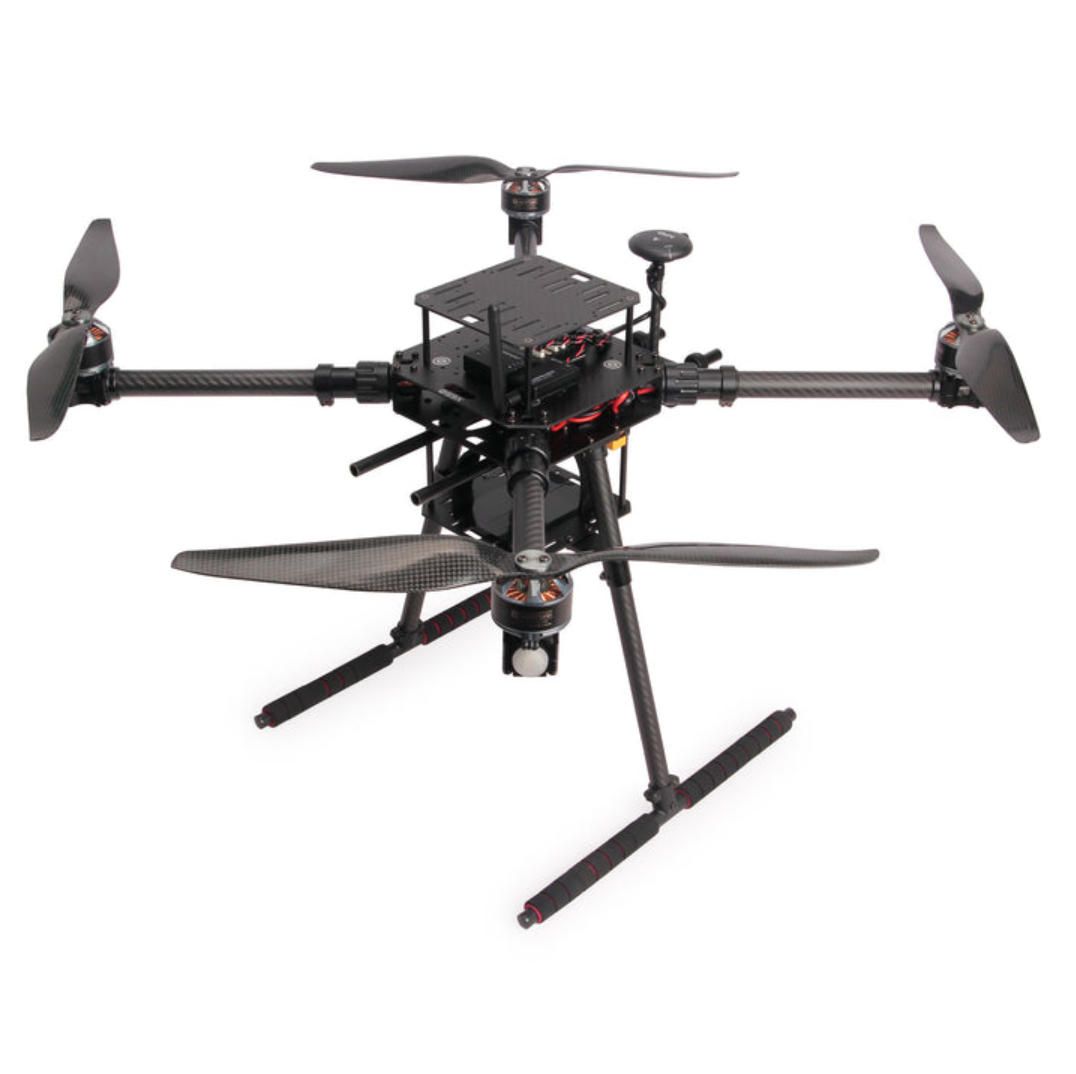
The ideal platform is a quadcopter or hexacopter running ArduCopter firmware on a Cube Orange+ or Holybro Pixhawk 6X flight controller. For solar inspection, flight endurance of 30 to 45 minutes is sufficient because the mission footprint is compact (the drone flies low and slow over the array) and battery swaps are straightforward in a flat, accessible environment.
The primary sensor is a radiometric thermal camera — not just a thermal imager, but a sensor that records calibrated temperature values per pixel. The FLIR Vue Pro R 640 (640 × 512 resolution, 13 mm lens, radiometric TIFF output) is the workhorse for ArduPilot-based builds because it accepts a PWM trigger signal from the Pixhawk's auxiliary output, synchronizing thermal captures with the aircraft's ground track. Each pixel carries absolute temperature data, enabling software to automatically flag cells that breach Delta T thresholds — typically 10°C above adjacent cells for moderate faults, 20°C for critical defects per IEC 62446-3 guidelines.
A secondary RGB camera (Sony A6100 or similar, 24 MP APS-C sensor) captures visual imagery in parallel, providing context for each thermal anomaly. Fault classification requires pairing the thermal signature with a visual — a hotspot caused by a cracked cell looks different from one caused by bird droppings, and only the RGB image reveals the difference.
RTK GPS (CubePilot Here3+ or Holybro H-RTK F9P) is critical for geo-referencing every thermal frame to a specific panel ID. Without centimeter-level positioning, the maintenance crew cannot locate the defective module among 200,000 nearly identical panels. ArduPilot's EKF3 fuses RTK corrections, IMU, and barometer to produce georeferenced trigger points accurate to within 2 centimeters.
Mission Planning in Detail
In Mission Planner, the operator imports the solar farm's layout as a KML or shapefile overlay, draws a survey polygon around the target array block, and selects Auto WP → Survey (Grid). The camera configuration dialog accepts the FLIR Vue Pro R's sensor dimensions (10.88 mm × 8.70 mm), focal length (13 mm), and image resolution (640 × 512).
Flight altitude is set to 20 to 30 meters AGL — low enough to resolve individual cells (achieving approximately 3 to 5 cm thermal GSD) but high enough to maintain safe clearance above the panel surface. Forward overlap is set to 75 percent and side overlap to 60 percent for reliable orthomosaic stitching. DO_SET_CAM_TRIGG_DIST is auto-calculated, typically producing a trigger every 3 to 5 meters at a cruise speed of 3 to 4 m/s.
The mission includes a "Hover and Capture" setting enabled for the multirotor, pausing briefly at each trigger point to eliminate thermal blur. The gimbal pitch is set to -90 degrees (nadir) via a DO_MOUNT_CONTROL command at the start of the mission. For tracker-mounted panels, the flight should be timed to coincide with the tracker angle that presents the panel face perpendicular to the nadir view — typically solar noon ± 30 minutes.
ArduPilot's geofence (FENCE_ENABLE = 1) is configured with an inclusion polygon matching the solar farm boundary and an altitude ceiling of 50 meters, preventing the aircraft from straying over neighboring property or public roads.
What A-Bots.com Custom-Develops
Panel-ID Geo-Mapping Engine. A-Bots.com builds a pre-processing module that ingests the solar farm's as-built CAD layout (panel positions, string assignments, inverter zones) and creates a geospatial lookup table. After the flight, each thermal frame's RTK coordinates are matched to a specific panel ID, string number, and inverter. The output is not a generic orthomosaic but a structured database: Panel A3-17 in String 4 of Inverter 12 shows a Delta T of 23.7°C at cell position (3,5).
AI Defect Classifier. A-Bots.com trains a YOLOv8 object detection model on a dataset of radiometric thermal images labeled with fault categories: single-cell hotspot, multi-cell hotspot, string outage (uniformly cold strip), bypass diode failure (diagonal thermal pattern), PID degradation, soiling/shading, and delamination. The model runs post-flight on the processing server and classifies every anomaly detected above the Delta T threshold, reducing the thermographer's review time from hours to minutes.
CMMS Integration Module. The classified fault report — containing panel ID, GPS coordinates, fault type, severity grade, thermal and RGB image pair — is exported as a CSV or JSON file formatted for ingestion into the farm's Computerized Maintenance Management System (SAP PM, IBM Maximo, or Infor EAM). Maintenance tickets are auto-generated, prioritized by severity, and assigned to the nearest field crew.
Mission Planner Plug-in for Panel-Row Flight Paths. Standard survey grids are agnostic to panel row orientation. A-Bots.com develops a plug-in that imports the panel layout and generates flight paths aligned to panel rows, ensuring that every flight strip centers directly over a row rather than crossing rows at arbitrary angles. This eliminates oblique thermal views that distort Delta T readings and ensures each panel receives a consistent nadir capture.
Measurable Outcomes
A 50 MW solar farm inspected quarterly by drone identifies an average of 3 to 5 percent of modules with actionable faults per inspection cycle. Restoring these modules to full output recovers approximately 2.5 MW of lost generation capacity. At a power purchase agreement rate of USD 0.06/kWh and 1,800 annual sun-hours (typical for the US Southwest), the recovered revenue is approximately USD 270,000 per year. The total cost of the drone system, sensors, and A-Bots.com's annual software license is typically recovered within the first inspection cycle.
Case 5: Power Line Corridor Inspection and Vegetation Management
The Problem
The United States operates approximately 160,000 miles of high-voltage transmission lines and 5.5 million miles of distribution lines. Vegetation encroachment — trees growing into conductor clearance zones — is the leading cause of non-weather-related power outages and a primary ignition source for wildfires. PG&E's equipment sparked the 2018 Camp Fire in California, the deadliest wildfire in the state's history, killing 85 people. The utility now spends over USD 2 billion annually on wildfire mitigation, a significant portion of which goes to vegetation management and line inspection.
Traditional inspection methods include helicopter patrols (USD 1,200 to 2,500 per mile), climbing crews (USD 500 to 1,500 per structure), and foot patrols along rights-of-way. These methods are slow, dangerous, and produce subjective data — an inspector's notebook judgment that a tree "looks close" does not quantify whether the clearance is 2.1 meters or 1.8 meters. LiDAR-equipped helicopters produce quantitative data but at a cost that limits survey frequency to once per year or less.
Drone-based inspection with LiDAR, thermal, and RGB sensors reduces inspection costs by approximately 60 percent while uncovering over four times more critical issues than traditional methods, as demonstrated by Georgia Power's drone program. A small drone team can survey approximately 14 miles of line per day, and BVLOS-capable fixed-wing drones extend that to 50 miles or more per sortie.
Hardware Architecture
Power line inspection demands a dual-platform approach, mirroring the livestock monitoring architecture from Part 1.
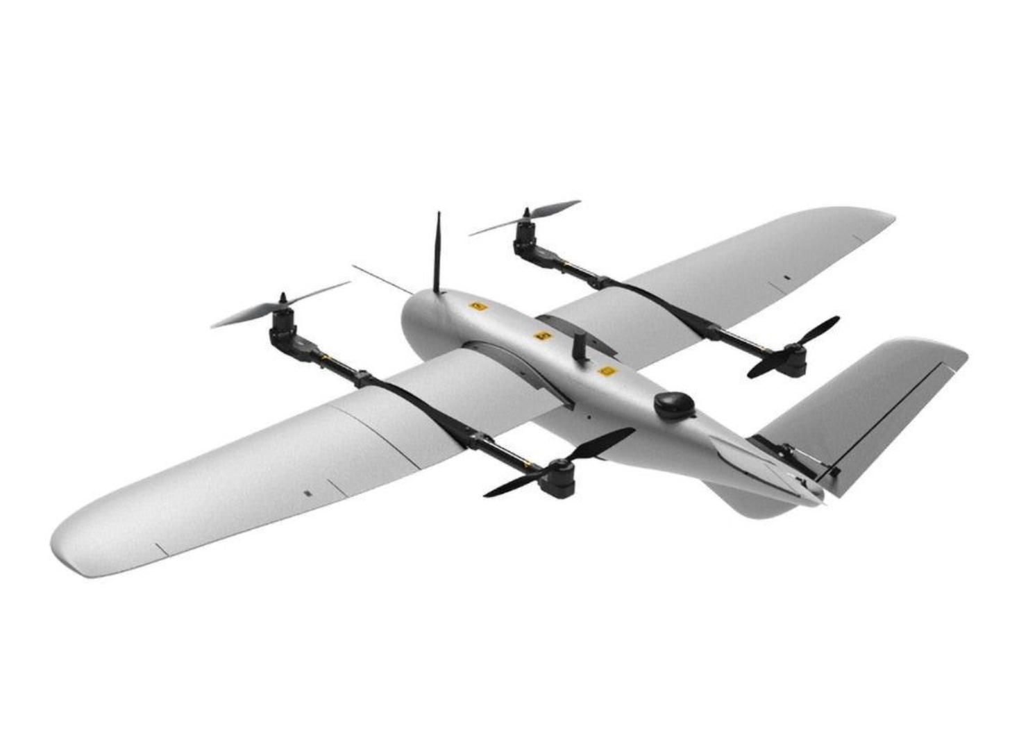
Long-Range Corridor Survey (Fixed-Wing VTOL). The primary platform is a fixed-wing VTOL running ArduPlane QuadPlane firmware — the Event 38 E400 (90-minute endurance, 1.36 kg payload, carbon fiber airframe, NDAA-compliant) or the MakeFlyEasy Fighter VTOL (120+ minutes endurance, 1.5 kg payload, 2430 mm wingspan). These aircraft cruise at 18 to 20 m/s along the transmission corridor, carrying a LiDAR sensor for 3D point cloud generation.
The LiDAR sensor of choice for corridor mapping is a compact unit weighing under 1.5 kg — the YellowScan Mapper (dual-return, 240 kHz pulse rate, 100 m range, 1.5 kg) or the LightWare SF45/B (solid-state, 45-degree FOV, suitable for obstacle avoidance and low-density point clouds). For higher-density requirements, the Phoenix LiDAR Recon-XT (2 to 5 cm RMS vertical accuracy at 80 m, 1.8 kg) integrates with ArduPilot-compatible platforms. The LiDAR captures millions of data points per corridor mile, generating 3D models of conductors, poles, towers, and surrounding vegetation with centimeter-level accuracy.
Close-Inspection Multirotor. When the corridor survey flags a suspect structure — a leaning pole, a corroded insulator, vegetation within the critical clearance zone — a multirotor (Holybro X500 V2 or EFT E410S with Pixhawk 6C) is deployed for detailed inspection. This platform carries a 30x optical zoom camera for component-level imagery and a FLIR Boson 640 thermal sensor for hotspot detection on connectors, transformers, and splice points.
Telemetry is provided by the RFD900x long-range radio (40+ km MAVLink telemetry) for the fixed-wing VTOL. ArduPilot's failsafe parameters (FS_SHORT_ACTN, FS_LONG_ACTN for ArduPlane) are configured to initiate Return-to-Launch on telemetry loss, with FS_SHORT_TIMEOUT set to 5 seconds. For BVLOS operations (FAA Part 107 waiver required), an LTE/4G cellular telemetry backup (Elsight Halo or similar) provides redundant command-and-control over mobile networks.
Mission Planning in Detail
The transmission corridor is defined as a series of waypoints following the centerline of the right-of-way, imported into Mission Planner from a KML file generated by the utility's GIS department. The fixed-wing VTOL executes a linear mission: VTOL takeoff → transition to fixed-wing cruise → fly corridor centerline at 60 to 80 m AGL → transition back to VTOL → land at a designated recovery point downrange.
Terrain following is critical in hilly or mountainous corridors. ArduPlane's terrain-following engine uses SRTM data with TERRAIN_LOOKAHEAD set to 2000 meters, allowing the aircraft to smoothly adjust pitch and throttle to maintain constant AGL as the terrain changes beneath the corridor. For corridors with extreme elevation variation (mountain crossings, river valleys), A-Bots.com pre-loads high-resolution DEM tiles (10 m or 30 m SRTM1) onto the autopilot's SD card before flight.
The LiDAR sensor triggers continuously during corridor flight, sweeping the terrain below in a cross-track pattern. No DO_SET_CAM_TRIGG_DIST is needed because LiDAR operates as a continuous scanner rather than a frame-based camera. However, if an RGB or thermal camera is flown simultaneously for visual documentation, trigger distance is calculated based on the camera's specifications and programmed via standard Mission Planner survey parameters.
For the close-inspection multirotor, Mission Planner's point-of-interest (POI) mode allows the pilot to orbit a specific tower at a constant radius and altitude, keeping the camera pointed at the structure. The DO_SET_ROI command locks the gimbal on the tower coordinates while the aircraft circles at 30 to 50 meters distance, capturing 360-degree imagery of every component.
What A-Bots.com Custom-Develops
Vegetation Clearance Analyzer. A-Bots.com builds a point cloud processing pipeline (Python + PDAL/CloudCompare libraries) that classifies the LiDAR data into conductor, structure, ground, and vegetation classes. The pipeline then computes the minimum distance between every conductor segment and the nearest vegetation point. Any clearance below the utility's threshold (typically 3 to 6 meters for transmission, depending on voltage class and NERC FAC-003 standards) triggers an alert with GPS coordinates, conductor span ID, and the species/height estimate of the encroaching tree.
Line Sag and Conductor Clearance Modeler. Using the 3D conductor positions extracted from the LiDAR point cloud, A-Bots.com calculates catenary sag for each span under various temperature scenarios (winter minimum, summer maximum, emergency loading). The software models how much additional sag occurs at peak load and flags spans where the ground clearance falls below NESC minimums, enabling the utility to prioritize re-tensioning or replacement before a violation occurs.
Digital Twin Dashboard. Each inspection flight adds to a cumulative 3D digital twin of the corridor, hosted on a Django-based web platform. Engineers can navigate the corridor in a virtual flythrough, click on any structure to view the latest RGB, thermal, and LiDAR data, and compare current measurements against historical baselines. Change detection algorithms highlight structures where LiDAR-measured lean has increased, vegetation has grown closer, or hardware geometry has shifted since the previous survey.
ArduPilot Corridor-Following Lua Script. Standard waypoint missions require manual waypoint placement along the corridor centerline. A-Bots.com develops a Lua scripting extension that reads the corridor KML file, auto-generates waypoints at configurable intervals (every 100 to 500 meters), applies terrain-relative altitude, and uploads the mission to the autopilot. The operator simply selects the corridor segment, clicks "Generate," and the aircraft is ready to fly.
Measurable Outcomes
Georgia Power's drone program demonstrated a 60 percent reduction in annual inspection costs and a four-fold increase in defect detection compared to traditional methods. For a utility managing 5,000 miles of transmission lines with an annual inspection budget of USD 10 million, a drone-based program reduces that cost to approximately USD 4 million while producing georeferenced, quantitative data that replaces subjective inspector notes. Vegetation-related outage prevention alone — avoiding a single major wildfire or blackout event — can justify the entire program cost many times over.
Case 6: Pipeline Corridor Surveillance and Methane Leak Detection
The Problem
The United States has approximately 2.9 million miles of natural gas pipeline. The Pipeline and Hazardous Materials Safety Administration (PHMSA) requires operators to patrol transmission pipelines at intervals ranging from bi-weekly to annually, depending on class location and proximity to populated areas. Traditional patrol methods — foot surveys, vehicle patrols, and manned helicopter overflights — are expensive, infrequent, and limited in detection capability.
Methane, the primary component of natural gas, is a potent greenhouse gas — 80 times more warming than CO2 over a 20-year horizon. The EPA's Subpart OOOOa regulations and the Inflation Reduction Act's methane fee (starting at USD 900 per ton in 2024, rising to USD 1,500 per ton by 2026) create a direct financial incentive for operators to find and fix leaks quickly. Research published in Frontiers in Robotics and AI estimates that more than 630,000 leaks occur annually in US distribution pipelines, with methane emissions in the range of 1.25 to 2.66 million tons.
Drone-based pipeline surveillance with onboard gas detection sensors represents a paradigm shift: instead of a human walking the right-of-way with a handheld sniffer once a quarter, a fixed-wing drone flies the corridor weekly, detecting leaks as small as 0.35 g/hr at flight altitudes up to 30 meters. The autonomous oil and gas inspection drone market generated USD 78 million in addressable value from US gas pipeline surveillance alone in 2025, with BVLOS-capable drones expanding reach to 60-to-120-kilometer patrol sorties per flight.
Hardware Architecture
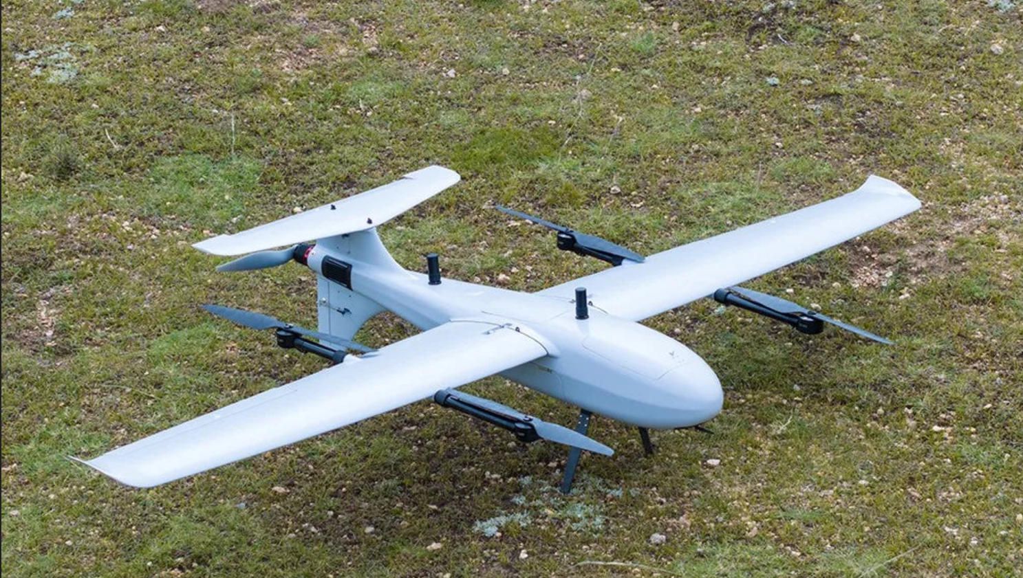
Pipeline surveillance is the definitive long-range, long-endurance mission. The platform is a fixed-wing VTOL running ArduPlane QuadPlane firmware, optimized for maximum range and payload efficiency.
Airframe. The MakeFlyEasy Fighter VTOL (2430 mm wingspan, 120+ min endurance, 1.5 kg payload, 19 m/s cruise) or the Event 38 E400 (90 min endurance, 1.36 kg payload, carbon fiber construction) are the baseline platforms. For operators needing 200+ km range per sortie, the MakeFlyEasy Freeman 2300 (2300 mm wingspan, 90 min endurance with 22000 mAh 6S battery at 600 g payload) provides extended coverage.
Flight Controller. Cube Orange+ with Here3+ RTK GPS running ArduPlane 4.5+. The QuadPlane parameters (Q_ENABLE = 1, Q_ASSIST_SPEED set to 1.5× stall speed) are tuned for safe transition between VTOL hover and fixed-wing cruise. ARSPD_FBW_MIN is calibrated to the airframe's stall speed (typically 10 to 12 m/s for these platforms), and ARSPD_FBW_MAX is set to 22 to 25 m/s for efficient cruise.
Methane Detection Payload. Lightweight optical gas imaging (OGI) cameras or laser-based methane detectors are the key differentiator. The MFE Detect LW (uncooled OGI detector, methane visualization, lightweight design compatible with multirotor and fixed-wing platforms) or the LinkedAll OGI 640 (640-pixel thermal resolution, methane/propane detection, MAVLink-compatible trigger interface) provide real-time gas visualization during flight. For quantitative detection, tunable diode laser absorption spectroscopy (TDLAS) sensors — such as those based on the Pergam Laser Methane Mini principle — detect methane concentrations as low as 5 ppm·m from 30 meters altitude.
Secondary Sensors. A standard RGB camera (triggered by DO_SET_CAM_TRIGG_DIST) captures visual documentation of the right-of-way for third-party encroachment detection — unauthorized construction, excavation, or vehicle activity near the pipeline. A thermal camera (FLIR Boson 640) detects temperature anomalies in exposed pipeline sections, valve stations, and compressor facilities.
Telemetry. The RFD900x provides the primary MAVLink telemetry link. For BVLOS operations over 40 km, an LTE/4G cellular modem (Elsight Halo or Doodle Labs Smart Radio) provides redundant command-and-control. ArduPilot's SERIAL_PASS protocol allows the LTE and RF links to operate simultaneously, with automatic failover.
Mission Planning in Detail
The pipeline centerline is imported into Mission Planner as a KML path. A-Bots.com's corridor mission generator (see Case 5) auto-generates waypoints along this path at 200-meter intervals, applying terrain-relative altitude of 25 to 30 meters AGL. This altitude is the optimal trade-off between methane detection sensitivity (sensors perform best below 30 m) and safe terrain clearance.
For a 100-kilometer pipeline segment, the mission requires approximately 90 minutes of flight time at 19 m/s cruise speed — within the endurance envelope of the MakeFlyEasy Fighter VTOL. The mission is segmented into outbound and return legs: the aircraft flies the corridor in one direction, lands at a pre-positioned recovery point downrange for battery swap, then returns along a parallel offset path to provide redundant coverage.
ArduPlane's rally point system (RALLY_LIMIT_KM parameter) defines emergency landing locations along the corridor at 10 to 15 km intervals, ensuring the aircraft always has a safe diversion option within glide range if power is lost. These rally points are pre-surveyed for obstruction clearance and loaded via Mission Planner's Rally Point editor.
The OGI camera operates continuously, streaming video to the companion computer for real-time analysis. The TDLAS sensor logs concentration readings at 10 Hz, geotagged by the RTK GPS, producing a continuous methane profile along the corridor.
What A-Bots.com Custom-Develops
Real-Time Leak Alert Pipeline. A-Bots.com builds a companion computer module (NVIDIA Jetson Orin Nano) that processes the OGI video stream and TDLAS concentration data in real time during flight. A convolutional neural network trained on gas plume imagery classifies video frames as "leak detected" or "clear." When a plume is identified, or TDLAS readings exceed a configurable threshold (default: 10 ppm·m above ambient), the system captures a GPS-stamped screenshot, records the methane concentration, and transmits an alert to the ground station via MAVLink custom message. The pilot — or, in autonomous BVLOS mode, the remote operations center — receives the alert within seconds.
Corridor Health Dashboard. Each patrol flight's data is uploaded to A-Bots.com's Django-based platform, building a longitudinal record of the pipeline corridor. The dashboard displays a color-coded map: green (no anomalies), yellow (elevated readings below action threshold), red (confirmed leak or encroachment). Operators can drill into any segment to view the OGI video frame, TDLAS concentration graph, RGB imagery, and thermal overlay. Time-series analysis shows whether a yellow zone is trending toward red, enabling predictive maintenance scheduling.
Regulatory Compliance Reporter. PHMSA and EPA reporting requirements demand specific data formats and documentation timelines. A-Bots.com's platform auto-generates compliance reports containing patrol date, corridor covered (GPS track log), any leaks detected (coordinates, concentration, timestamp), corrective actions taken, and operator certifications. Reports are exportable as PDF or CSV and formatted to match the operator's existing regulatory filing templates.
Multi-Drone Corridor Orchestrator. For operators managing thousands of miles of pipeline, a single drone cannot cover the entire network in a regulatory cycle. A-Bots.com develops a fleet management layer that divides the network into patrol segments, assigns each segment to a drone/pilot team, schedules missions based on weather windows and regulatory deadlines, and tracks completion status. The system ensures no segment is missed and flags overdue patrols before they become compliance violations.
Measurable Outcomes
A midstream operator managing 500 miles of transmission pipeline typically spends USD 500,000 to 1,000,000 annually on patrol and leak detection using manned aircraft and foot surveys. A drone-based program covering the same corridor reduces that cost to USD 150,000 to 300,000 — a 50 to 70 percent saving. More critically, weekly drone patrols detect leaks 4 to 12 weeks earlier than quarterly manned patrols, reducing methane emissions and avoiding EPA methane fee exposure. At the 2026 rate of USD 1,500 per ton, early detection of a single 10-ton-per-year leak saves USD 15,000 in fees plus the avoided cost of gas loss and environmental remediation.
The ArduPilot Advantage in Energy and Infrastructure
All three energy cases share characteristics that make ArduPilot and Mission Planner the ideal foundation: long-duration automated flights over repetitive corridors, integration with specialized sensors via MAVLink and PWM interfaces, terrain-following capability essential for maintaining consistent altitude over variable topography, and the need for repeatable missions that produce comparable data across inspection cycles.
ArduPilot's open-source nature means that A-Bots.com can extend the firmware at any layer — adding custom MAVLink messages for real-time leak alerts, writing Lua scripts for corridor-following automation, or modifying the EKF to fuse LTE-derived position data in GPS-denied environments near high-voltage lines (where electromagnetic interference can degrade GNSS signals). These modifications are impossible with proprietary firmware locked to a single manufacturer's ecosystem.
Mission Planner's terrain data engine, rally point system, geofence framework, and survey grid generator provide the infrastructure for planning energy inspection missions that would require expensive third-party software on other platforms. And because ArduPilot runs on hardware ranging from the USD 50 Pixhawk 6C Mini to the USD 500 Cube Orange+, energy operators can match their investment to their scale — a solar farm O&M company with three sites does not need the same hardware as a transcontinental pipeline operator, but both benefit from the same software ecosystem and the same custom development partner.
What Comes Next
Part three of this series will explore three use cases in construction, mining, and emergency response — areas where ArduPilot-based drones equipped with photogrammetry, LiDAR, and thermal sensors are replacing manual surveying, enabling real-time progress monitoring, and saving lives in search-and-rescue operations.
If your energy or infrastructure organization is ready to replace helicopter patrols, climbing crews, and handheld inspections with automated drone workflows — if you need a solution that integrates with your CMMS, meets IEC and NERC standards, and scales from a single solar farm to a continental pipeline network — A-Bots.com is ready to build it. Contact A-Bots.com at info@a-bots.com or through Telegram at @Alphabots_support to start the conversation.
Here is the list of ArduPilot-compatible drone models applicable to the three Energy and Infrastructure Built cases:
Case 4 — Solar Farm Thermal Inspection (Multirotor Platforms)
These missions require low-altitude precision flight (20–30 m AGL), stable hover-and-capture for radiometric thermal imaging, and RTK geo-referencing to map each frame to a specific panel ID.
- Holybro X500 V2 — carbon fiber quadcopter, Pixhawk 6C/6X compatible, ~18 min flight time. Suitable for small-to-medium solar arrays (up to 5–10 MW per sortie). Payload mount for FLIR Vue Pro R 640 + companion computer. Frame kit ~USD 500.
- Holybro X650 — larger foldable frame, 20 mm carbon fiber arms, supports heavier dual-camera payloads (thermal + RGB simultaneously). Extended endurance over X500 with larger propellers and 6S batteries.
- Holybro S500 V2 — compact quadcopter kit, budget-friendly entry point for operators starting a solar inspection program. Carries single thermal camera payload. Frame kit ~USD 300.
- EFT E610 / E616 — agricultural hexacopter frame repurposed for inspection, max takeoff weight 16–25 kg. Hexacopter redundancy protects expensive thermal and RGB payloads. Supports Cube Orange+ with vibration-isolated mounting. Ideal for large utility-scale farms (20–50 MW) where longer endurance and payload flexibility matter.
- Tarot T960 — foldable hexacopter, 960 mm wheelbase, carbon fiber arms, 25–30 min flight time with 6S batteries. Popular among ArduPilot integrators for custom inspection builds. Supports dual-gimbal configurations (thermal + RGB).
- Tarot T810 — hexacopter, 810 mm wheelbase. More compact than T960 for rooftop solar installations where transport and deployment space are limited.
- Freefly Astro — commercial-grade quadcopter, Pixhawk-based, RTK built-in, ~40 min flight time, LTE cloud connectivity. Pre-integrated mission computer supports onboard AI processing. Higher price point (~USD 15,000+) but turnkey deployment for solar O&M companies requiring immediate operational capability.
- Inspired Flight IF800 Tomcat — lightweight, foldable, NDAA-compliant frame. Designed for infrastructure inspection with swappable payload bays. Suitable for operators working under US government or utility contracts requiring domestic supply chain compliance.
- ACSL SOTEN — compact Japanese-made drone, NDAA-compliant, IP43 rated, 25 min flight time. One-touch swappable camera system supports thermal, optical zoom, and standard RGB payloads. Designed for regulated environments where security and data sovereignty are required.
Case 5 — Power Line Corridor Inspection (Dual-Platform: Fixed-Wing VTOL + Multirotor)
Long-range corridor survey requires maximum endurance and LiDAR payload capacity. Close-inspection multirotor handles per-tower detailed examination.
Fixed-Wing VTOL (Corridor Survey with LiDAR):
- Event 38 E400 — carbon fiber fixed-wing VTOL, 90 min endurance, 1.36 kg (3 lb) payload, ArduPlane QuadPlane firmware. NDAA-compliant, made in USA. Swappable payload bay accepts LiDAR, RGB, thermal, or EO/IR gimbal. Starting price ~USD 18,900. Covers 40–60 corridor miles per sortie at 80 m AGL.
- Event 38 E455 — heavy-lift VTOL variant, designed for heavier LiDAR payloads (YellowScan Mapper, Phoenix Recon-XT at 1.5–1.8 kg). Extended endurance up to 2.5 hours in survey configuration. Used by US Army and Los Alamos National Laboratory.
- MakeFlyEasy Fighter VTOL — 2430 mm wingspan, 120–134 min endurance at 19 m/s, max payload 1.5 kg. Tool-less disassembly, transport box 1250 mm. One of the best endurance-to-cost ratios for corridor mapping. PNP kit ~USD 1,500–2,000 (requires separate Pixhawk, GPS, radio).
- MakeFlyEasy Freeman 2300 — 2300 mm wingspan VTOL, ~90 min endurance with 600 g payload on 6S 22000 mAh. Suitable for LiDAR corridor mapping where payload is compact (LightWare-class sensors). Affordable entry for distribution-line survey programs.
- MakeFlyEasy Hero 2180 — 2180 mm wingspan VTOL, ~136 min endurance at 19 m/s with 600 g payload. Operational altitude up to 5000 m, suitable for mountain corridor operations. Wind resistance Class 5.
- Raefly VT290 — VTOL fixed-wing, ArduPilot-compatible, extended endurance and heavier payload support for dual-sensor configurations (LiDAR + RGB).
- Raefly VT370 Hybrid — gas-electric hybrid VTOL for extreme endurance requirements (200+ km corridors without battery swap). Suitable for transcontinental transmission line operators.
- Holybro Swan-K1 — ArduPilot-native VTOL, integrated Pixhawk flight controller. Minimal assembly required, designed for commercial survey with mapping-grade payloads.
- ARACE Griffin QuadPlane — VTOL quadplane, ArduPilot-supported, designed for professional corridor survey operations with modular payload bay.
Multirotor (Per-Tower Close Inspection):
- Holybro X500 V2 — quadcopter with Pixhawk 6C, carries 30x optical zoom camera or FLIR Boson 640 thermal for component-level tower inspection at 30–50 m standoff distance.
- Holybro X650 — larger platform for dual-sensor close inspection (zoom + thermal simultaneously). Foldable arms for field transport between tower sites.
- EFT E410S — lightweight quadcopter frame for inspection tasks. Compact profile for deployment from utility vehicle at tower base.
- Freefly Astro — RTK-enabled, 40 min flight, mission computer for automated tower orbits using DO_SET_ROI commands. LTE connectivity streams live inspection video to remote engineering office.
- Inspired Flight IF800 Tomcat — NDAA-compliant, foldable, designed for infrastructure inspection in regulated utility environments. Payload flexibility for thermal, zoom, and LiDAR payloads.
Case 6 — Pipeline Corridor Surveillance and Methane Leak Detection (Long-Range Fixed-Wing VTOL)
Pipeline missions demand maximum range per sortie (60–120 km), compatibility with gas detection payloads, and BVLOS-capable telemetry architecture.
Primary Patrol Platforms:
- MakeFlyEasy Fighter VTOL — 120+ min endurance, 1.5 kg payload, 19 m/s cruise speed. Covers approximately 100 km per sortie. Carries OGI camera (MFE Detect LW or LinkedAll OGI 640) plus secondary RGB camera. The go-to platform for operators balancing cost and range.
- Event 38 E400 — 90 min endurance, carbon fiber construction survives the rough field conditions typical of pipeline rights-of-way. Proven in BVLOS pipeline inspection demos (Event 38 announced a successful BVLOS pipeline inspection demo in February 2025).
- Event 38 E455 — heavy-lift variant, supports heavier methane detection payloads including TDLAS sensors and multi-sensor configurations (OGI + thermal + RGB). 2.5 hour endurance in ISR configuration.
- MakeFlyEasy Freeman 2300 — 90 min endurance with 600 g payload. Extended range for operators covering 50–80 km segments with lightweight laser-based methane detectors.
- MakeFlyEasy Hero 2180 — 136 min endurance, high-altitude capability (5000 m). Suitable for pipeline corridors in mountainous terrain (Rocky Mountain, Andes, or Central Asian operations).
- Raefly VT240 Pro — VTOL fixed-wing, ArduPilot-compatible. Designed for commercial survey with modular payload integration for OGI and thermal sensors.
- Raefly VT370 Hybrid — gas-electric hybrid for ultra-long-range pipeline patrols (200+ km per sortie without battery swap). Addresses the needs of midstream operators managing transcontinental trunk lines where no intermediate landing sites are available.
- FlyDragonDroneTech FDG23 — ArduPilot-supported VTOL platform listed on the ArduPilot ready-to-fly vehicle page. Designed for industrial survey and inspection applications.
- FlyDragonDroneTech FDG410 — larger VTOL variant with heavier payload capacity for multi-sensor pipeline configurations.
Secondary Inspection Platforms (Valve Stations, Compressor Facilities):
- Holybro X500 V2 — quadcopter for close-range inspection of above-ground pipeline components: valve assemblies, metering stations, pig launchers/receivers. Carries thermal camera for hotspot detection on pressurized equipment.
- ACSL SOTEN — NDAA-compliant, secure communications. Suitable for pipeline operators under federal contract (DOE, DOD adjacent infrastructure) where data security requirements mandate non-Chinese hardware.
- Freefly Astro — RTK-enabled, LTE connectivity, 40 min flight time. Ideal for compressor station inspections where precise geo-referencing and live video streaming to remote operations centers are required.
Flight Controllers Compatible Across All Energy/Infrastructure Cases
- CubePilot Cube Orange+ — triple-redundant IMU, STM32H757, vibration-isolated design. Recommended for all commercial energy inspection operations due to sensor redundancy and proven reliability.
- Holybro Pixhawk 6X — FMUv6 standard, STM32H753, dual IMU. Professional-grade alternative to Cube Orange+ at lower price point.
- Holybro Pixhawk 6C — STM32H743, cost-effective for development and lighter inspection platforms (S500, X500).
- Holybro Pixhawk 6C Mini — compact form factor for space-constrained installations on smaller fixed-wing airframes (Striver Mini, Hero 2180).
- CUAV Pixhawk V6X — industrial-grade, cube or flat form factor, STM32H7. Alternative supply chain for operators seeking non-Holybro hardware sourcing.
- Matek H743-WING V3 — lightweight controller optimized for fixed-wing builds where every gram matters for endurance.
All platforms run ArduPilot firmware (ArduCopter, ArduPlane, or QuadPlane) and integrate with Mission Planner for survey grid planning, terrain following, corridor waypoint generation, geofencing, and sensor trigger control via MAVLink and PWM interfaces.
✅ Hashtags
#DroneInspectionEnergy
#ArduPilotInfrastructure
#SolarFarmDroneInspection
#PowerLineDroneLiDAR
#PipelineMethaneDetection
#MissionPlannerEnergy
#CustomDroneSoftware
Other articles
App Controlled Scent Diffuser: Top 3 Reviewed Pura, AromaTech, Aera The app controlled scent diffuser market is booming, with the global aromatherapy diffuser industry valued at $1.72 billion in 2025 and growing at over 7% annually. This expert review compares the three leading smart fragrance systems — Pura, AromaTech, and Aera — analyzing their companion apps, connectivity approaches, and real user feedback. The article breaks down essential features every app controlled scent diffuser needs, from scheduling and intensity control to smart home integration and OTA firmware updates. Manufacturers looking to build or improve their own connected diffuser product will find a clear roadmap for custom IoT app development with A-Bots.com.
App Controlled Outlet: Tapo P210M vs Eve Energy Outlet The app controlled outlet market is entering a new phase as in-wall smart outlets replace traditional receptacles in American homes. This article delivers a detailed head-to-head comparison of the two leading in-wall app controlled outlet products available in the United States — the TP-Link Tapo P210M and the Eve Energy Outlet. Evaluated through the lens of their companion mobile applications, the comparison covers energy monitoring, scheduling, privacy architecture, Matter integration, and setup experience. Market data from Consegic Business Intelligence and Mordor Intelligence frames the growth opportunity, while A-Bots.com demonstrates how expert IoT app development powers the next generation of connected home devices.
DJI Agras T100 vs Hylio AG-272: Best Heavy-Duty Ag Drones Agricultural drones have evolved from lightweight scouting tools into heavy-duty industrial platforms capable of spraying thousands of acres per week. This in-depth comparison examines two leading heavy-duty models — the DJI Agras T100 with its 100-liter spray tank and advanced LiDAR sensing, and the Hylio AG-272, a Texas-built workhorse offering fleet coordination of up to three drones from a single operator station. The article covers specifications, obstacle avoidance systems, regulatory considerations including NDAA compliance, alternative drone applications beyond spraying, and the critical role of custom software in maximizing drone ROI for modern farming operations.
DJI Agras T25P vs XAG V40: Best Drones for Vineyards Vineyards demand what broadacre farms do not: precision on steep slopes, targeted canopy penetration, and fungicide timing measured in hours. This comparison examines two compact agricultural drones built for exactly these conditions. The DJI Agras T25P brings Safety System 3.0, Orchard Mode with automated 3D flight routes, and terrain following on slopes up to 50 degrees. The XAG V40 counters with a unique twin-rotor design that delivers focused downdraft for superior spray penetration into dense vine canopies, IP67 waterproofing, and AI-powered mapping through its RealTerra system. The article covers real vineyard case studies from Germany, Italy, California, and New Zealand, plus the role of custom drone software in precision winemaking.
ArduPilot Drone Solutions for Agriculture Modern agriculture demands more than manual scouting and uniform input application. This article presents three detailed drone use cases built on the open-source ArduPilot firmware and Mission Planner ground station: multispectral vineyard health monitoring with MicaSense RedEdge-P sensors and terrain-following flight on sloped terrain, variable-rate prescription mapping for broadacre crops using VTOL platforms and RTK GPS, and autonomous livestock headcount verification with onboard AI detection running on NVIDIA Jetson companion computers. Each case specifies the hardware architecture, Mission Planner configuration, and custom software modules developed by A-Bots.com to bridge raw aerial data and actionable farm decisions.
Top stories
Copyright © Alpha Systems LTD All rights reserved.
Made with ❤️ by A-BOTS