Home
Services
About us
Blog
Contacts
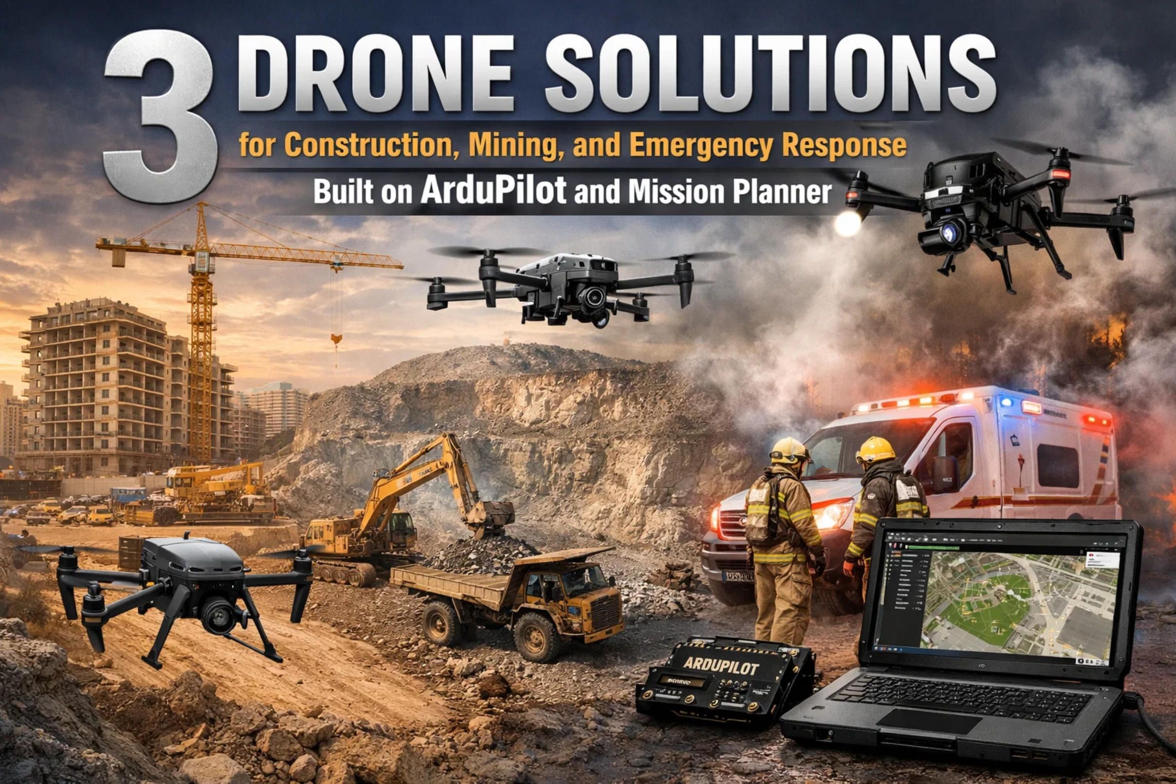
3 Drone Solutions for Construction, Mining, and Emergency Response Built on ArduPilot and Mission Planner
A general contractor on a USD 40 million highway interchange project discovers that the earthworks subcontractor has over-excavated a retention basin by 3,200 cubic yards. The discovery comes from a quarterly survey — three months after the material was hauled away. The change-order dispute that follows costs more than the drone system that would have caught the error on the day it happened. A quarry operator in Ohio reconciles year-end inventory against production records and finds a 10,000-ton discrepancy — roughly USD 65,000 in unaccounted aggregate. The write-off lands on the balance sheet because stockpile volumes were estimated by eye rather than measured by instrument. A search-and-rescue team in Utah spends 10 hours on horseback searching a mountain canyon for a missing hiker, only to locate the person within 30 minutes once a thermal-equipped drone is finally deployed.
These scenarios repeat across construction sites, mining operations, and emergency response agencies worldwide. The common thread is that better aerial data — captured more frequently, processed faster, and delivered in formats that integrate with existing workflows — would have changed the outcome. Drones built on the ArduPilot and Mission Planner ecosystem provide exactly that capability: repeatable, automated, survey-grade data collection at a fraction of the cost and risk of traditional methods.
A-Bots.com, a full-cycle custom software development company with offices in the USA, Ukraine, and Romania, has built its drone software practice on this ecosystem. With more than 70 completed projects — from the Shark Clean IoT application to the Scandpay mobile payment platform — A-Bots.com applies the same rigorous engineering standards to drone firmware extensions, companion computer pipelines, and cloud analytics dashboards. The company develops custom ArduPilot modules and Mission Planner plug-ins that bridge the gap between raw aerial data and actionable project intelligence.
This is the final installment of a three-part series. Part one covered agriculture: vineyard monitoring, broadacre variable-rate mapping, and livestock tracking. Part two addressed energy and infrastructure: solar farm thermal inspection, power line LiDAR corridor mapping, and pipeline methane surveillance. Here we close with construction, mining, and search-and-rescue — three domains where the commercial drone market is growing fastest. According to Grand View Research, the global commercial drone market was valued at USD 30.02 billion in 2024 and is projected to reach USD 54.64 billion by 2030, with construction and mining among the sectors driving adoption.
Case 7: Construction Site Progress Monitoring and Earthworks Verification
The Problem
Construction projects are dynamic environments where the physical state of the site changes daily — excavation advances, formwork goes up, concrete is poured, steel is erected, and utilities are trenched. Yet the documentation of this progress typically lags behind reality by days or weeks. Project managers rely on superintendent walk-throughs, phone photos, and monthly surveyor visits to understand what has been built, how much material has been moved, and whether the work conforms to design specifications.
The consequences of this documentation gap are tangible. Cut-and-fill disputes between earthworks subcontractors and general contractors are among the most common sources of change orders in civil construction. Without frequent volumetric data, over-excavation goes undetected, material quantities are disputed, and schedule slippage becomes visible only when it is too late to recover. Skanska, one of the world's largest construction companies, maintains a fleet of over 50 drones and 70 trained pilots because the firm recognized that weekly aerial data eliminates these blind spots.
Photogrammetry — the science of converting overlapping aerial photographs into georeferenced 3D models — delivers construction deliverables that traditional methods cannot match at comparable cost: orthomosaics with sub-centimeter ground sample distance (GSD), digital surface models (DSM) for volumetric calculations with accuracy exceeding 98 percent, and dense point clouds exportable as LAS/LAZ files for direct overlay on CAD and BIM models.
Hardware Architecture
Construction site mapping favors multirotor platforms for their ability to hover, capture imagery from multiple angles, and operate within confined airspace above active job sites.
The primary platform is a quadcopter or hexacopter running ArduCopter firmware on a Cube Orange+ or Holybro Pixhawk 6X flight controller. A Holybro X500 V2 or X650 frame supports the necessary payload: a high-resolution RGB camera (Sony A6100, 24 MP APS-C sensor, or Sony RX1R II, 42 MP full-frame), RTK GPS module (CubePilot Here3+ or Holybro H-RTK F9P), and optional LiDAR for penetrating vegetation on site perimeters.
RTK GPS is essential for construction surveying. Without centimeter-level accuracy, the photogrammetric output cannot be overlaid on CAD drawings with confidence. ArduPilot's EKF3 fuses RTK corrections with IMU and barometric data to produce georeferenced camera trigger positions accurate to within 2 centimeters. For sites where cellular RTK (NTRIP) corrections are unavailable, a PPK workflow uses base-station logs processed post-flight through Emlid Studio or similar software.
For larger civil construction sites — highway corridors, dam projects, airport expansions — a fixed-wing VTOL (Event 38 E400 or MakeFlyEasy Fighter VTOL) provides the coverage needed to survey kilometers of linear infrastructure in a single flight while maintaining the photogrammetric overlap required for accurate 3D reconstruction.
Mission Planning in Detail
In Mission Planner, the operator draws a survey polygon around the active construction zone and selects Auto WP → Survey (Grid). For photogrammetric reconstruction, the camera configuration dialog accepts the sensor dimensions, focal length, and image resolution. Forward overlap is set to 80 percent and side overlap to 70 percent — higher than the minimum 60/40 because construction sites contain repetitive textures (bare earth, gravel, concrete) that challenge photogrammetric feature matching at lower overlap levels.
Flight altitude is typically 60 to 90 feet (18 to 27 meters) AGL for mid-rise building sites, yielding 0.5 to 1.0 cm GSD with a 24 MP camera — fine enough to resolve rebar patterns, anchor bolt positions, and slab edges. For large civil sites, altitude increases to 60 meters AGL to balance coverage and file size while maintaining approximately 2 cm GSD.
ArduPilot's geofence (FENCE_ENABLE = 1) is configured with an inclusion polygon matching the project boundary, preventing the aircraft from overflying adjacent properties or active roadways. The altitude ceiling is set to comply with FAA Part 107's 400-foot AGL limit or site-specific restrictions.
For weekly monitoring missions, the waypoint file is saved as a template and reloaded each flight. Because the aircraft returns to identical waypoints at identical altitudes, the resulting orthomosaics are directly comparable across dates — a requirement for reliable change detection and volumetric delta calculations.
What A-Bots.com Custom-Develops
BIM Overlay Engine. A-Bots.com builds a processing pipeline that ingests the photogrammetric point cloud (LAS format), registers it to the project coordinate system using RTK ground control points or known survey monuments, and overlays it on the BIM model (IFC or Revit export). The overlay highlights dimensional variances — where the as-built deviates from the as-designed — color-coded by magnitude. A 5-centimeter deviation in a foundation wall is yellow; a 15-centimeter deviation triggers a red alert and an automatic notification to the project engineer.
Automated Cut/Fill Volumetrics Module. Each weekly flight generates a DSM. A-Bots.com's Django-based platform computes the volumetric difference between the current DSM and the previous flight's DSM, producing a cut/fill heat map and a net volume report in cubic yards or cubic meters. The report is formatted for direct import into the project's cost-tracking system (Procore, Oracle Primavera, or Microsoft Project), linking earthworks quantities to schedule activities and budget line items.
Progress Timeline Dashboard. All orthomosaics, DSMs, and point clouds are organized chronologically on a web-based platform. Stakeholders — the owner, architect, general contractor, and subcontractors — log in via browser, select any two dates, and view a side-by-side comparison or animated time-lapse of site evolution. Annotations, measurements, and comments are geolocated on the map, creating a documented record of decisions and observations tied to specific locations and dates.
Mission Planner Auto-Schedule Plug-in. For contractors flying weekly, A-Bots.com develops a plug-in that loads the saved survey template, checks weather conditions via API (wind speed, cloud cover, precipitation probability), and presents the operator with a go/no-go recommendation. On "go" days, the plug-in pre-loads the mission to the autopilot and configures the camera trigger distance based on the current wind conditions (adjusting cruise speed to maintain consistent overlap in windy conditions).
Measurable Outcomes
Construction firms using weekly drone surveys report a 60 percent reduction in surveying man-hours compared to traditional methods. Volumetric accuracy exceeding 98 percent eliminates the cut-fill disputes that typically generate USD 50,000 to 200,000 in change orders per project. Real-time BIM overlay catches design conformance issues within days rather than months, avoiding rework costs that average 5 to 9 percent of total project value on large commercial builds. For a USD 40 million project, avoiding even 1 percent in rework saves USD 400,000 — a return that dwarfs the annual cost of a drone program.
Case 8: Mining and Quarry Volumetric Surveys and Pit Progression Tracking
The Problem
Open-pit mines and quarries are dynamic three-dimensional environments where the geometry of the site changes with every blast cycle, every haul truck load, and every stockpile delivery. Accurate volumetric measurement of stockpiles, pit progression, bench geometry, and overburden removal is critical for financial reporting, regulatory compliance (NI 43-101 in Canada, JORC in Australia, SEC S-K 1300 in the US), and operational planning.
Traditional stockpile measurement requires a surveyor to physically climb the stockpile with a GPS receiver in a backpack — an occupational health and safety risk on loose aggregate with steep slopes. Laser scanners (terrestrial LiDAR) must be repositioned multiple times around the stockpile and require the area to be clear of equipment during scanning. Both methods interrupt production: a surveyor on a stockpile means no loader is working that pile. For operations where shutdown costs exceed USD 10,000 per hour, the survey itself becomes the bottleneck.
Drone surveys eliminate all of these constraints. A 20-acre stockpile yard can be surveyed in 12 to 15 minutes with a multirotor, producing a complete volumetric report within one hour of landing. BHP measures areas of 1.2 km by 1 km weekly, delivering reports from takeoff to final numbers in under one hour. Independent tests report ±2 to 3 percent variance versus total-station benchmarks when RTK/PPK photogrammetry is paired with 5 to 8 ground control points. Event 38 documented a 60 percent reduction in man-hours at a quarry deployment — crew time fell from 40 to 16 hours per month.
Hardware Architecture
Mining sites demand rugged platforms that tolerate dust, vibration, and wind. A hexacopter built on a Tarot T960 or EFT E616 frame with a Cube Orange+ flight controller provides the motor redundancy and payload capacity needed for dual-sensor operations (RGB + LiDAR).
For photogrammetry-only stockpile measurement on clean aggregate surfaces, a high-resolution RGB camera (Sony A6100 or Sony RX1R II) with RTK GPS delivers sub-centimeter GSD and ±2 to 3 percent volumetric accuracy. For deep pit walls with shadow zones, near-vertical blast faces, and dusty conditions where photogrammetric feature matching fails, LiDAR is essential. The LightWare SF45/B (solid-state, lightweight, affordable) provides low-density point clouds sufficient for stockpile volume, while the YellowScan Mapper or Phoenix LiDAR Recon-XT (1.5 to 1.8 kg, 240 kHz pulse rate, 2 to 5 cm vertical accuracy) delivers survey-grade data for pit progression and bench geometry analysis.
For large open-pit operations spanning hundreds of hectares, a fixed-wing VTOL (Event 38 E400 or MakeFlyEasy Fighter VTOL) covers the entire site — active pit, stockpile areas, overburden dumps, haul roads, and processing facilities — in a single flight of 60 to 90 minutes.
RTK GPS is non-negotiable for mining volumetrics. A CubePilot Here3+ or Holybro H-RTK F9P paired with a base station or NTRIP service provides centimeter-level positioning. ArduPilot logs the RTK fix status in the mission log, and A-Bots.com's processing pipeline rejects any imagery captured during RTK float (degraded accuracy) conditions.
Mission Planning in Detail
The mine surveyor defines stockpile polygons and pit boundaries in Mission Planner, importing KML or shapefile boundaries from the mine's GIS system. Each stockpile receives its own survey polygon, flown at 30 to 40 meters AGL with 80/70 percent overlap for photogrammetry. The pit itself is flown at 60 to 80 meters AGL (higher to maintain safe clearance above bench crests and highwalls).
ArduPilot's terrain-following mode is critical for pit surveys. The pit floor may be 50 to 100 meters below the surrounding terrain. Without terrain following, a fixed-altitude mission would place the drone dangerously close to the highwall crest while flying far above the pit floor. Setting waypoints with terrain-relative altitude (using SRTM data or custom DEM tiles uploaded to the SD card) ensures the aircraft maintains consistent AGL throughout the survey, producing uniform GSD across the entire pit.
For LiDAR flights, the sensor operates continuously (no DO_SET_CAM_TRIGG_DIST needed). The mission flight speed is calibrated to the LiDAR's pulse rate and desired point density. At 240 kHz and 5 m/s cruise speed at 40 m AGL, the YellowScan Mapper produces approximately 15 to 20 points per square meter — sufficient for stockpile volume calculation and bench geometry extraction.
What A-Bots.com Custom-Develops
Automated Stockpile Volume Calculator. A-Bots.com builds a Python-based processing pipeline that ingests the photogrammetric DSM or LiDAR point cloud, automatically delineates the stockpile toe (base boundary) using slope-change detection algorithms, computes the volume above the base plane, and multiplies by the material's bulk density (configurable per stockpile type: crusite limestone at 1.52 t/m³, ROM iron ore at 2.1 t/m³, coal at 0.83 t/m³). The output is a tonnage report with GPS-referenced stockpile boundaries, exportable as CSV for ERP import (SAP, Oracle) or DXF for mine planning software (Deswik, Vulcan, Surpac).
Pit Progression Tracker. Each survey adds a new DSM to the historical database. A-Bots.com's platform computes the difference between consecutive surveys, generating a volumetric delta map showing where material was extracted (cut) and where waste was dumped (fill). Cumulative extraction volumes are tracked against the mine plan, alerting managers when actual extraction deviates from planned sequence by more than a configurable threshold.
Slope Stability Monitoring Module. Using LiDAR point clouds from successive surveys, A-Bots.com computes displacement vectors for each point on the pit wall. Movement greater than 5 centimeters between surveys triggers an alert, identifying potential slope instability zones before they develop into rockfalls or landslides. The system overlays displacement data on a 3D pit model, allowing geotechnical engineers to visualize deformation patterns and prioritize remediation.
Haul Road Condition Analyzer. Drone RGB and LiDAR data capture the surface condition of haul roads — rutting depth, cross-slope, drainage gullies, and material loss. A-Bots.com's pipeline generates a condition index for each road segment, identifying areas requiring grading or resurfacing. Poor haul road condition is a direct driver of tire wear, fuel consumption, and cycle time; maintaining roads in optimal condition based on drone data can reduce haulage operating costs by 10 to 15 percent.
Measurable Outcomes
A quarry processing 500,000 tons of aggregate annually that eliminates the typical 2 percent inventory discrepancy through weekly drone surveys recovers USD 50,000 to 70,000 per year in previously unaccounted material. The 60 percent reduction in survey man-hours (from 40 to 16 hours per month) saves an additional USD 15,000 to 20,000 annually in labor. For large open-pit mines, slope stability monitoring alone justifies the investment — a single detected instability event that prevents a wall failure can avoid USD 1 million to 10 million in cleanup costs, production delays, and safety incidents. The total investment in a drone system, sensors, and A-Bots.com's annual software platform is typically recovered within the first quarter of operation.
Case 9: Search-and-Rescue Operations with Thermal Imaging and Rapid Area Coverage
The Problem
When a person goes missing in wilderness terrain, the probability of survival decreases sharply with time. In cold environments, hypothermia can become fatal within 3 to 6 hours. In a post-disaster scenario — earthquake, flood, wildfire — the "golden hour" principle means that every minute of delay in locating a victim reduces the chance of survival. Yet traditional search methods — ground teams on foot, dog units, manned helicopter overflights — are slow, expensive, and limited by terrain and visibility.
A ground search team can cover approximately 1 to 2 square kilometers per hour in moderate terrain. A manned helicopter with a thermal camera covers more area but costs USD 1,500 to 3,000 per hour and cannot fly in the marginal weather conditions (low cloud, gusty wind, limited visibility) that often accompany the emergencies that create missing persons in the first place. Furthermore, helicopter rotor wash can disturb debris fields in disaster zones, potentially endangering trapped survivors.
Drones fill the gap between ground teams and manned aircraft. A thermal-equipped drone covers 5 to 15 square kilometers per hour at a fraction of the cost, deploys within minutes rather than the hours required to mobilize a helicopter, and operates safely in wind conditions up to 12 m/s. Utah State University Extension documented a case where a thermal drone located a cow-calf pair in Huntington Canyon in under 30 minutes, covering approximately 600 acres — a search that would have taken ground crews an entire day. The same principle applies to finding missing humans, with the added urgency that every minute counts.
Hardware Architecture
SAR missions require rapid deployment, reliable thermal imaging, and extended flight time. The platform must be portable enough for a single responder to carry to the launch point, rugged enough to operate in adverse weather, and capable of transmitting live video to a command post for real-time decision-making.
Primary Search Platform (Multirotor). A hexacopter on a Tarot T810 or EFT E610 frame with a Cube Orange+ flight controller provides 25 to 35 minutes of flight time with a thermal payload. The hexacopter configuration provides motor redundancy critical in mountain terrain where a motor failure over a cliff face would be catastrophic. The thermal sensor is a FLIR Boson 640 (640 × 512, 9 mm or 13 mm lens) mounted on a 2-axis stabilized gimbal. The Boson's thermal sensitivity of less than 40 mK (millikelvin) detects the body heat of a human at distances up to 300 to 500 meters in cold ambient conditions.
For extended search missions, the Freefly Astro (40-minute flight time, LTE connectivity, onboard mission computer) or the Inspired Flight IF800 Tomcat (foldable, NDAA-compliant, interchangeable payloads) provide longer endurance and superior telemetry range.
Wide-Area Search Platform (Fixed-Wing VTOL). For large-scale disaster response covering tens of square kilometers, a fixed-wing VTOL (Event 38 E400 with EO/IR gimbal, or MakeFlyEasy Fighter VTOL with thermal payload) provides 90 to 150 minutes of endurance, scanning a grid pattern at 60 to 80 meters AGL. The fixed-wing VTOL covers ground 5 to 10 times faster than a multirotor, making the initial wide-area sweep dramatically more efficient.
Telemetry and Communication. The RFD900x provides MAVLink telemetry at 40+ km range. For command-post operations, an LTE/4G modem streams live thermal video to a remote operations center where analysts review the feed on large screens, supplementing the pilot's on-site awareness with additional eyes.
ArduPilot's GCS failsafe (FS_GCS_ENABLE = 1) triggers Return-to-Launch on telemetry loss. The DO_SET_ROI command allows the pilot to lock the gimbal on a suspected target while orbiting at a safe distance.
Mission Planning in Detail
The SAR commander defines the search area based on the last known position (LKP) of the missing person and the projected search area calculated from terrain, weather, and the subject's mobility profile. This area is imported into Mission Planner as a KML polygon.
The search is executed in a systematic grid pattern using Mission Planner's Survey (Grid) tool. For thermal search, strip spacing is wider than for photogrammetry — a 30 to 40 percent side overlap is sufficient because the objective is detection rather than reconstruction. At 60 m AGL with a FLIR Boson 640 (9 mm lens, 50-degree HFOV), each thermal frame covers approximately 57 meters of swath width. With 30 percent overlap, strip spacing is approximately 40 meters, enabling rapid coverage.
The "Hover and Capture" option is disabled for SAR missions — the drone flies continuously at 4 to 6 m/s while the thermal camera records video rather than still frames. This allows the onboard AI or ground-station analyst to detect moving heat signatures in real time. The thermal video is streamed via MAVLink video channel or LTE connection to the command post.
ArduPilot's terrain-following is essential for mountain SAR. The search area may span 500 meters of elevation change. Without terrain following, a fixed-altitude mission would fly dangerously close to ridge crests while being too high above valley floors to detect a person's thermal signature. SRTM terrain data (loaded on the SD card or streamed from Mission Planner) ensures the aircraft maintains 60 m AGL throughout the search pattern.
What A-Bots.com Custom-Develops
Real-Time Human Detection Module. A-Bots.com trains a YOLOv8 detection model on a dataset of thermal imagery containing humans in diverse wilderness environments — standing, sitting, lying down, partially obscured by vegetation, and in various ambient temperature conditions. The model runs on an NVIDIA Jetson Orin Nano companion computer, processing the thermal video stream at 15 to 30 frames per second. When a human-shaped thermal signature is detected with confidence above 85 percent, the system captures a GPS-stamped screenshot and transmits an alert to the ground station with coordinates, confidence score, and a thermal thumbnail. The pilot or SAR commander can then direct the drone to orbit the target for visual confirmation.
Search Grid Optimization Engine. Rather than flying a uniform grid, A-Bots.com develops a probability-weighted search planner. The SAR commander inputs the LKP, terrain data, weather conditions, and subject profile (age, physical condition, likely direction of travel). The engine generates a prioritized search grid using Bayesian probability models — high-probability areas are searched first, optimizing the chance of early detection. The grid is output as a standard Mission Planner waypoint file.
Multi-Drone Coordination Module. In large-scale disasters, multiple drones operate simultaneously. A-Bots.com's platform divides the search area into sectors, assigns each drone a non-overlapping sector, tracks coverage in real time on a shared dashboard, and reassigns sectors dynamically as areas are cleared. De-confliction rules ensure minimum separation between aircraft (configurable, typically 200 meters horizontal and 30 meters vertical). The system uses ArduPilot's ADSB_TYPE parameter to exchange position data between aircraft if ADS-B transponders are installed.
Post-Mission Thermal Mosaic Analyzer. After the search flight, the recorded thermal video is geotagged and processed into a thermal orthomosaic. A-Bots.com's software applies the same YOLOv8 model to every frame post-flight, catching detections that were below the real-time confidence threshold. The analyst can then review flagged frames at leisure, zooming into marginal detections that merit a follow-up flight or ground team dispatch.
Measurable Outcomes
Drone deployment in SAR reduces search time by 60 to 80 percent compared to ground teams alone. A thermal drone covering 600 acres in 30 minutes replaces a full day of horseback searching. The cost per search hour drops from USD 1,500 to 3,000 (manned helicopter) to USD 100 to 300 (drone operation including pilot, equipment amortization, and processing). More critically, the time saved translates directly into lives: a person located 2 hours earlier in a hypothermia scenario has a significantly higher survival probability. For public safety agencies, the investment in a drone program — typically USD 15,000 to 40,000 for hardware and A-Bots.com's custom software — is justified by a single successful rescue that would otherwise have required a multi-day ground operation or helicopter mobilization.
The ArduPilot Ecosystem: A Common Foundation for Diverse Missions
Across all nine cases in this three-part series — from vineyard NDVI mapping to quarry volumetrics to wilderness SAR — ArduPilot and Mission Planner provide the consistent, extensible, vendor-neutral foundation that makes custom drone solutions economically viable.
ArduPilot's open architecture means that A-Bots.com can add a Lua script for adaptive terrain following in a vineyard, a custom MAVLink message for real-time methane alerts over a pipeline, and a companion computer pipeline for thermal human detection in a SAR mission — all without forking the core firmware, all maintaining compatibility with upstream security patches, and all deployable on hardware ranging from a USD 50 Pixhawk 6C Mini to a USD 500 Cube Orange+.
Mission Planner's survey grid generator, terrain data engine, geofence framework, rally point system, and camera trigger calculator eliminate the need for expensive third-party mission planning software. And because the entire ecosystem is open-source, A-Bots.com's clients own their toolchain — no vendor lock-in, no subscription fees for flight operations, no dependency on a single manufacturer's product roadmap.
If your drone stopped flying tomorrow, would your software still work with a different airframe? On ArduPilot, the answer is always yes. That portability is not a technical footnote — it is a business advantage that protects your investment for years to come.
Ready to Build Your Solution?
This three-part series has demonstrated nine real-world drone use cases across agriculture, energy, construction, mining, and emergency response. Each case shares a common architecture: ArduPilot firmware running on Pixhawk-class hardware, Mission Planner handling flight operations, and A-Bots.com's custom software bridging the gap between raw aerial data and actionable decisions.
Whether you need a vineyard health monitoring system, a solar farm inspection platform, a pipeline surveillance network, a construction progress tracker, a mining volumetric dashboard, or a SAR thermal detection system — A-Bots.com has the engineering depth to deliver. The company's team works with your operations staff to define requirements, select hardware, develop custom firmware and software, validate through SITL and HITL testing, and support field deployment.
Contact A-Bots.com at info@a-bots.com or through Telegram at @Alphabots_support to start the conversation. Your drones should work as hard as you do — and the software should make them smarter every flight.
Here is the list of ArduPilot-compatible drone models
Case 7 — Construction Site Progress Monitoring (Multirotor + Fixed-Wing VTOL)
These missions require high-resolution photogrammetry with RTK/PPK accuracy, repeatable weekly flights over identical waypoints, and compatibility with BIM/CAD overlay workflows.
Multirotor (Site Mapping and Progress Tracking):
-
Holybro X500 V2 — carbon fiber quadcopter, Pixhawk 6C/6X compatible, ~18 min flight time. Carries Sony A6100 (24 MP) or equivalent RGB camera plus RTK GPS module. Suitable for sites up to 10–15 acres per sortie. Frame kit ~USD 500.
-
Holybro X650 — larger foldable frame, 20 mm carbon fiber arms. Supports heavier dual-payload configurations (RGB camera + LiDAR for vegetated perimeters). Extended endurance with 6S batteries. Ideal for medium-scale commercial building sites.
-
Tarot T960 — foldable hexacopter, 960 mm wheelbase, 25–30 min flight time. Motor redundancy protects high-value camera payloads (Sony RX1R II, 42 MP full-frame). Popular among ArduPilot survey integrators for custom photogrammetry builds.
-
Tarot T810 — hexacopter, 810 mm wheelbase. Compact transport profile for urban construction sites with limited staging areas.
-
EFT E610 / E616 — hexacopter frame, max takeoff weight 16–25 kg. Supports dual-sensor operations (RGB + LiDAR simultaneously). Cube Orange+ with vibration-isolated mounting. Suitable for large civil projects where payload flexibility matters.
-
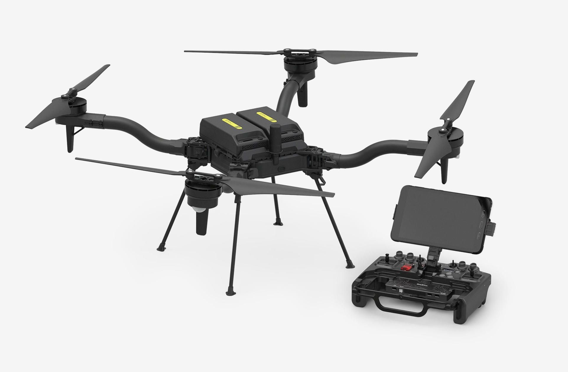
Freefly Astro — commercial-grade quadcopter, Pixhawk-based, RTK built-in, 61 MP Sony ILX-LR1 camera option, ~40 min flight time, LTE cloud connectivity. Pre-integrated mission computer supports onboard processing. Price ~USD 15,000+. Turnkey solution for general contractors scaling a drone program without custom airframe assembly.
-
Inspired Flight IF800 Tomcat — foldable, NDAA-compliant. Designed for infrastructure inspection and mapping with swappable payload bays. Suitable for government-funded construction projects (DOT, DOD) requiring domestic supply chain compliance.
-
Holybro S500 V2 — compact quadcopter, budget entry point for small residential or commercial builders running their first drone survey program. Carries single RGB camera with RTK GPS. Frame kit ~USD 300.
Fixed-Wing VTOL (Highway Corridors, Dam Projects, Airport Expansions):
-
Event 38 E400 — carbon fiber fixed-wing VTOL, 90 min endurance, 1.36 kg payload. Covers 2–5 km of linear infrastructure per sortie at 120 m AGL with photogrammetric overlap. NDAA-compliant, made in USA. Starting price ~USD 18,900.
-
Event 38 E455 — heavy-lift VTOL, supports dual-sensor payloads (RGB + LiDAR) for large civil earthworks projects. 2.5 hour endurance. Used by US Army and national laboratories.
-
MakeFlyEasy Fighter VTOL — 2430 mm wingspan, 120–134 min endurance, 1.5 kg payload, 19 m/s cruise. Covers hundreds of hectares per flight. Tool-less disassembly for truck-bed transport between project sites. PNP kit ~USD 1,500–2,000.
-
MakeFlyEasy Freeman 2300 — 2300 mm wingspan VTOL, ~90 min endurance with 600 g payload. Suitable for highway and rail corridor mapping where lightweight RGB cameras are sufficient.
-
MakeFlyEasy Hero 2180 — 2180 mm wingspan VTOL, ~136 min endurance. Operational altitude up to 5000 m for high-elevation dam and infrastructure projects in mountain regions.
-
Holybro Swan-K1 — ArduPilot-native VTOL, integrated Pixhawk, minimal assembly. Quick deployment for contractors who need fixed-wing coverage without custom airframe builds.
-
DRONEE Mapping Plane — simple ArduPlane-based fixed-wing, hand-launch capable. Budget option for small civil contractors who do not need VTOL functionality and have runway or open-field access.
-
MotoDoro Farm Mapper — fixed-wing for photogrammetric mapping, ArduPlane firmware. Lowest-cost option for contractors adding aerial survey to an existing earthworks operation.
Case 8 — Mining and Quarry Volumetric Surveys (Multirotor + Fixed-Wing VTOL)
Mining missions demand rugged platforms tolerant of dust and vibration, RTK/PPK GPS for survey-grade accuracy, and LiDAR capability for deep pit walls and shaded stockpiles.
Multirotor (Stockpile and Pit Mapping):
-
Tarot T960 — hexacopter, 960 mm wheelbase, carbon fiber foldable arms. The go-to frame for mining survey builds. Motor redundancy critical when flying over active pits and unstable highwalls. Supports RGB + LiDAR dual payloads (total 2–3 kg). 25–30 min flight time on 6S batteries.
-
EFT E616 — heavy hexacopter frame, max takeoff weight up to 25 kg. Supports YellowScan Mapper (1.5 kg) or Phoenix LiDAR Recon-XT (1.8 kg) plus RGB camera. Cube Orange+ with vibration damping essential in high-dust environments.
-
EFT E610 — slightly lighter variant, suitable for photogrammetry-only stockpile operations where LiDAR is not required. Carries Sony A6100 + RTK GPS with comfortable endurance margin.
-
Holybro X650 — foldable arms for transport between pit and stockpile survey locations. Adequate payload for compact LiDAR sensors (LightWare SF45/B) or single RGB camera.
-
Holybro X500 V2 — quadcopter for smaller quarry operations. Carries RGB camera with RTK for weekly stockpile volume measurement on sites under 20 acres. Budget-friendly entry point.
-
Freefly Astro — RTK built-in, 40 min flight time, 61 MP camera option. LTE connectivity streams live video to mine control room. Suitable for large mining companies requiring turnkey deployment with minimal integration effort.
-
Inspired Flight IF800 Tomcat — NDAA-compliant, foldable. Suitable for mining operations on federal land or under government contract where supply chain compliance is mandatory.
-
ACSL SOTEN — compact, NDAA-compliant, IP43 rated. Swappable payload system. Suitable for mines in regulated jurisdictions (US, Australia, Japan) where data security and hardware provenance requirements apply.
Fixed-Wing VTOL (Large Open-Pit and Multi-Site Operations):
-
Event 38 E400 — 90 min endurance covers entire open-pit sites (pit + stockpiles + overburden dumps + haul roads) in a single sortie. Carbon fiber airframe survives the dust and rough handling typical of mine environments. Event 38 documented 60% man-hour reduction at a quarry deployment.
-
Event 38 E455 — heavy-lift variant for dual LiDAR + RGB payloads. Suitable for deep open-pit mines (copper, gold, iron ore) where both photogrammetry and LiDAR data are required for bench geometry and slope stability analysis.
-
MakeFlyEasy Fighter VTOL — 120+ min endurance, 1.5 kg payload. Covers multi-site quarry operations (e.g., three adjacent pits) in a single flight. Tool-less disassembly fits in mine vehicle for transport between sites.
-
MakeFlyEasy Freeman 2300 — 90 min endurance with 600 g payload. Suitable for monthly site-wide photogrammetric surveys of medium-scale quarries (50–200 acres).
-
Raefly VT290 — VTOL fixed-wing, ArduPilot-compatible. Extended endurance for large-area mine mapping where maximum coverage per battery is the priority.
-
Raefly VT370 Hybrid — gas-electric hybrid for ultra-long-endurance mining surveys. Suitable for remote mine sites in Australia, Canada, or Africa where multi-hundred-hectare coverage is required without intermediate landing logistics.
Case 9 — Search-and-Rescue Operations (Multirotor + Fixed-Wing VTOL)
SAR missions require rapid deployment, reliable thermal imaging in adverse weather, extended flight time, and live video streaming to command posts.
Multirotor (Primary Search and Close Inspection):
-
Tarot T810 — hexacopter, 810 mm wheelbase. Compact and portable for carry-in deployment to remote trailheads or disaster staging areas. Motor redundancy for mountain terrain where motor failure over a cliff is not survivable. Carries FLIR Boson 640 thermal on 2-axis gimbal. 25–30 min flight time.
-
EFT E610 — hexacopter, larger payload capacity for dual thermal + RGB or thermal + spotlight configurations. Suitable for night SAR where illumination is needed after thermal detection.
-
Tarot T960 — largest hexacopter option, 30+ min endurance. Carries heavier EO/IR gimbals with optical zoom + thermal in a single housing. Provides the longest multirotor endurance for extended search patterns.
-
Holybro X500 V2 — quadcopter, compact and quick to deploy. Carries single FLIR Boson 640 thermal camera. Suitable for rapid initial deployment while larger platforms are being prepared. Budget-friendly backup aircraft.
-
Holybro X650 — foldable arms, larger than X500. Supports Jetson Orin Nano companion computer for onboard AI human detection alongside thermal camera. Good balance of portability and processing power.
-
Freefly Astro — 40 min flight time, LTE connectivity for live video streaming to remote command center. RTK positioning provides precise GPS coordinates of detected targets. Onboard mission computer supports real-time AI processing. Price ~USD 15,000+.
-
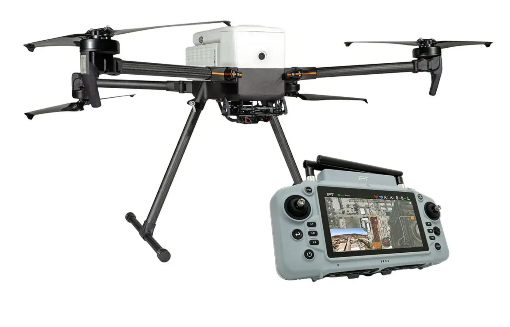
Inspired Flight IF800 Tomcat — NDAA-compliant, foldable, interchangeable payloads (thermal, zoom, spotlight, speaker, drop system). Designed specifically for public safety and infrastructure inspection. Suitable for fire departments and SAR teams under government procurement.
-
ACSL SOTEN — NDAA-compliant, 25 min flight time, IP43 rated. Swappable thermal/zoom/RGB payloads. Secure communications for law enforcement SAR operations where data security is required.
-
Holybro S500 V2 — smallest and lightest quadcopter option. Carried as a backup or secondary search platform in a responder's vehicle. Rapid launch for initial area assessment while primary platforms mobilize.
Fixed-Wing VTOL (Wide-Area Disaster Response and Extended Search):
-
Event 38 E400 — 90 min endurance with EO/IR gimbal (NextVision integration announced by Event 38). Carbon fiber airframe for rugged field deployment. Covers 20–40 square kilometers in a single search sortie at 60–80 m AGL. NDAA-compliant. Originally developed in partnership with Air Force Rapid Sustainment Office and Air National Guard for first-responder applications.
-
Event 38 E455 — heavy-lift VTOL, 2.5 hour endurance. Carries heavier EO/IR payloads with integrated laser rangefinder for precise target coordinate marking. Event 38 integrated CENTUM's Lifeseeker Mini S10 (cellular phone detection payload) on the E455 — enabling location of missing persons through their mobile phone signal even when the phone is not answered.
-
MakeFlyEasy Fighter VTOL — 120+ min endurance. Covers tens of square kilometers in systematic grid search. Thermal payload at 60–80 m AGL provides wide swath coverage for initial area sweep before multirotors are dispatched for close confirmation.
-
MakeFlyEasy Hero 2180 — 136 min endurance, operational altitude up to 5000 m. Suitable for mountain SAR operations at high elevation where thin air reduces battery performance on standard platforms. Wind resistance Class 5 for adverse weather operations.
-
MakeFlyEasy Striver Mini VTOL — smallest VTOL in the MakeFlyEasy lineup. Hand-portable for rapid deployment from a SAR vehicle. ~60 min endurance for localized search missions around a known last-seen point.
-
Raefly VT240 Pro — VTOL fixed-wing, ArduPilot-compatible. Compact transport for mobile SAR teams that deploy from helicopters or off-road vehicles to forward staging areas.
Flight Controllers Compatible Across All Construction, Mining, and SAR Cases
-
CubePilot Cube Orange+ — triple-redundant IMU, STM32H757, vibration-isolated. Recommended for all commercial and public safety operations where sensor redundancy is critical. The standard choice for mining and SAR where failure tolerance is non-negotiable.
-
Holybro Pixhawk 6X — FMUv6 standard, STM32H753, dual IMU. Professional-grade alternative at lower price point. Suitable for construction survey programs and quarry operations.
-
Holybro Pixhawk 6C — STM32H743, cost-effective. Suitable for development builds, backup aircraft, and lighter platforms (S500, X500).
-
Holybro Pixhawk 6C Mini — compact form factor for small fixed-wing airframes (Striver Mini, Hero 2180) and space-constrained multirotor builds.
-
CUAV Pixhawk V6X — industrial-grade, cube or flat form factor. Alternative supply chain option for operators diversifying hardware sourcing.
-
Matek H743-WING V3 — lightweight controller optimized for fixed-wing builds where weight savings directly translate to longer endurance.
All platforms run ArduPilot firmware (ArduCopter, ArduPlane, or QuadPlane) and integrate with Mission Planner for survey grid planning, terrain following, geofencing, rally point management, and camera/LiDAR trigger control via MAVLink and PWM interfaces.
✅ Hashtags
#DroneConstructionMonitoring
#MiningDroneSurvey
#SearchRescueDrone
#ArduPilotConstruction
#MissionPlannerMapping
#StockpileVolumetrics
#ThermalSARDrone
Other articles
App Controlled Outlet: Tapo P210M vs Eve Energy Outlet The app controlled outlet market is entering a new phase as in-wall smart outlets replace traditional receptacles in American homes. This article delivers a detailed head-to-head comparison of the two leading in-wall app controlled outlet products available in the United States — the TP-Link Tapo P210M and the Eve Energy Outlet. Evaluated through the lens of their companion mobile applications, the comparison covers energy monitoring, scheduling, privacy architecture, Matter integration, and setup experience. Market data from Consegic Business Intelligence and Mordor Intelligence frames the growth opportunity, while A-Bots.com demonstrates how expert IoT app development powers the next generation of connected home devices.
DJI Agras T100 vs Hylio AG-272: Best Heavy-Duty Ag Drones Agricultural drones have evolved from lightweight scouting tools into heavy-duty industrial platforms capable of spraying thousands of acres per week. This in-depth comparison examines two leading heavy-duty models — the DJI Agras T100 with its 100-liter spray tank and advanced LiDAR sensing, and the Hylio AG-272, a Texas-built workhorse offering fleet coordination of up to three drones from a single operator station. The article covers specifications, obstacle avoidance systems, regulatory considerations including NDAA compliance, alternative drone applications beyond spraying, and the critical role of custom software in maximizing drone ROI for modern farming operations.
DJI Agras T25P vs XAG V40: Best Drones for Vineyards Vineyards demand what broadacre farms do not: precision on steep slopes, targeted canopy penetration, and fungicide timing measured in hours. This comparison examines two compact agricultural drones built for exactly these conditions. The DJI Agras T25P brings Safety System 3.0, Orchard Mode with automated 3D flight routes, and terrain following on slopes up to 50 degrees. The XAG V40 counters with a unique twin-rotor design that delivers focused downdraft for superior spray penetration into dense vine canopies, IP67 waterproofing, and AI-powered mapping through its RealTerra system. The article covers real vineyard case studies from Germany, Italy, California, and New Zealand, plus the role of custom drone software in precision winemaking.
ArduPilot Drone Solutions for Agriculture Modern agriculture demands more than manual scouting and uniform input application. This article presents three detailed drone use cases built on the open-source ArduPilot firmware and Mission Planner ground station: multispectral vineyard health monitoring with MicaSense RedEdge-P sensors and terrain-following flight on sloped terrain, variable-rate prescription mapping for broadacre crops using VTOL platforms and RTK GPS, and autonomous livestock headcount verification with onboard AI detection running on NVIDIA Jetson companion computers. Each case specifies the hardware architecture, Mission Planner configuration, and custom software modules developed by A-Bots.com to bridge raw aerial data and actionable farm decisions.
Drone Solutions for Energy Infrastructure Energy infrastructure inspection is shifting from helicopter patrols and climbing crews to automated drone workflows. This article details three production-ready use cases built on ArduPilot firmware and Mission Planner: radiometric thermal inspection of utility-scale solar farms with IEC 62446-3 compliance and AI-powered defect classification, LiDAR-based power line corridor mapping with vegetation clearance analysis and digital twin generation, and BVLOS pipeline surveillance with onboard optical gas imaging and real-time methane leak alerting. Each case specifies hardware architecture, ArduPilot parameters, Mission Planner configuration, and custom software modules developed by A-Bots.com for seamless integration with existing CMMS and regulatory reporting systems.
Top stories
Copyright © Alpha Systems LTD All rights reserved.
Made with ❤️ by A-BOTS