Home
Services
About us
Blog
Contacts
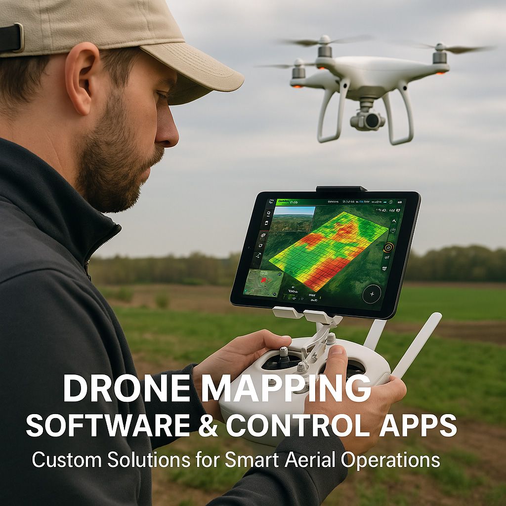
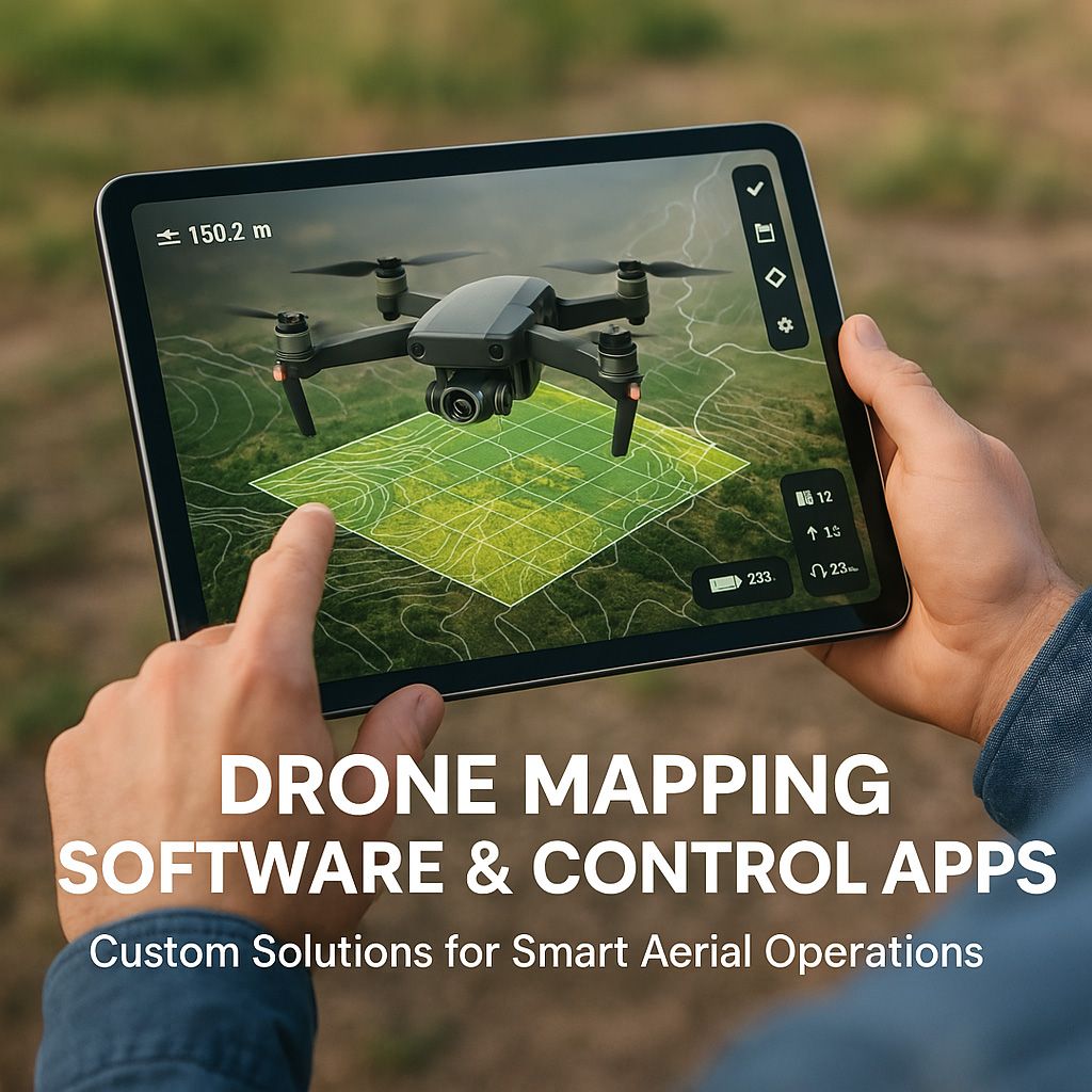
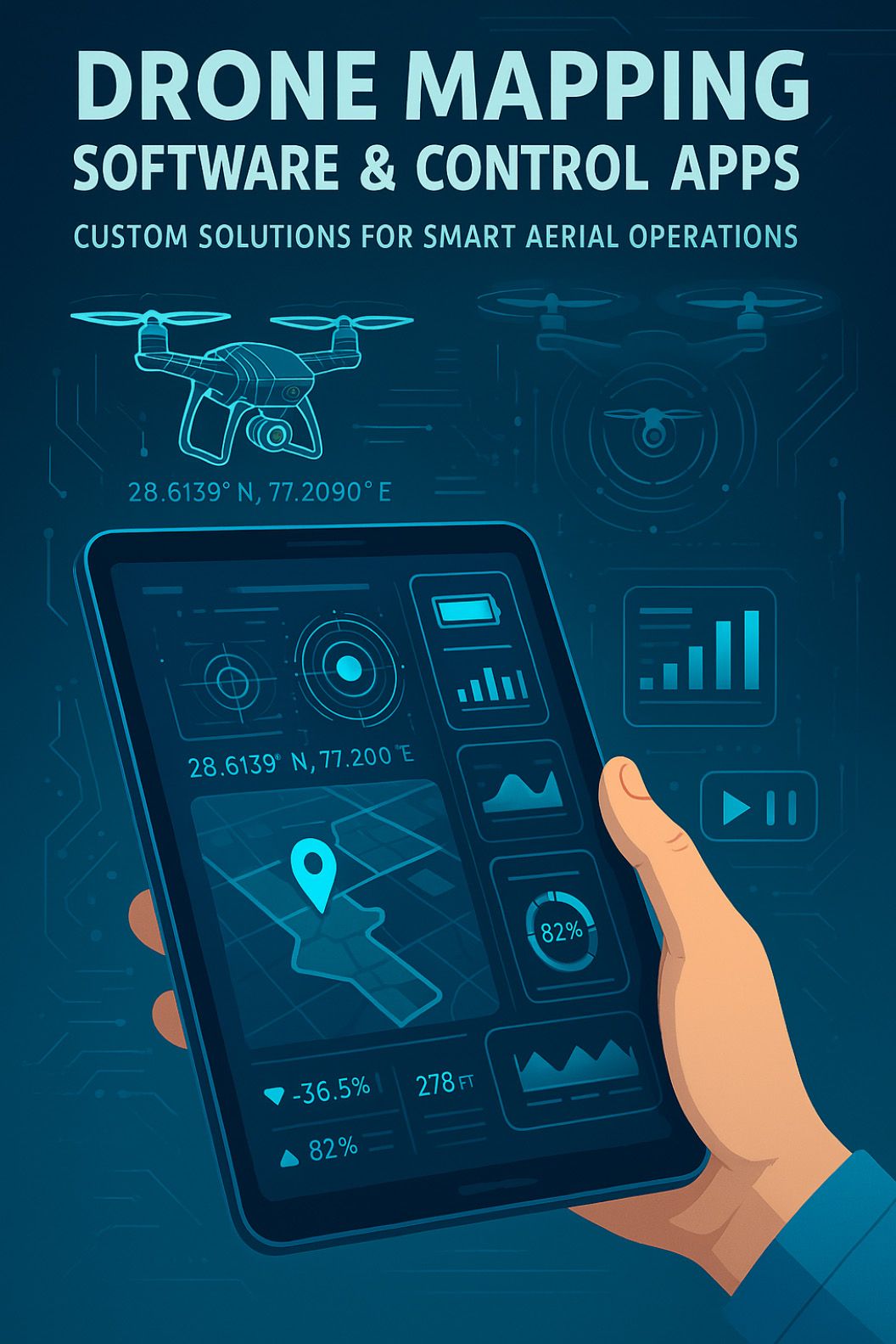
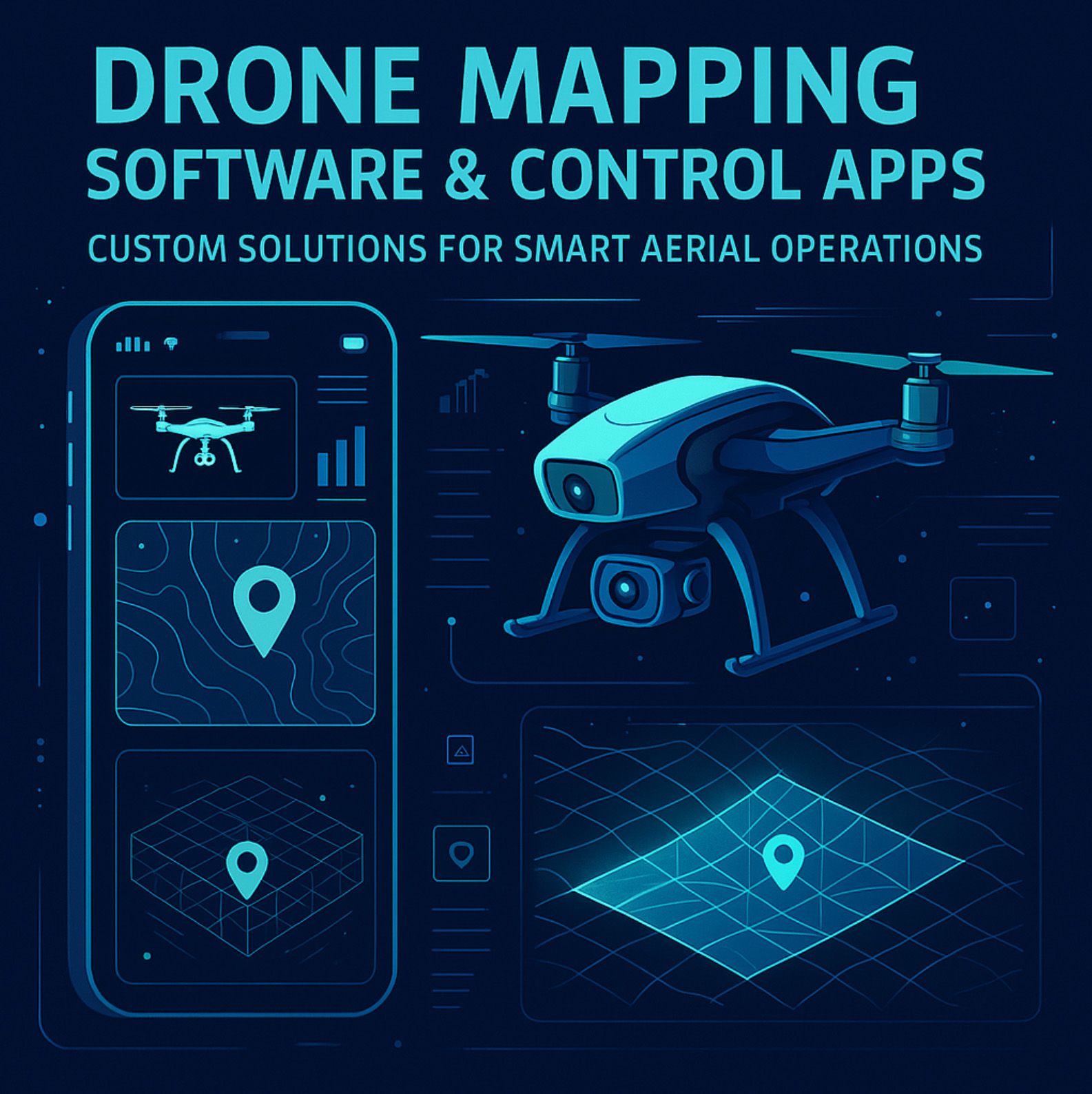
Drone Mapping Software & Control Apps: Custom Solutions for Smart Aerial Operations
1. Introduction: The Sky’s the Limit, But Only with the Right Software
2. What Is Drone Mapping and Control Software?
3. Use Cases: How Industries Use Drone Apps Today
- 3.1. Agriculture & Precision Farming
- 3.2. Construction & Land Development
- 3.3. Environmental Monitoring & Public Safety
- 3.4. Energy & Infrastructure
- 3.5. Real Estate, Mining, Insurance... and Beyond
4. Limitations of Off-the-Shelf Drone Software
5. Why Custom Drone Applications Make a Difference
6. How A-Bots.com Builds Custom Drone Mapping Software
- 6.1. Discovery: Understanding the Mission on the Ground
- 6.2. Design: Custom UI/UX for Real-World Use
- 6.3. Development: Modular, Scalable, Integrated
- 6.4. Testing & Validation: Field-Tested in Real Environments
- 6.5. Deployment & Support: From MVP to Mission-Critical
7. The Future of Drone Technology Is Modular, AI-Powered, and Custom
Need a Custom Drone App? A-Bots.com Can Build It.
1. Introduction: The Sky’s the Limit, But Only with the Right Software
The global rise of drones has changed the way we see the world—literally. Whether surveying agricultural fields in Kansas or scanning construction sites in California, unmanned aerial vehicles (UAVs) have become vital tools across industries. But there’s one factor that quietly determines just how effective these flying machines can be: software.
Today’s drones are no longer simply remote-controlled cameras. They are autonomous aerial data platforms, capable of executing complex missions, collecting geospatial data, processing analytics, and integrating with business ecosystems. This transformation isn’t driven by hardware alone—it’s driven by the intelligence embedded in their software systems.
The Software Gap
Despite the hardware boom—led by manufacturers like DJI, which commands over 70% of the global civilian drone market—there’s still a glaring software gap. While drones are technically capable of mapping, surveying, or monitoring, many operators are left struggling with fragmented or underpowered applications.
Off-the-shelf drone apps often provide generic controls or limited mapping functionality. For serious use cases—like precision farming, volumetric measurements, or automated flight scheduling—these platforms simply fall short. What’s needed is not just a better app, but a custom-built solution designed around the needs of each operation.
“Drones are as smart as the software that controls them. Without the right tools, you’re flying blind.”
— Anonymous drone pilot, AgTalk forum
The Rise of Drone Mapping and Control Software
According to Grand View Research, the global drone software market was valued at $5.45 billion in 2022 and is projected to grow at a CAGR of 18.6% through 2030. This growth is not just about more drones in the sky—it’s about smarter drones doing more valuable work.
One of the most promising sectors is drone-based mapping and surveying, which enables professionals to create 2D orthomosaic maps, 3D terrain models, elevation profiles, and geospatial overlays—all from a flying platform. Applications span across agriculture, real estate, infrastructure, energy, and environmental monitoring.
And yet, for many businesses, the real challenge isn't flying the drone—it's using the data effectively. That’s where custom drone software development comes into play.
Custom Solutions for Real-World Problems
Imagine a farmer who wants to monitor nitrogen levels across 500 acres using NDVI imagery—or a construction firm that needs volume calculations from drone-captured point clouds. These aren’t off-the-shelf problems, and they can’t be solved with off-the-shelf software.
That’s why companies like A-Bots.com are stepping in—not just to develop apps, but to craft intelligent aerial systems tailored to each client’s workflow, region, hardware, and goals.
Where This Article Goes Next
In the following sections, we’ll explore:
- What drone mapping and control software really is,
- How it’s being used in industries like agriculture, construction, and environmental science,
- Why generic apps often fail,
- What custom drone software unlocks,
- And how A-Bots.com is helping clients in the U.S., Europe, and beyond build the tools they need to elevate their aerial operations.
Because in today’s sky-high tech landscape, the right software isn’t optional—it’s mission critical.
2. What Is Drone Mapping and Control Software?
Modern drones are powerful machines—but it’s the software that turns them from flying cameras into intelligent data-gathering systems. At its core, drone mapping and control software enables operators to plan missions, control flight paths, capture geospatial data, and transform that data into actionable maps, models, and insights.
But what does that really mean in practice? Let’s break it down.
🧠 From Manual Control to Mission Autonomy
In the early days of drone tech, control meant using a joystick or smartphone screen to fly the drone manually. Today, thanks to advanced software, drones can:
- Automatically follow predefined waypoints across a field or job site
- Adjust altitude based on terrain
- Pause or resume missions when battery levels dip
- Return home when weather conditions change
This isn’t just “remote control”—it’s automated intelligence, often powered by mobile apps connected to cloud-based systems.
🗺️ What is Drone Mapping?
Drone mapping involves using drones equipped with high-resolution cameras, LiDAR, or multispectral sensors to capture data from above, then stitch that data into useful cartographic outputs. These may include:
- 2D orthomosaic maps — highly accurate, true-to-scale maps stitched from many photos
- 3D surface and terrain models — topographic reconstructions used in land planning, mining, or construction
- Vegetation indexes (like NDVI) — for monitoring crop health in agriculture
- Thermal overlays — used in search & rescue, solar panel inspections, and leak detection
The real magic lies in the software pipeline that turns raw drone footage into structured information.
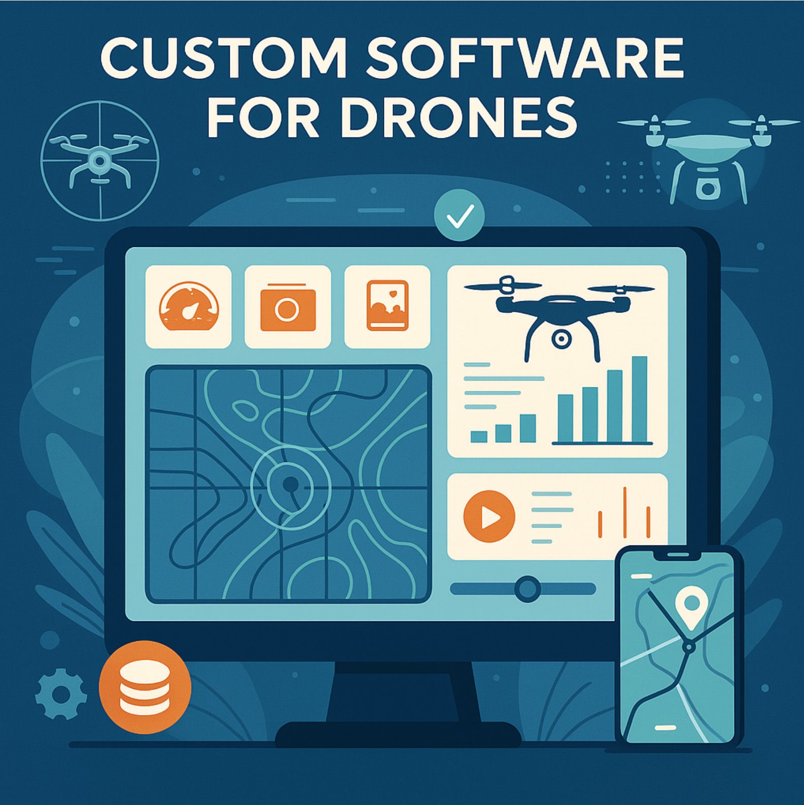
🔧 Key Components of Mapping & Control Software
Custom or advanced drone applications typically include modules for:
- Flight Planning
- Draw flight zones directly on a map
- Set altitude, speed, overlap, and camera angle
- Include terrain awareness (using elevation data or DSMs)
- Save mission templates for repeatable tasks
- Live Control and Telemetry
- Real-time location tracking
- Battery, speed, wind, and height monitoring
- Emergency override (pause, return-to-home, hover)
- Dual-control options for teams or multi-drone coordination
- Image Capture & Data Sync
- Automated photo triggers based on GPS or time intervals
- Tagging images with metadata (altitude, GPS, camera settings)
- Syncing imagery with cloud servers or edge devices
- Data Processing & Mapping
- Stitching images into orthomosaics (photogrammetry)
- Generating elevation maps, contour lines, 3D mesh
- Integrating GIS layers and exporting into CAD, GeoTIFF, or KMZ formats
🎯 Why Software Matters More Than Hardware
Even the most advanced DJI drone is only as useful as the app controlling it. Without the right software:
- Flights may be inefficient or incomplete
- Data may be unusable due to poor overlap or resolution
- Users may lack visibility into progress, performance, or hazards
A well-designed mapping and control app acts like a flight engineer, a data scientist, and a project manager—all embedded in one interface.
📱 Beyond Desktop: The Power of Mobile Drone Apps
Mobile applications play an essential role, especially in field work. They allow operators to:
- Plan or adjust flights directly on location
- Receive push alerts during operations
- Sync data while offline and upload later
- Share real-time previews with clients or supervisors
This is especially critical in sectors like agriculture or environmental monitoring, where signal may be limited, and time is of the essence.
🛠️ A Foundation for Custom Solutions
The components described above form the baseline for any drone operation. But in many real-world scenarios—such as monitoring hundreds of acres of farmland, inspecting dangerous structures, or integrating data into a custom ERP—you need more than a baseline.
This is where custom software development makes the leap: tailoring each feature to the workflow, data needs, and hardware ecosystem of the client.
3. Use Cases: How Industries Use Drone Apps Today
The beauty of drone technology is that it soars across boundaries—literally and figuratively. From vast wheat fields to busy urban construction zones, drone applications are now transforming industries that never thought they'd need flying robots. But as adoption spreads, so does the realization that the software behind the drone is what truly defines its usefulness.
Let’s explore how different sectors are leveraging drone mapping and control apps in ways that are practical, powerful, and sometimes even surprising.
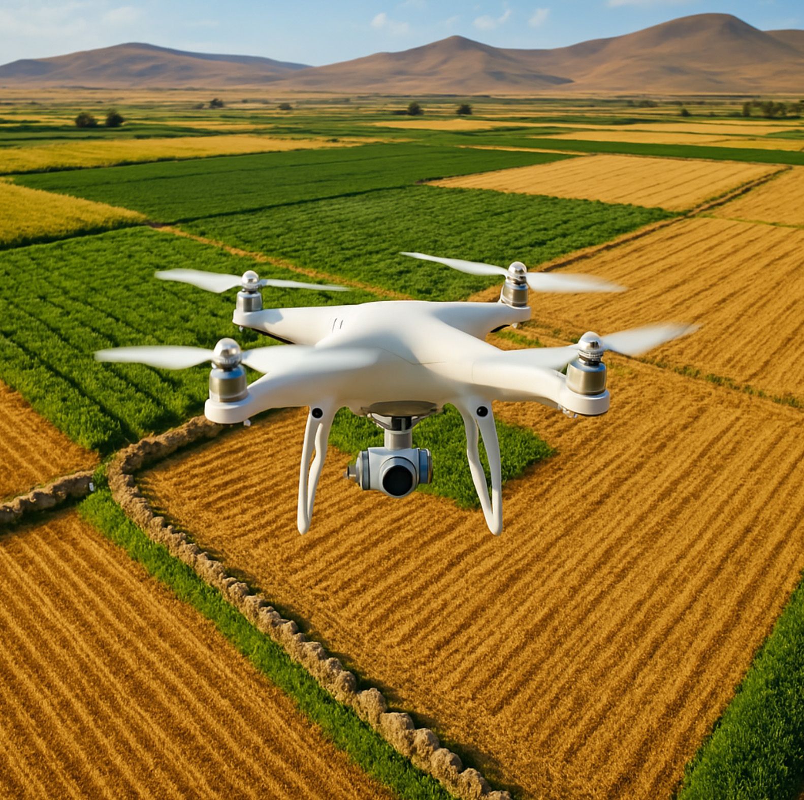
3.1. Agriculture & Precision Farming
In modern agriculture, efficiency is everything. Farmers today are no longer just tilling soil—they're managing data. And drones have become one of the most powerful data-gathering tools in their arsenal.
With a well-built drone app, a farmer can map out a 500-acre cornfield, schedule an automated flight over a specific zone, and analyze NDVI vegetation indexes—all before lunch. Custom software enables integration with existing irrigation systems, crop rotation schedules, and weather feeds. For many, it’s the difference between hoping the harvest will be good and knowing it will be.
One agritech user joked:
“My drone gives me more honest feedback than my teenage son. At least it sends me a report.”
This is no longer about flying toys—it’s precision agriculture with real economic impact.
3.2. Construction & Land Development
On a construction site, time is quite literally money. Drone mapping apps allow managers to get an updated orthomosaic map of their job site in minutes, compare it to CAD plans, and make sure the crew isn’t pouring concrete in the wrong place.
But it goes deeper. Custom drone software can be designed to detect changes in volume, elevation, or material stockpiles over time. Site managers receive automated weekly 3D updates, safety officers monitor hazards from the air, and investors get visual proof that progress is on schedule.
One engineer put it perfectly:
“I trust drone maps more than blueprints—because blueprints don’t lie, but people sometimes do.”
3.3. Environmental Monitoring & Public Safety
For governments, NGOs, and public safety teams, drone software provides a critical edge. In forested regions, drones with thermal cameras detect wildfires long before human eyes can. In coastal areas, they're used to measure erosion and rising sea levels. And in emergency situations—earthquakes, floods, or missing persons—drone apps can direct search missions with GPS accuracy.
Here, the app is more than just a controller—it’s a mission coordinator. It stores previous routes, manages team permissions, syncs data with emergency databases, and provides real-time status to responders.
In such high-stakes contexts, custom functionality isn’t a luxury—it’s a lifesaver. For example, one European rescue team needed a dual-language interface with offline mapping and altitude warnings based on local terrain data. Generic software didn’t cut it. A custom solution saved both time and, potentially, lives.
3.4. Energy & Infrastructure
From wind turbines to solar farms and utility lines, inspection has always been dangerous, costly, and time-consuming. Drone software changes that. Apps now guide drones through precise inspection paths, capture high-resolution images of micro-cracks or corrosion, and send AI-generated alerts if anomalies are detected.
Some companies integrate drone data with their existing asset management platforms. Others build custom dashboards that overlay inspection data on interactive 3D models.
One solar technician summed it up well:
“I used to climb 12-foot panels with a clipboard. Now I use an app. My knees thank me.”
3.5. Real Estate, Mining, Insurance... and Beyond
In real estate, drones offer clients bird’s-eye views of properties, construction progress, or site potential. In mining, they calculate excavation volumes and optimize haulage. In insurance, they provide rapid post-disaster assessments—no need to wait for adjusters with ladders.
What all these examples share is a common thread: off-the-shelf drone apps often don't fit the workflow. That’s why more and more companies are turning to custom drone applications, tailored to their industry, data format, safety requirements, and regulatory constraints.
Because when your needs fly above the standard... so should your software.
4. Limitations of Off-the-Shelf Drone Software
The explosion of drone adoption across industries has naturally led to a proliferation of off-the-shelf drone software platforms. These products promise everything from simplified flight planning to real-time 3D mapping in just a few clicks. And for small-scale hobbyists or basic surveying needs, many of them do offer real value. But when it comes to enterprise-level operations, nuanced data requirements, or integration into complex workflows, these platforms often fall dramatically short.
Off-the-shelf solutions tend to prioritize mass-market usability over depth, and in doing so, they sacrifice the very flexibility that many industries depend on. The limitations are not always obvious at first glance—many organizations only realize them once they've hit a bottleneck in their operations or tried to scale beyond the app’s intended scope.
Let’s start with the elephant in the room: rigid architecture. Most commercial drone applications are designed around a fixed feature set. You can plan a flight, capture images, maybe even generate a map. But what if your organization needs to classify land zones by infrared signature, or match survey data with historical GIS layers, or use a different coordinate system like NAD83 instead of WGS84? In most off-the-shelf systems, you can't. You’ll find yourself either working around the software—exporting, converting, reformatting—or giving up on entire workflows because they weren’t envisioned by the app’s original designers.
This rigidity extends to data processing. Let’s say a forestry agency wants to process thermal and RGB data simultaneously to track both vegetation density and fire risk. Most consumer-grade software won’t support multisensor workflows. The workaround? Multiple exports, hours of manual merging, and custom scripts outside the platform. Contrast that with a custom-built app, where the logic for layered thermal-RGB analysis is embedded directly into the image processing pipeline—automatically and in real time.
Here's a simplified pseudo-logic of what a custom module might execute:
if thermal.reading > 42.5 and vegetation_index(NDVI) > 0.3:
flag = "High Fire Risk"
mark_area_on_map(GPS_coords, color="red")
notify_team(priority="urgent")
Such logic is simply not possible in most out-of-the-box tools. They’re not designed for conditional logic tied to sensor data, nor are they capable of intelligent decision-making based on spatial thresholds. And the irony? Most of the hardware (such as DJI’s Matrice series) is more than capable of this functionality—the limiting factor is the software.
Then comes the issue of integration. Enterprises rarely operate in a vacuum. Drone data needs to feed into other systems—ERP, CRM, GIS platforms, logistics tools. Off-the-shelf software offers little or no support for custom integrations. You may get a CSV export if you're lucky, but connecting your drone platform directly to, say, an SAP system or a custom agricultural management suite is out of reach without middleware, third-party connectors, or manual intervention. Meanwhile, custom software can offer seamless RESTful API pipelines or even real-time MQTT messaging, providing the operational agility that modern companies require.
Another underdiscussed limitation is user access control. Many industries need strict user hierarchies: a junior technician should not have access to alter mission parameters, a regional manager may need read-only access across multiple drone fleets, and legal teams may need visibility into only compliance-related flight logs. With commercial apps, you're lucky if you get admin vs. user roles. That’s insufficient in a world where data governance is a legal necessity, not a luxury.
And let’s not forget regulatory compliance. Companies operating in the U.S. must follow FAA Part 107 rules, while those in the EU must adhere to EASA standards. Drone missions in urban areas, near airports, or above critical infrastructure may require dynamic geofencing or local airspace data integration. Most commercial apps treat regulations as an afterthought, offering simple “fly zones” with little real-time updating or no-trespass logic. Custom-built systems can query real-time NOTAM (Notice to Air Missions) APIs and dynamically reroute missions on the fly based on new restrictions—something no boxed software does effectively.
Then there's the performance at scale issue. Aerial operations in agriculture may involve capturing hundreds of acres daily, producing gigabytes of imagery. Basic apps slow down or crash when asked to stitch a map across such datasets. Worse, their cloud platforms may throttle upload speeds or charge extra for large jobs. Custom applications, on the other hand, can optimize by chunking data into tiles, implementing on-device compression, or processing with edge AI modules—techniques entirely inaccessible via commercial interfaces.
But perhaps the most subtle limitation is brand control and client experience. Many companies using drones do so in a B2B or B2C capacity—offering reports, insights, or media to external stakeholders. Off-the-shelf apps don’t allow for branded dashboards, white-label reporting, or even export styling. Imagine delivering a critical infrastructure report with a competitor’s watermark or generic formatting. It reflects poorly on your company and undermines the professionalism of your offering.
In the end, the metaphor is simple: buying boxed drone software is like buying a one-size-fits-all spacesuit. It might look impressive, but when you actually need to do the mission—adjust oxygen flow, connect comms, maneuver in unexpected ways—you’ll wish you had something custom-fitted.
For businesses that rely on drones as core tools—not just gadgets—the software must be as tailored and precise as the mission itself. That’s why more organizations, from agriculture cooperatives in Texas to urban planners in Scandinavia, are turning to custom development firms like A-Bots.com to get the control, flexibility, and intelligence they need.
Because flying smart isn't about hardware—it's about software that truly fits.
5. Why Custom Drone Applications Make a Difference
When a business relies on drones for critical operations—be it in agriculture, energy, real estate, or public safety—it can’t afford software that’s "close enough." Precision, compliance, and efficiency demand more than a standard app. This is where custom drone applications come in—not as a luxury, but as an operational necessity.
Think of it like this: two companies may both use drones, but their goals, workflows, and environments could be wildly different. One may be mapping citrus groves in California with NDVI overlays; the other inspecting power lines in Alaska where wind and temperature sensors are mission-critical. There’s no universal interface that fits both. But a custom-built solution understands context—and that makes all the difference.
Tailored to the Mission, Not the Market
Generic drone apps are designed to serve as many people as possible. That’s good for product-market fit, bad for specialization. A custom drone application, on the other hand, is designed around the problem, not just the drone.
For instance, a mining operation might need volumetric measurements of excavation sites that are accurate within 2%. Most SaaS mapping tools offer 10–20% error margins because they don't integrate tightly with terrain-specific calibration. A custom solution can embed advanced geospatial correction algorithms and even reference LIDAR or GCP data in real time to improve accuracy.
And it’s not just about the data. Custom apps can account for user context. A field technician using gloves and a sunlit tablet needs a different interface than a project manager in an office. One may need oversized buttons, haptic feedback, and offline sync; the other needs dashboard analytics and real-time alerts. With a custom UI/UX strategy, everyone gets what they actually need.
Advanced Features? You Define Them.
The real power of custom apps lies in how deeply they can embed intelligence into your drone ecosystem. You define what matters—whether it's AI, multi-drone coordination, or backend analytics.
Let’s say a large-scale farming cooperative wants a feature to automatically detect irrigation leaks. With a multispectral camera and a bit of computer vision, it’s possible. A custom pipeline can be built to analyze thermal anomalies in real-time and flag suspicious patterns. The logic might look something like this behind the scenes:
for frame in flight_data:
if detect_thermal_drop(frame) and NDVI(frame) < 0.25:
alert_type = "Leakage Suspected"
send_to_dashboard(alert_type, location)
Such custom functionality becomes a core part of the app, not an afterthought or a hacked plugin.
Similarly, inspection companies can define their own flight logic algorithms: for example, drones that slow down over high-risk zones, pause for HD imaging at set intervals, or loop around structures for 360° scans. These aren’t just nice-to-haves—they’re performance multipliers.
Seamless Integration with Enterprise Systems
Enterprise workflows are rarely isolated. You want your drone data to speak with your CRM, ERP, GIS, or asset management systems. Off-the-shelf apps usually stop at "Export to CSV." But custom apps can go further.
A real estate development firm might want annotated drone maps pushed into their internal project portal with layered filters—client visibility, permit stages, terrain risks. That’s only possible when your software has direct API integrations with your stack.
The result? No more jumping between platforms. No more errors from manual uploads. Just clean, synchronized operational intelligence, delivered instantly where it’s needed.
Compliance by Design
In aviation, the line between success and catastrophe can be thin. Custom drone software ensures that compliance is built into the interface—not bolted on as an update.
Let’s take European real estate developers operating under EASA regulations. A custom drone app can:
- Pull in geofencing data in real time from Eurocontrol
- Disable camera feeds when flying over privacy-sensitive zones
- Auto-log missions with secure time-stamped data trails
- Notify controllers of upcoming flights using U-Space protocols
That’s not something a boxed app is going to handle—certainly not on your terms.
Branded Experience & Ownership
Beyond performance and control, there's another aspect often overlooked: ownership. A custom drone application isn't just a tool—it’s part of your brand. You decide the visuals, the reporting formats, the access levels. You can white-label the platform, publish it under your organization’s name, and deliver reports that are instantly recognizable to your clients and stakeholders.
More importantly, you own the roadmap. Want to add AI object recognition next year? Or switch from DJI to Parrot drones without rewriting your stack? With a modular custom solution, you evolve on your terms.
Real World, Real Gains
In Kazakhstan, a national agricultural initiative used custom-built drone software to assess irrigation efficiency across 12,000 hectares. The platform integrated with regional weather APIs, analyzed evapotranspiration metrics, and helped reduce water waste by 27% in the first season.
In Florida, a power utility deployed custom control software to inspect 600 miles of lines. The drones flew pre-programmed routes with precision turns at every pylon, captured 4K footage, flagged anomalies using AI, and uploaded to a secure internal cloud—all with zero human intervention on-site.
These aren’t science fiction—they’re daily reality for companies that invest in software designed for them, not for everyone else.
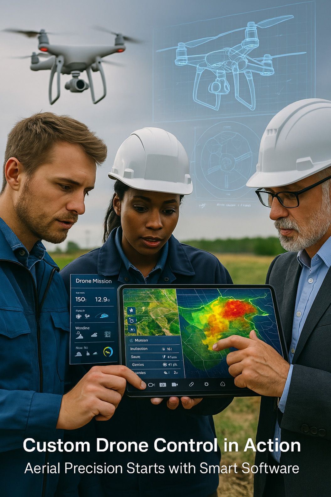
6. How A-Bots.com Builds Custom Drone Mapping Software
At A-Bots.com, we don’t just build apps—we engineer intelligence in the sky. Our mission is simple: to transform drones into fully integrated, business-optimized systems through custom software that fits our clients’ operations like a glove. Whether it’s precision agriculture in the Midwest, infrastructure monitoring in Europe, or smart surveillance in Australia, we’ve built scalable, field-tested, future-ready solutions that elevate drone capabilities to a whole new level.
So how do we do it?
6.1. Discovery: Understanding the Mission on the Ground
Before a single line of code is written, we engage in a deep discovery process. We don’t just ask, “What do you need the drone to do?”—we ask:
- What problem are you solving?
- What’s the current workflow like without a drone?
- Where does the data go after the drone lands?
- Who are the users and what devices are they using?
This allows us to define not just features, but real business outcomes. For instance, a client in the renewable energy sector didn’t just need a drone app—they needed automated anomaly detection, predictive failure analysis, and integration with SAP. That changed the entire architecture of the software from day one.
We also assess hardware platforms (DJI, Autel, Parrot, etc.), payload sensors (LiDAR, multispectral, thermal), and geographic/regulatory requirements. A B2B agriculture drone in Nebraska is a world apart from a drone used in a fire zone in southern Spain.
6.2. Design: Custom UI/UX for Real-World Use
Once we have a clear picture of the mission, we move to interface and interaction design. This is where the vision becomes tangible.
Our design team creates:
- Custom UI mockups (based on user types: pilots, analysts, managers)
- Adaptive screen layouts for tablets, phones, or rugged devices
- Color-coded overlays for maps (NDVI, thermal, elevation, etc.)
- Report templates and dashboards for stakeholders
We also build accessibility into the core design: from touch-friendly controls for field gloves to high-contrast modes for direct sunlight visibility.
We prototype every workflow—whether it’s a three-step emergency launch sequence or a complex multi-day flight schedule over a mining site. These flows are tested with real users, refined, and made bulletproof before development even begins.
6.3. Development: Modular, Scalable, Integrated
Our dev stack is modern and built for performance. We use:
- Flutter or React Native for cross-platform mobile development
- Node.js, Python, or Golang for robust backend logic
- WebSocket, MQTT, and RESTful APIs for real-time drone communication
- PostGIS, MongoDB, and AWS for geospatial storage and cloud sync
- Integration with DJI SDKs, DroneDeploy APIs, or custom drone control protocols
We don’t build monoliths—we build modular platforms. Each function (e.g., mapping, flight control, AI detection, weather sync, reporting) is encapsulated, testable, and extendable. This means when your needs grow or your drone fleet changes, the software grows with you.
Security? It’s not a plugin—it’s embedded in every layer:
- Encrypted telemetry
- Role-based access control (RBAC)
- On-premise or regional cloud hosting options
- Full GDPR and FAA Part 107 data compliance
6.4. Testing & Validation: Field-Tested in Real Environments
Our QA isn’t confined to emulators—we do live flight testing with our hardware partners. Every release is stress-tested in real-world conditions:
- Offline mode in rural zones
- Battery-drop recovery
- Emergency geofence response
- Latency benchmarks on 3G vs 5G connections
- Sensor accuracy validation (e.g., NDVI vs ground truth)
We also conduct multi-user simulations, especially for scenarios where drones, operators, and analysts must collaborate across distances and time zones. You don’t just get code—you get proven stability.
6.5. Deployment & Support: From MVP to Mission-Critical
We handle publishing to public or private app stores, set up user access, conduct team training, and prepare documentation for every workflow. But the real value comes after launch.
Our post-deployment support includes:
- Real-time system monitoring
- Feature roadmap collaboration
- Firmware update compatibility
- Analytics on software usage and ROI performance
- Ongoing security updates
Many of our clients view us not as vendors, but as their drone software partner. Some have been with us across three generations of drone hardware—because they know we’ll keep them in the air, and ahead of the curve.
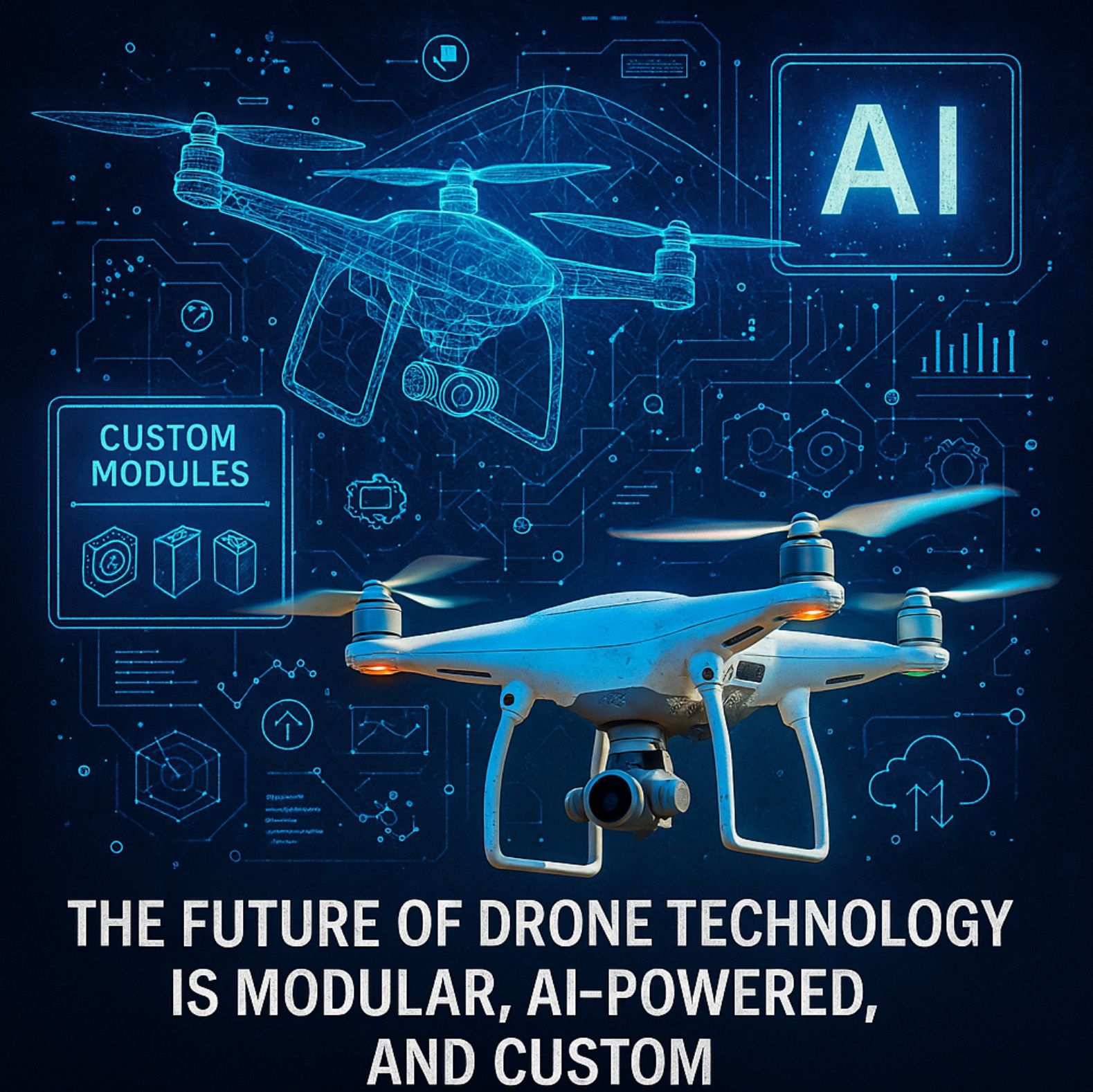
7. The Future of Drone Technology Is Modular, AI-Powered, and Custom
The sky, quite literally, is no longer the limit. As drone technology accelerates past the early adopter phase and into mainstream enterprise operations, we’re witnessing a seismic shift—not just in what drones can do, but in how they do it. The convergence of AI, edge computing, modular architecture, and mission-specific customization is not a trend. It’s the future. And that future belongs to companies that understand software is not just part of the drone—it’s the pilot, the strategist, the analyst, and the engineer, all rolled into one.
We used to think of drones as hardware. Today, we know better. The drone itself is increasingly a commodity: a flying sensor array, standardized and reliable, mass-produced by giants like DJI and Autel. What separates a game-changing drone operation from a glorified aerial camera is not the model number—it’s the software stack that drives it. That’s why the next generation of drone innovation isn’t about building smarter drones. It’s about building smarter software ecosystems—ones that adapt, learn, and integrate in ways that mimic human intelligence, but operate on silicon efficiency.
We’re moving into a modular world. Businesses no longer want monolithic platforms that force a one-size-fits-all approach. They want Lego-like software ecosystems, where flight planning, terrain analysis, object recognition, and reporting modules can be plugged in, updated, replaced, or expanded as the mission evolves. A mining operation doesn’t need vegetation analysis. An agritech firm doesn’t need transmission tower inspection. Each deserves a core system tailored to its goals, with optional modules built for the terrain, the team, and the task. The future is modular because the real world isn’t generic—and neither are the problems it presents.
Artificial intelligence, meanwhile, is no longer a buzzword—it’s the backbone of next-gen drone missions. We’re already seeing AI models deployed directly on the drone hardware itself, using edge processors to make decisions in real time. A drone inspecting a wind turbine can now identify corrosion, categorize it by risk, and even suggest corrective maintenance intervals—before the footage is ever downloaded. An agriculture drone can detect early signs of disease based on subtle spectral patterns in the crops, long before the human eye would notice. These aren’t dreams. They’re real applications, driven by AI modules that can be seamlessly embedded in custom-built software pipelines.
Let’s not forget adaptability. In the fast-changing regulatory landscape—especially in the U.S. and European Union—custom solutions will be the only way to stay compliant and competitive. Tomorrow’s drones will need to dynamically reroute in restricted airspace, respect GDPR data handling rules, and integrate seamlessly with UTM systems. Boxed software won’t keep up. But a custom app—built with modular compliance logic, real-time NOTAM updates, and region-specific behavior—can evolve as the laws evolve. Compliance won’t be a burden. It’ll be a feature.
And what about user experience? The days of clunky, desktop-only interfaces are gone. The next decade belongs to cloud-native, mobile-first, AI-assisted interfaces that adapt to the operator. Think voice-assisted planning in the field. Think gesture control through AR glasses. Think predictive workflows that suggest mission changes based on wind patterns or last week’s performance metrics. The interface of the future won’t just respond. It will anticipate. And custom software is what allows that intuition to emerge—because it learns from your business, your workflows, your users.
We heard one field engineer jokingly say, “Our old drone software was like a teenager—expensive, moody, and always needing updates. Now, with our custom app, it’s like flying with a co-pilot who knows my job better than I do.” And that’s exactly the point. The best drone apps don’t just do what they’re told. They think ahead, guide the operator, and quietly reduce risk and effort while increasing precision and ROI.
This vision of the future isn’t science fiction—it’s already unfolding at A-Bots.com. We’re helping clients build modular drone ecosystems where new modules can be deployed overnight, AI logic can be tuned for specific crops, buildings, or soil types, and integration with business systems is as seamless as breathing. From agriculture in Iowa to infrastructure in Norway, from real estate development in Florida to environmental conservation in Western Australia, we’re seeing it happen—and we’re building the tools to make it repeatable, reliable, and scalable.
What does this mean for the companies still on the fence about drone technology? It means the future isn’t coming. It’s here. And it doesn’t belong to the biggest budgets. It belongs to the boldest ideas. It belongs to those who understand that the winning formula in the drone age is modular software + intelligent AI + custom-fit architecture.
At A-Bots.com, we believe in this formula—and we build it every day. Because the sky’s not just a place to fly. It’s a platform for innovation.
Hashtags
#dronecontrol
#dronemapping
#customdronesoftware
#djiapps
#agtech
#droneapps
#droneapplication
#aerialmapping
#aibaseddrone
#modulardronesoftware
#dronesolutions
#appfordrone
#dronemappingsoftware
#mappingsoftwaredrone
#dronetomapsoftware
#softwarefordrone
Other articles
Custom CRM for Real Estate Developers
Off-the-shelf CRM tools weren’t built for the complexity of real estate development — but we were. This in-depth article explores why custom CRM solutions are redefining how developers manage projects, leads, teams, and revenue. See real-world ROI calculations, key challenges, and expert insights from A-Bots.com, a top CRM development company.
Custom Agriculture App Development for Farmers In 2024, U.S. farmers are more connected than ever — with 82% using smartphones and 85% having internet access. This article explores how mobile applications are transforming everyday operations, from drone-guided field scouting to livestock health tracking and predictive equipment maintenance. It examines why off-the-shelf apps often fail to address specific farm needs and how collaborative, farmer-funded app development is gaining momentum. Through real-world examples and step-by-step guidance, readers will learn how communities of growers can fund, design, and launch custom apps that fit their exact workflows. A-Bots.com offers tailored development services that support both solo farmers and agricultural groups. With offline capabilities, modular design, and support for U.S. and international compliance, these apps grow alongside the farm. Whether you're planting soybeans in Iowa, raising cattle in Texas, or running a greenhouse in California — this article offers the tools and inspiration to build your own farm technology. Discover why more farmers are saying: we don’t wait for the future — we build it.
Top stories
Copyright © Alpha Systems LTD All rights reserved.
Made with ❤️ by A-BOTS